#newfoundland ferry
Text


Benches/Chairs (No. 61)
Charlottetown, PEI (five pics)
St. John's, NL
MV Confederation, NS
Quebec City, QC (three pics)
#MV Confederation#original photography#tourist attraction#cityscape#landmark#architecture#summer 2015#nature#flora#tree#exterior#landscape#travel#vacation#interior#chair#bench#Canada#Nova Scotia#Newfoundland and Labrador#St. John's#ferry#Charlottetown#PEI#Prince Edward Island#Quebec City#Québec
3 notes
·
View notes
Text
Listen I love trains as much as the next tumblr user but NO ONE is doing it like the ferry is doing it.
#This post brought to you by the ferry from Nova Scotia to Newfoundland#You own my heart and soul you beautiful creature#loqui#public transit
1 note
·
View note
Text

This is from circa 2005. We went on a big trip through Maine, into New Brunswick where we saw the bay of fundy, and then through Nova Scotia, finally by a ferry boat to Newfoundland.
37 notes
·
View notes
Text
The Sign of Four: The End of the Islander
Mediæval is an archaic spelling of medieval, using the æ letter that is rare in English, but far more common in Danish, Norwegian and Icelandic, for example.
Ceylon was the name used for what is now Sri Lanka until 1972, when that country (which become independent in 1948) become a Republic. Today, the name only really remains in the country for Ceylon tea, apparently for marketing reasons.
There has been a police force dedicated to the Thames since 1798, being founded as the privately funded Marine Police to tackle the high volume of cargo theft from ships there. Two years later, the government set up the Thames River Police to replace the successful force. The Metropolitan Police took it over in 1839 and made it the Thames Division, it now being called the Marine Policing Unit. Historically, they also did search and rescue, today done by the RNLI.
They had just acquired their first steam launches by 1888, historically relying on rowing boats that had proved inadequate in an 1878 two-ship collision that had killed 600 to 700 people.
Gravesend is on the south bank of the Thames, twenty-one miles from Charing Cross. It was the first port of entry into London for a long time, but the opening of Tilbury Docks on the other side of the river took much of its traffic. The pilot station for the Port of London remains there, along with a RNLI lifeboat station.
There was also a ferry from Gravesend to Tilbury until March 2024, when it stopped due to lack of funding from the 'bankrupt' Thurrock Council, despite being popular.
Pocahontas is also buried in Gravesend.
The Downs is a ship anchorage off the port of Deal in Kent; ships would - and still do - anchor there to protect themselves from strong southerly or westerly winds (as the coast blocked them) or if waiting for suitable winds to head elsewhere. Indeed, the port town grew up to deal (pun intended) with their needs during their says.
There would be six bridges east of Westminster Bridge on the Thames at this time; Tower Bridge, opened in 1886, would be the easternmost crossing point that a pedestrian or carriage could use at this point. The Thames Tunnel was by now a railway tunnel. Those to the east of that were reliant on ferries until 1897, when the western part of the Blackwall Tunnel opened, in a few years becoming the bottleneck it still is to this day.
St Paul's Cathedral, at 111m high, was the tallest building in London from 1710 until 1939 when Battersea Power Station was completed at two metres taller. . Today, there are still restrictions on building new skyscrapers in London to ensure the catherdal can still be viewed.
The Tower of London had been a tourist attraction since at least the Elizabethean period; it was getting over 500,000 visitors a year by the end of the century, but still retained some non-tourist uses.
The Pool of London is the bit of the river from London Bridge to Limehouse - it was the site of the original port until the Docklands were built to deal with massive overcrowding. The maritime industry here effectively collapsed along with the rest of the docks in the 1960s, but this area hasn't seen as much regeneration as parts further east.
The West India Docks were three large docks and associated buildings built at the beginning of the 19th century (1800 to 1802) to deal with trade to/from the British West Indies, to wit the sugar produced by the slave labour in the plantations there; Robert Milligan, its architect, was a slave trader who was unhappy about the delays and theft of his goods at the wharves, so wanted a more secure facility. Closed in 1980, it was converted into the Canary Wharf development, with the famous Underground station built in the former middle dock.
Now I have mistaken a Newfoundland dog for a coat-wearing homeless person in the dark myself - they are very big dogs. However, this has to be taken in the context of the rest of the description of Tonga.
Barking Level is where the River Roding enters the Thames. It is a largely industrial area today.
Plumstead Marshes were an area of low-lying soggy ground that was used by the Royal Arsenal (see "The Bruce-Partington Plans") as a testing range; no human inhabitants (since Roman times, when the water levels were lower) and the soft ground could absorb explosions better. They were drained in the 1960s and most of the area become the new community of Thamesmead; one of those "futuristic estates" that instead became crime-ridden due to bad planning and lack of amenities, which have not yet been fully corrected.
A slightly graphic (including a nasty facial/eye injury) discussion of the problems of recovering bodies from the Thames can be found in this February 2024 news article on the search for a chemical attacker's body: https://news.sky.com/story/the-traumatising-search-for-dead-bodies-in-the-thames-and-why-dozens-are-found-every-year-13071612
16 notes
·
View notes
Text
I haven't taken the ferry from newfoundland to labrador but I did take the ferry from nova scotia to newfoundland and one of the engines was out so it took over nine hours
11 notes
·
View notes
Text
thanks for tagging me! @souplover-69
favourite colour/
I really love muted shades of purple and blue
last song/
the body is a blade by japanese breakfast
last movie/
call me by your name, i have it on dvd 💀
currently reading/
this question made me realize i haven't picked up a book in a really long time, the last book i read was the hunger games trilogy i think. i actually have 1st edition hard covers with the box and jackets they came in that i bought at a book fair in middle school! i wanna be buried with them when i die
currently craving/
a large poutine, especially one from the matane-godbout ferry in quebec that you have to wait in line for an hour just to eat.
coffee or tea/
definitely coffee, i grew up drinking a lot of tea though cause my mom's side are all from newfoundland
im not sure which of my mutuals have already done this yet so i'm just gonna tag some blogs i like off the top of my head:P
@ridgeworld2006 @moldavite @lxvenderghost @lambotel @urlocalaxemurderer @daughterofcainandchaos
3 notes
·
View notes
Note
Gostosuras ou travessuras!🍬
Feliz dia das bruxas!
Now I'm wracking my brain for a recipie that uses sweetened condensed milk, because it's sold on every corner store shelf where I come from and I know brazil makes candy with sweetened condensed milk (my family makes brigadeiros), but I am drawing a complete blank.
So I grew up in Newfoundland, and a lot of Newfoundland's food culture is based around everything having to be shipped in/canned. Now that we have the highway and the ferry everyone has pivoted more to fresh food, so most people will make their tea with fresh milk or cream. (Newfoundland is a BIG tea culture, so is most of the east of canada.)

(Photo from MMDIY)
But sometimes when you're talking to older people, they still want their tea to be done up with canned (evaporated) or sweetened condensed milk. And I've done that when I really want tea and we're out of milk. It's quite the culinary experience.
3 notes
·
View notes
Text
2 notes
·
View notes
Text
East & South Labrador
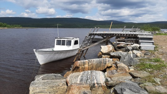
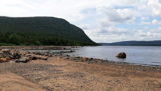
Drove this day another 406km through the boreal forest from Happy Valley - Goose Bay to the tiny hamlet of Port Hope Simpson, which brought me back to the coast, this time the eastern Labrador shore! Apart from Labrador being the "Big Land" of forests, it's also the big land of flies, which is a bit of a shock to the system after not having had any yet in my travels so far (mosquitos yes but flies are worse). There's the huge flies that sound like a bomb is ready to go off when circling your head 😳 and the tiny ones that are barely noticeable but swarm you in their hundreds. Like a woman told me earlier this week; "they all bite and they're hungry!" 🥺. I had managed to dodge the large flies as they're rather slow but impossible to escape the midgets, however generally there's much less of anything on the coast so that's good news!
I won't bore you with more pictures of ugly trees, but instead here are two from Port Hope Simpson, where - you'll guess it - the first stop was at the gas bar (although I'm back now into safe territory with more gas pumps) and then checked in before 2pm already, even including an extra 30 minute Newfoundland time change, which happens somewhere obscure on the road (doesn't really matter where, as there's nothing anyway 😅). Walked a bit around the harbour and then spent à few lovely hours along the water reading a book - A History of Time by Stephen Hawking that my sister gave me 20 years ago and which is interesting but needs to be read piecemeal, it's been a while since I brushed up on my physics! 😝
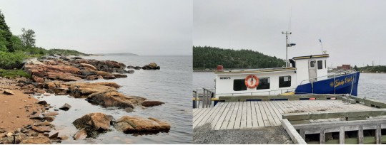
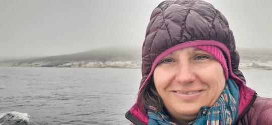
In the morning, the weather had done a 180, and changed from a sunny 28 degrees to a foggy & rainy 10 degrees😢. For the next few days, I was bundled up in my thermal underwear, woollen socks (thanks Tara for knitting them!), 3 layers of sweaters, winter coat, hat & gloves, whereas record heat temperatures were broken around the world...
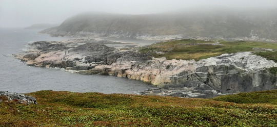
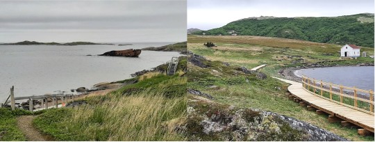
I arrived early at the Mary's Harbour ferry dock so that I could still do a short hike up & down the hill to Gin Cove, which is not too special but still pretty enough and got me warmed up before boarding the little boat to Battle Harbour Historic site where I'm staying the night on the island. Despite the poor weather, I preferred to stay outside to watch for icebergs & whales (none) but I do see a puffin! 😊 With me are two elderly couples from Nova Scotia and Newfoundland who I find out are hyperactive, still scuba diving, skiing and planning a 3-week ATV road trip on their 70th, something to aspire!
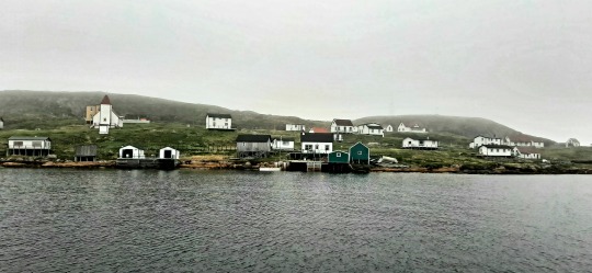
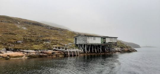
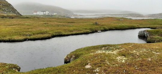
Battle Harbour used to be the unofficial capital of Labrador in its heyday when it was the largest cod fishing village on the east coast and had amongst others the first hospital and Marconi wireless station. Some fishermen would stay all year, but most would travel from Newfoundland for the summer. It started declining when the school was relocated to Mary's Harbour but still operated until the cod fishing moratorium was imposed in 1992. The village is now restored and run by a historic trust, which provides visitors an opportunity to stay through all-inclusive packages. Seeing slowly the buildings come out of the clouds as the boat approaches made it even more mystical!
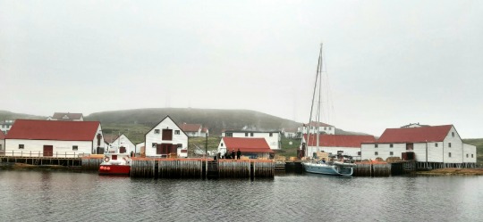
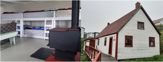
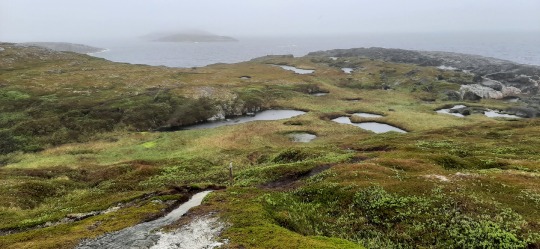
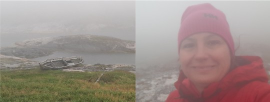
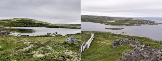
I'm staying in the bunkhouse all by myself (which I had already been counting on 😁) which was the original cookhouse built in the 1770's. After delicious lunch, we were given an elaborate tour of the buildings, which was really interesting as it was led by a 6th generation islander, who had lots of personal stories of how she helped salt the cod. Similarly, the handyman on the boat was one of the 10-year old boys who found a plane wreck the day after it had crashed in the fog (and which I saw myself also in the fog), so that truly connects the history to the present...unsurprisingly, they're still bitter about what happened with the fishery as it destroyed their community, and some of the blame was given to the sharply increasing seal population since the hunt was forbidden in the 80's, which likely has a grain of truth (though most of the blame went to the federal government)... Despite the pouring rain, I decide to take a little hike around the island in the hope to spot icebergs (as there were 3 the day before) but all I got were beautiful landscapes and getting fully soaked. 😜

Over the communal dinner table, I got to know the rest of the guests; an (apparently famous) painter from Newfoundland - Jean-Claude Roy who shares the same first name as my father & comes from the same French region, his somewhat eccentric wife and a guy from North Carolina who is shooting a documentary about JCs relationship with Battle Harbour where he's been painting for over 10 years. The other group consisted of 5 Swedish sailors who toured the world on a yacht, showing breathtaking pics of Antarctica and leaving the next morning for Greenland.... Needless to say that the evening, including a black-white 1930's movie about an Artic exploration followed by beers in the pub, provided lots of interesting conversations! Compared to this lot, my road trip is really not that special😁.
I try another hike in the morning but the fog is even worse, so I give up quickly and instead play a patience card game in front of the wood stove, much better! The way back on the boat is quite rough but all is forgotten when the captain steers us along an iceberg!!💖 I had already seen quite a few in 2010 in Newfoundland but very happy I saw one again! Back on the road, the fog was really bad but when I turned the corner onto the south shore, it suddenly disappeared and I see not one but 3 white blobs on the sea! 😊 Iceberg Alley made its name true and in the next two days I saw a total of 41 icebergs; anything from little "bergy bits" to tabular, drydock, dome & pinnacle shapes, very very cool & unique in the world! Most were farther away and could only be properly seen with the binoculars, but a few were close to shore.

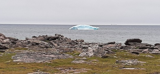
The Red Bay world heritage site has an interesting history of Basque whaling and a ferry ride to Saddle Island for an interpretative hike, but there's basically nothing left (or it was reburied for preservation) so there's a lot of imagination needed to gather what was there 😂.

After a late lunch I was ready to crash in the hotel being hangover from the night before, but decided to at least drive to the start of the Tracy Hill trail, which is notorious for its 689 steps. The trail builders included corny inspirational quotes to keep you walking, and I must confess that the first one did get me to actually start: "One day or Day one?". Apart from pretty scenery, every step seemed to show more icebergs; 22 from the top, which was a perfect way to close the day!


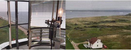
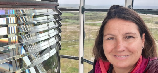
The next morning, I woke up again in fog (getting fed up with it now!) so at the lighthouse at L'Anse Amour, I first drank my cup of tea in the car while checking out icebergs and birds. It's the tallest lighthouse in Atlantic Canada which my legs definitely felt when walking up the steps to the Fresnel lens & active light at the top. The Strait of Belle Isle provides a 200km shorter route to Europe than around Newfoundland, but has strong currents, up to 200km/hr winds & often ice, so it has had its fair share of shipwrecks & heroic tales of rescue.
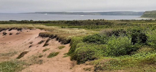
Nearby, a 9,000-year-old burial mound of a Maritime Archaic Indian child was found, representing the oldest known human remains in North America but there's now nothing to see apart from pretty dunes. In L'Anse au Clair I stop at the lovely visitor centre in an old church and do a small hike to an abandoned fishing village called the Jersey Room, after the families that settled here from Jersey island near France.

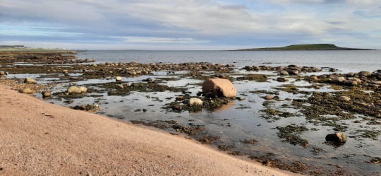
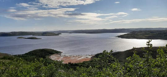
When I cross into Quebec, it's suddenly 1.5 hours earlier! The entire Atlantic and Newfoundland time zones are undone in a split second, which confuses me in my day-planning and makes it a very loooong day. Checking in at the ferry terminal (more on that later), doing groceries and lunch kept me busy for a bit and then I was off to a viewpoint where I was told you could see one of North America's largest puffin colonies... which are on that island far away in the picture below... I could definitely see with my binoculars it was full of birds but whether they were puffins or gulls?!? 😂 Nearby were again lots of Eider duck so don't think they're that special after all... they seem to do well!
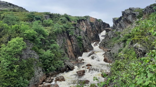
Driving west to the end of the road, there were some more pretty viewpoints and a waterfall, until I reached the Salmon Bay Farm, which is actually a scallops farm located in Salmon Bay. I've toured an oyster farm when I was little in the Netherlands and didn't realize there were also scallop farms until now. After a tour of the on-land facilities and explanation how they're cultivated (interesting titbits; scallop shells grow year rings just like trees so you can count how old they are, and they have up to 200 eyes along the edge of the shell), I chose the left scallop to taste raw (both the muscle and the roe, which were very tender) and also tasted two steamed scallops, which included also the roe as well as the baleen-like frill which is used to filter the water for nutrients. All accompanied with a glass of wine & finished with local jam biscuits, great experience!
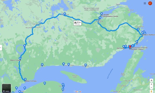
Only 15 minutes more to the west, I reach the end of the road, thereby finishing my tour of Labrador of close to 2,000km! It was a long drive of, as someone put it; "trees and rocks, then rocks and trees, and after that trees and rocks again" 🤣 but very happy to have done it and seen this part of Canada! 🍁💖


The only way to complete my loop back to Baie-Comeau is by a 2-day boat trip west until I reach the village of Kegaska where the road starts anew. There's no ferry but instead a cargo boat, so my car needs to be shipped into a container to make the voyage, a first for me! 😃 I was supposed to report this morning at 5:30am but when I dropped by yesterday, I was told that the boat got terribly delayed...likely until 10pm - midnight tonight. Good news is that I could sleep in this morning (although wide awake at 3:45 due to the time difference) and that I have an extra day here - going for a hike once this is posted, but on the flip side, I might now stay two nights onboard sleeping in a chair instead of a hotel, plus may need to cancel an excursion I had already booked for after my arrival. Mother nature is in control so hoping there won't be much more delays! 🤞
As a side note, it's shocking to realize that the time is here the same as it is in Thunder Bay, over 3,000 km to the west! No wonder that it's light so early here...
PS. the boat's departure time has just been updated to 9am tomorrow morning so I can luckily stay another night at the hotel here but will need to adjust my plans forward. It's going to be an interesting few days ahead...
Distance driven this week: 1,954km
Icebergs: 1 from Battle Harbour boat, 6 from the road, 22 from Tracy Hill, 3 from L'Anse Amour, 4 from L'anse au Clair, 6 from Blanc-Sablon
Wildlife: 1 puffin (Battle Harbour boat), 17 female Eider ducks (Red Bay) and 50+ male Eider ducks (Blanc-Sablon), 1 osprey & 50+ Merganser ducks (L'Anse Amour), 1 mink whale & 1 seal (L'Anse au Clair)
SUPs: none
Hikes: one at Mary's Harbour, one at Battle Harbour, two at Red Bay, one at L'Anse au Clair
2 notes
·
View notes
Text
Back to Nova Scotia
Our return trip from Gros Morne took us out round the Bay of Islands coast to see the various places mentioned by Cook in his travels particularly the Bay itself and York harbour. The biggest difficulty is the total lack of stopping places in order to get photos and also lack of toilet facilities on these routes, particularly given there are also very few coffee stops outside of the major towns. We did manage to get out to both York Harbour and Lark Harbour and then it was south to Codroy for our overnight before the ferry back to Nova Scotia.
Cook names the area Bay of Islands, because there are a few, and then of course, named the Bay of Islands in New Zealand when he got there, though there are far more islands in NZ's Bay.
Interestingly we did get our compensation for the cancelled ferry when we got to the port and we later learned that the Port aux Basque ferry we were on, developed a fault and couldn't then return to Newfoundland causing even more cancellations. I think we were lucky to get there and back even if we did have to travel to a different port - I'd fly next time!
0 notes
Text
Ferry left North Sydney at 8:30 PM. Arriving in Port-Aux-Basques around 4:30 AM. This is the earliest I’ve ever arrived in Newfoundland from taking the ferry and I am so damn tired.
1 note
·
View note
Text

Rock-A-Hoola Waterpark
"From Atlas Obscura: Located in Newberry Springs, California, the "Fun Spot of the Desert" is now a haunting ruin, and a reminder that putting a water park in a desert is a bad idea. While the original spot, the manmade Lake Dolores, ran successfully from the 1960s to 1990, the 1998 renovation into the 1950s-esque Rock-A-Hoola only lasted about a year before a disastrous accident that left an employee paraplegic doomed them. Since closing, the faux-50s architecture and waterslides have faded and broken under the unrelenting Mojave sun. vandals and scavengers have damaged most of the buildings and signs, but they still stand, rusting away like some time lost ruin.
Both the '50s style and the hubris of putting a water park in a desert contribute to the Extinction-ness of this site."
Trinity Loop
"Originally part of the Newfoundland Railway, the site was converted into an amusement park after developments in transportation rendered it defunct. In addition to the rail loop, the site included a Ferris wheel, a railcar restaurant, live entertainment, miniature golf, a museum, and a petting zoo. It was abandoned in 2004, and today has become a sprawling maze of dilapidated train tracks, graffiti-filled ruins, and ghostly murals. People still visit the site to swim, fish for trout, and film amateur horror movies."
#minipoll#the magnus archives#the extinction#end-of-the-world's fair#poll#Rock-A-Hoola Waterpark#Trinity Loop
1 note
·
View note
Text
Sunrise Trip Silly Numbers
Home to St. John's Newfoundland
Total Miles: 6175
Nights away: 12
New States: 8 (Indiana, Ohio, Pennsylvania, New Hampshire, Maine, Connecticut, Maryland, West Virginia)
New Providences: 4 (Ontario, New Brunswick, Nova Scotia, Newfoundland)
Ferry Rides with the car: 2 (Over and back)
Number of Coffees: At least one a day
Gallons of Gas: We don't talk about this
Number of NA Beers: 4 (A new thing for me)
Number of Protein Shakes left unopened in hotel frigs: 3
Number of Birds killed by my car: 1 (Stupid fat bastard)
Number of Sunrises: 2
Number of Sunsets: 3
Weather conditions driven through: Sun, Dark, Drizzle, Rain, Snow Flurries, Snow Squalls, Fog, Foggier Fog
Would I do it again?? In a heartbeat
1 note
·
View note
Text
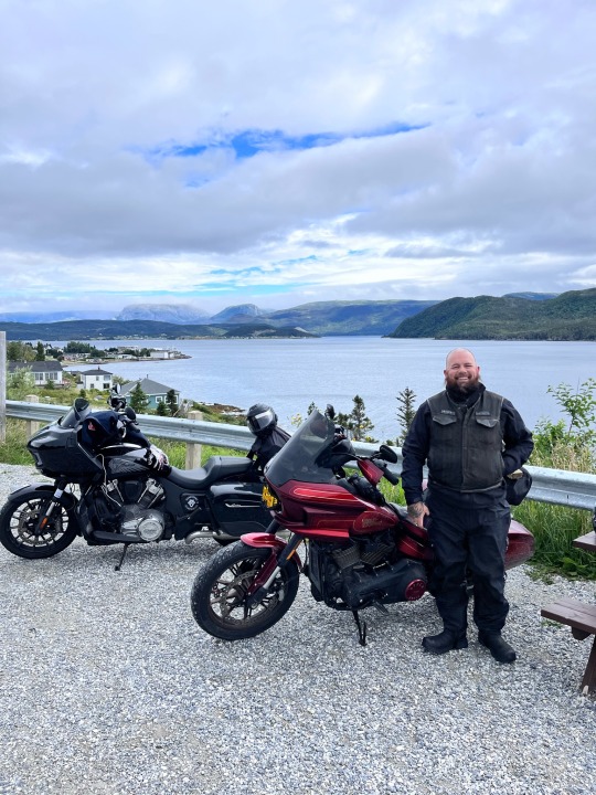
Newfoundland Road trip 2023
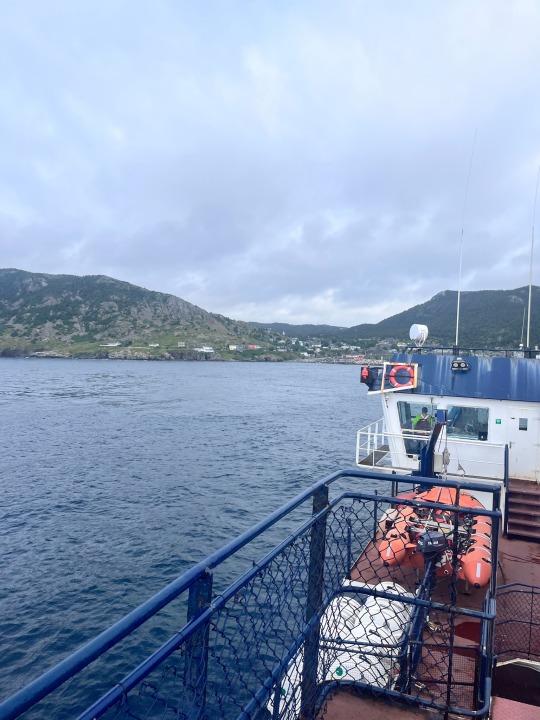
It was early August 2023; I had just barely made it out of Montreal on my flight as thunder and lighting storms surrounded the airport. I’ve never climbed that high, that fast in a plane, it felt more like a rocket ship. I arrived home in Nova Scotia late that night, but was able to get a good rest and sleep in. After a few loads of laundry, some packing, and a rear tire change on the Indian Challenger I was ready to hit the road. Cam rolled into the yard late afternoon on his Lowrider ST El Diablo. We tore out of there making tracks for North Sydney, Nova Scotia. It was around a 350KM ride. We had to take a backroad detour along the way to avoid a huge traffic delay that occurred regularly in Truro, Nova Scotia. After stopping for supper and then hitting some wet roads, we finally rolled into North Sydney just after dark. There, we were loaded onto a ferry that would take us across the gulf of St. Lawerence to the province of Newfoundland. The ferry set sail just before midnight and would dock on the rock just before 7AM. Being my 7th trip over to Newfoundland on my bike I didn’t find the ferry lounge chairs too bad, and with a little help I was able to sleep through the night.
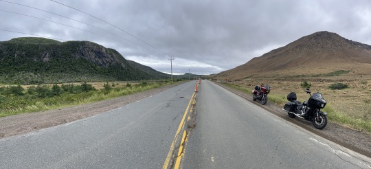
We awoke just before the ferry reached the island to get some breakfast at the ferry cafeteria. A little fuel before a long day of riding. It would be just over 910KM to travel to our destination of St. John’s on the complete opposite side of the island. Some people say it’s a boring ride, but I’ve always enjoyed it. The landscape is constantly changing. From the Codroy Valley to the winding mountain roads around Corner Brook, through Terra Nova Park, and across the barrens as you cross the Avalon peninsula. The scenery is always changing, giving you something new to look at. You just have to stay alert and watch out for those damn moose.
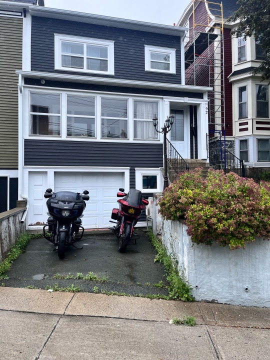
The sun was shining, and the temperature was in the low 20’s. A perfect day for riding. We made good time, with 5 fuel stops, and a Mary Browns lunch break in Gander. We pulled into our Air BNB in downtown St. Johns around 7PM. The Air BNB was, well, it was interesting. I booked late this time so the spots I regularly stayed in were taken. For trips to Newfoundland its important to book early, or you get stuck with high prices or not so desirable accommodations. The location was right, and it was clean, but the place had that old musty grandma smell. Every room had floor to ceiling wallpaper, and I don’t think it had been renovated since the 60s or 70s.
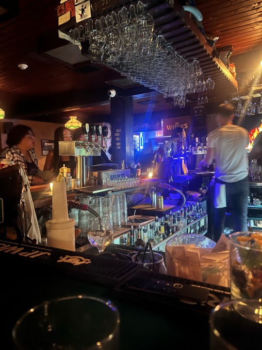
The next day was calling for heavy rain, so once we got everything unpacked, we went to the grocery store to pick up some drinks and snacks. After that we decided to walk down to George Street for some late-night food, and of course a few drinks. George Street is one of my all-time favourite places to tie one on. You can’t beat the hospitality of Newfoundlanders. We got our food and did a little bar hopping until we wound up at my favourite spot: Christian’s Pub. A hole in the wall bar about the same size as a modern Canadian kitchen. It’s been my favourite spot for years, and its where I became an honorary Newfoundlander (kiss the Cod fish, do a shot of screech, and recite a rhyme). They even still have a cigarette vending machine on the back wall. Over the years I made good friends with the young guys who run the bar most nights, Robby, and Marshall. These guys are a great time, and we had a lot of fun there over the years. I wish I could go into more detail, I probably have enough to write a whole column on Christian’s pub alone. I’ll just leave you with “you had to be there.”. One thing is for sure, the drinks never stop flowing and the tunes are always on point. As Newfoundlanders say, “Best Kind”. You just never want to leave. When you do, you’re probably walking sideways like me and Cam were that night. We made it back to the BNB on foot and passed out around 3AM.
The next morning, we awoke with heavy heads, and to heavy rain showers. Luckily the two go hand in hand when you’re on a motorcycle road trip and you have time for a down day. So, we did just that, took the day off. We relaxed kicking back at the Air BNB. In the early afternoon we did end up dragging our asses into a cab and down to the Bagel Café (the best breakfast spot in town) for some brunch.
The morning of Day 4 we were well rested. The rain had stopped but it was still misting, and the road was wet. We suited up in our rain gear and hit the road for a day of riding. There were a couple loops around the Avalon peninsula that I had never ridden and wanted to check out in the next couple of days. Our first stop was of course a lighthouse, 1 of 5 we would visit on this trip. Lighthouses are one of the best destinations you can have when exploring by motorcycle in Atlantic Canada. The roads to get to them might be questionable in condition, but they provide some of the best twisty’s and coastal scenery. The best part is they are always at the end of the road, so you leave nothing unexplored.
The first lighthouse was Cape St. Francis just north of St. Johns in Biscayan Cove. The road turned to dirt a few Kilometers out. It got tighter and tighter until we came to a steep hill with washouts and large loose stone. Google maps told us we were about 800 meters away, so we parked our bikes and walked down. The road curved along a rocky hill to the lighthouse which was unique as it also served as a helicopter pad. We snapped a few pictures, enjoyed the scenery, then made the climb back up to our bikes. From there we headed to Portugal Cove, where we caught a quick 20-minute ferry over to Bell Island. My friend Gill who I had met just the year before in another part of Newfoundland now lived there through the summer with her boyfriend Curtis. Just off the ferry on the top of a hill she had a great view across the water. We enjoyed a few snacks and learned a lot about Bell Island. Basically, the whole island is undermined. Iron ore had been mined there extensively over the years. All shut down now, most of its residents (including Curtis) are cod fishermen.
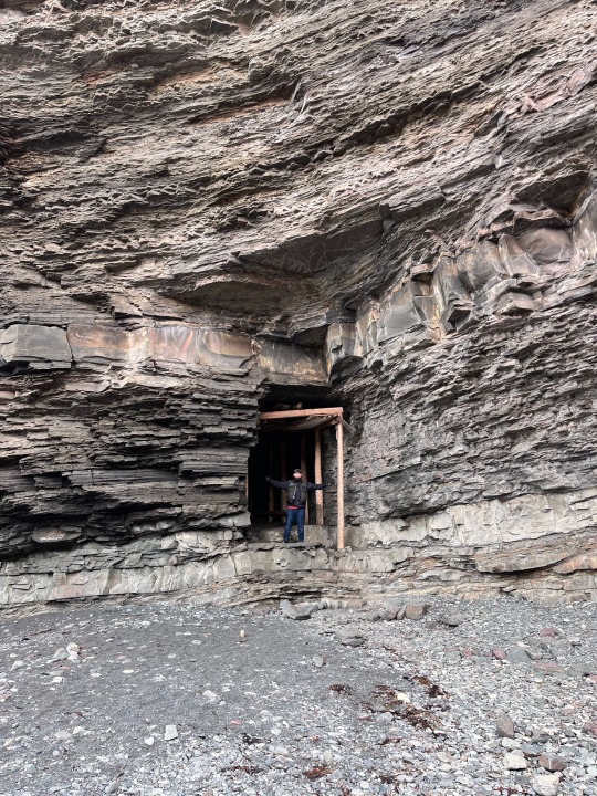
We headed out and explored Grebes Nest, a cobbly beach in a very small, secluded cove with rock cliffs over 100 feet tall, accessible only by an old Iron ore mine tunnel. From there we went to check out the Bell Island lighthouse, and then enjoyed a big feed of local cod fish and chips at Dicks Fish and Chips.
After we said our goodbyes, we were waiting for the ferry to take us back to the main island when Cam noticed a problem with his kickstand, his bike seemed to be leaning over a lot more the usual. We did some wrenching and took it off right there on the wharf. Everything checked out, bolts were tight, and the bushings did not seem to be worn. Cam picked up a 2x4 there to jam under it while parked to help keep the bike level. Something he brought all the way back to Nova Scotia with him. We loaded our bikes back on to the decrepit old ferry, by this time the sky had cleared, and the sun was shining.
Back on the mainland, we followed the coastal road along Route 60, through Conception Bay, Holyrood, and Cupids Crossing. We finally hung a right and headed out on a sliver of land towards our third lighthouse of the day at Green Point. Now labelled a heritage lighthouse by the federal government it is well kept and has an amazing view. Time was ticking and we were getting close to riding in the dark, so we gathered up our thoughts and hit the road back to St. Johns, making it back just before dusk. I try my best to be off the road by dark when I’m traveling in Newfoundland. The moose are plentiful, and I’d rather not have one jump out in front of me.
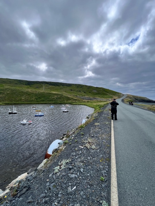
Day 5 on our trip consisted of more exploring on the Avalon peninsula. After a quick stop at Rugged Rock Harley Davidson, we headed south down Route 10 along the Irish loop. Another beautiful ride where the road touched parts of the coast, and then cut straight through the barrens (lots of rock and no trees). We hung a right in Portugal Cove South and headed up this immaculately paved and vacant road to a place called the miniature fishermen, a display of miniature versions of all types of ships you can think of in a small cove. A local that lived nearby had put a lot of time into meticulously crafting these minis. We enjoyed the perfect road to its full potential on the ride back out, making a few passes at speed.
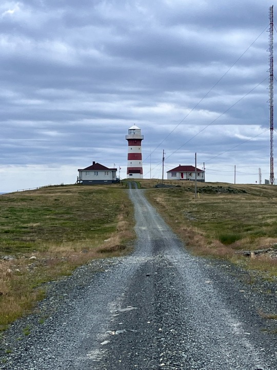
From there we continued around the loop, our next stop was 12KM off the main route down a fairly decent dirt road across the barrens to the coast. The Cape Pine lighthouse sits just in from the coastal cliffs about 300 feet from sea level. The only lighthouse that I’ve been to that was constructed of cast iron. Back when it was constructed in 1851, it cost the British government 6500 pounds.
We followed Route 90 back up the coast. A gas stop and a good lunch at a local store kept us going strong for the rest of the day. We decided to cut across Route 91, and then head south down Route 92 to Cape Saint Mary’s. Here, we would see our first moose, and the first live moose I had ever seen on Newfoundland while riding my motorcycle. Grazing in the ditch, they ran off quickly as we approached them.
Another 10KM off the main road (this one was a paved single lane) we arrived at Cape Saint Mary’s to check out our 5th and final lighthouse of the trip. Along with the lighthouse was a large parking lot with a building labelled Ecological Reserve. Alongside it was a group of ten individuals with the biggest cameras I had ever seen. They looked more like telescopes. As we walked up to the building, I asked one of the ladies what the big cameras were for. She looked at me in surprise and said, “We are here to see and photograph the Northern Gannet.” Not sure what that was I asked, “What’s a Gannet?” She replied in shock and awe, “You’re not here to see the birds!?”
We walked in the front door of what we discovered was a migratory bird museum. There, the curator asked if we were there to see the birds. “What birds?” I said. “The Northern Gannet, look out that giant window in the front, there are over 100,000 of them on that rock over there!” Said the curator. Wow, what a sight! “You can walk right over there in amongst them if you want to get shit on” said the curator, “That’s what’s going to happen to all those photographers from national geographics.” Me and Cam had a good laugh. We checked out the museum and walked out about halfway, staying far enough back not to get shit on.
Not soon after it was time to hustle as it was late in the afternoon. We finished the loop heading north up Route 100, along the windy coast. We wound up on a dirt road, having to backtrack a little before we found pavement again. We made it back to St. Johns again just as the sun set. Time for a bite, and one last visit to Christians Pub before we head back over to the west side of the rock tomorrow. Just one drink, that’s all. Just one.
Day 6 I woke up slightly hungover, but ready to blast to the west coast of the island. Our destination was Norris Point, a small community nestled in Gros Morne national park. I had stayed in Norris Point on every trip I had ever taken to Newfoundland and made some great friends there over the years. It was about a 700-kilometer day of backtracking the road we had came across the rock on. That was until we reached Deer Lake, where we turned north up Route 430 (The Viking Route).
Just up the road a few kilometers we entered Gros Morne national park, which has the best roads, and the best riding in the whole province. There are no potholes to dodge, and no bumps in the road. Just a pile of twistys, blind hills, and corners to navigate as you weave your way north. There’s lots to look at: mountains, rock faces, and the east arm of Bonne Bay. With breathtaking lookoffs just off the road it’s hard not to stop at all of them and take in the beautiful natural scenery. Definitely a must ride if you’re in Newfoundland on a motorcycle.
We stopped at one of my favourite spots, a lookoff at sea level at the base of Gros Morne on a long straight stretch parallel to the bay. You can see Norris Point from here, further across the harbour is the town of Woody Point, and beyond that is the Tableland mountains. We enjoyed some snacks and a beverage before riding the remainder of the road, a quick 15 minutes to our cottage in Norris Point.
Pulling into Out East BNB we were greeted by my good friends Jean and Milton, owners of the lovely property. After unpacking our stuff and getting situated, we noticed rain had started to fall. We had made reservations at a nearby restaurant. Jean was aware of the rain as well, and decided to lend us her car to drive over so we would not get soaked. The hospitality here is hands down amazing, and it’s a big reason why I keep coming back.
After we returned it was down to Terrys Shed to enjoy some drinks and a little smoke. I met Terry on my first trip to the rock in 2016, and my first stay at Out East BNB, which was originally Terrys BNB. The BNB at that time had just been purchased by Jean and Milton but still had Terry’s name on it. I was a bit lost and ended up down at the end of the lane at a shed. I noticed it had a motorcycle in it, and another parked outside. When I poked my head in to ask for some directions, that’s when I met Terry, and I’ve been visiting him on every trip in his iconic shed ever since.
Day 7 was our last day on the rock. We packed up our bikes at the cabin and enjoyed a wonderful breakfast that Jean had cooked for us. From there, we headed south back down Route 430 until we reached the turnoff for Route 431: a road through the mountains and along some rivers to the opposite side of Bonne Bay, which was home to the villages of Woody Point, Trout River, and the Tablelands Park. Another fantastic ride.
I really wanted to take Cam over to see the Tablelands. The Tableland mountains are a very unique place. The rock that forms them are red in color and they are highly acidic, so much so that little to no plant life grows on them. This is because it is part of the earths mantle that has pushed up through the crust.
Across the valley is another mountain that is lush and green. The road runs along the valley floor below perfectly splitting the two scenes. You look to one side, and you feel like you’re riding on mars; look the other way and it’s life on earth. Before we left, we visited the interpretation center there, and each got a sticker for the inside of our saddlebags.
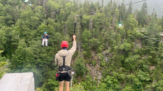
From there we headed to Steady Brook, and a ski hill called Marble Mountain, which was just off the Trans Canada highway. I had gotten into some ziplining adventures earlier on this summer, and there was one here that I really wanted to check out. Nine ziplines back and forth across the mountain, and over top of Steady Brook waterfalls, which would take about an hour to complete. We lucked out as it was calling for rain all day, so we were the only two on the tour with the two guides, a couple guys from college. What a blast, what a thrill!
Afterwards we grabbed a quick meal in Corner Brook and headed for the overnight ferry in Port-aux-Basques. There was a slight delay due to high winds the last few days. It was raining hard by the time we were loaded up onto the ferry. After we got situated, it was lights out for me.
Day 8 we floated into North Sydney, Nova Scotia somewhat rested, and ready for the ride home. Rain or shine, from this point its always hammer down to get home, get unpacked, and give the bike a much-needed wash. Until next year Newfoundland!
Travis Mack - Darksiders Dartmouth

#motorcycle#roadtrip#atlantic canada#lighthouse#newfoundland and labrador#harleydavidson#indianmotorcycle#indianchallenger#explore
1 note
·
View note
Link
Check out this listing I just added to my Poshmark closet: 9 vintage Laminated Reversable Place Mats 17 inch Hawaii, Nova Scotia, Canda, Ka.
0 notes
Text
BAR HARBOR, Maine — Atlantic storm Lee — which made landfall at near-hurricane strength, bringing destructive winds and torrential rains to New England and Maritime Canada — kept weakening Sunday after officials withdrew warnings and predicted the storm would disappear early this week.
The U.S. National Hurricane Center said Sunday morning that the post-tropical cyclone was about 135 miles west of Channel-Port Aux Basques, Newfoundland. The top sustained wind speed was 45 mph with some higher gusts expected.
"Gradual weakening is forecast during the next couple of days, and Lee could dissipate on Tuesday," the U.S. hurricane center said.
The sky was sunny in Maine on Sunday morning. Gov. Janet Mills suspended a state of emergency. Less than 5% of electricity customers were still without power, down from 11% by midday Saturday during the height of the storm. In Canada, 14% of Nova Scotia had no electricity, down from 27% on Saturday, with smaller numbers in New Brunswick and Prince Edward Island.
The center discontinued a tropical storm warning for the coast of Maine late Saturday. It reported late Sunday morning that all tropical storm warnings for Canada were discontinued.
Storm surges were expected to subside on Sunday after being forecast as up to 3 feet on Saturday along coastal areas, the hurricane center said.
Fatality reported in Maine
A 51-year-old motorist in Searsport, Maine, died Saturday after a large tree limb fell on his vehicle on U.S. Highway 1 during high winds. The limb brought down live power lines and utility workers had to cut power before removing the man, who died later at a hospital, Police Chief Brian Lunt said.
A driver suffered minor injuries Saturday, after a tree downed by Lee went through his windshield on Route 11 in Moro Plantation, Maine, according to Maine State Police. John Yoder, 23, of Apple Creek, Ohio, attempted to stop but couldn't avoid the tree. Yoder suffered minor cuts but the other five passengers in the van were not injured. Police blamed high winds for the downed tree.
The storm was tracked as moving around 22 mph and expected to proceed northeast, taking the weather system across the Canadian Maritimes. Rainfall was expected to be an additional 1 inch or less for portions of eastern Maine, New Brunswick and Nova Scotia, the U.S. storm center said.
In Bar Harbor, Maine, the touristy gateway to Acadia National Park, a whale watch vessel broke free of its mooring and crashed ashore Saturday. Authorities worked to offload 1,800 gallons of diesel fuel to prevent it from spilling into the ocean.
Lee flooded coastal roads in Nova Scotia and took ferries out of service while fanning anxiety in a region still reeling from wildfires and severe flooding this summer. The province's largest airport, Halifax Stanfield International, canceled all flights.
"People are exhausted," said Pam Lovelace, a councilor in Halifax. "It's so much in such a small time period."
Hurricane-force winds extended as far as 140 miles from Lee's center, with tropical storm-force winds extending as far as 320 miles, enough to cover all of Maine and much of Maritime Canada.
The storm skirted some of the most waterlogged areas of Massachusetts that experienced severe flash flooding days earlier, when fast water washed out roads, caused sinkholes, damaged homes and flooded vehicles.
In eastern Maine, winds died down enough by late afternoon Saturday for utility workers to begin using bucket trucks to make repairs.
The entire region has experienced an especially wet summer, ranking second in the number of rainy days in Portland, Maine — and Lee's high winds toppled trees stressed by the rain-soaked ground in Maine, the nation's most heavily wooded state.
Cruise ships found refuge at berths in Portland, Maine, while lobstermen in Bar Harbor and elsewhere pulled traps from the water and hauled boats inland.
Billy Bob Faulkingham, House Republican leader of the Maine Legislature, and another lobsterman survived after their boat overturned while hauling traps ahead of the storm Friday, officials said.
The boat's emergency locator beacon alerted authorities and the pair clung to the hull until help arrived, said Winter Harbor Police Chief Danny Mitchell. The 42-foot boat sank.
"They're very lucky to be alive," Mitchell said.
Lee shared some characteristics with 2012's Superstorm Sandy. Both storms were once-strong hurricanes that became post-tropical cyclones — cyclonic storms that have lost most of their tropical characteristics — before landfall. But Sandy caused billions of dollars in damage and was blamed for dozens of deaths in New York and New Jersey.
Lee also was not anywhere near as severe as the remnants of Hurricane Fiona, which a year ago washed houses into the ocean in eastern Canada, knocked out power to most of two provinces and swept a woman into the sea.
Destructive hurricanes are relatively rare so far north. The Great New England Hurricane of 1938 brought gusts as high as 186 mph and sustained winds of 121 mph at Massachusetts' Blue Hill Observatory. There have been no storms that powerful in recent years.
Separately, Tropical Storm Nigel was strengthening and expected to become a hurricane by Monday, the U.S. hurricane center said. It appeared to pose no threats to the U.S. or Canada. It was about 990 miles northeast of the Lesser Antilles and about 1,115 miles east-southeast of Bermuda. It had maximum sustained winds of 60 mph and was moving north-northwest at 13 mph.
0 notes
Last Seen Blogs

ahlnandco
AHLN&Co

tsundeadly
hi

quetzalxico
La Familia Mexicana Rusa

letlive-inthedepths
Dreams Only Last For A Night

patrycja
As long as you...