
Don't wanna be here? Send us removal request.
Statistics
We looked inside some of the posts by mappingtomorrow and here's what we found interesting.
Average Info
Notes Per Post
2
Likes Per Post
2
Reblog Per Post
0
Reply Per Post
0
Time Between Posts
4 days
Number of Posts By Type
Text
7
Last Seen Tumblr Blogs


Fun Fact
1,644 Tumblr posts in 1 second.
Text
Geospatial Analytics Revolution: Transforming Urban Planning, Transportation, and Defense (2025-2030)
Posted on 22nd May, 2025 by Rene Parekh: Author of Mapping Tomorrow The Dawn of a New Geospatial Era Have you ever wondered how your food delivery app knows exactly when your meal will arrive? Or how city planners determine where to place new public transport routes? Or perhaps how climate scientists predict the impact of rising sea levels on coastal cities with pinpoint accuracy? The answer…
#blockchain#defense#digital twins#geospatial analytics#gis#location intelligence#market growth#remote sensing#smart cities#spatial AI#spatial data#transportatiom#urban planning
0 notes
Text
Choosing the right GIS software in 2025: ArcGIS Pro vs QGIS 3 Analyzed I have just published a comprehensive comparison of the two leading GIS platforms as they stand in 2025. The age-old battle between proprietary and open-source solutions continues, but with fascinating new developments! Both platforms have evolved dramatically since 2020, with QGIS closing many historical capability gaps while ArcGIS Pro has leaned into enterprise integration and AI. Is your organization making the right choice? Well, the answer depends on your specific needs, budget constraints, and strategic priorities. Check out my full analysis to help navigate this critical decision for your mapping needs! Please do have a look at the post, leave a like and comment your thoughts and your experiences working with these softwares. Also do let me know which software do you think is worth investing for? Since it is the AI revolution, which software can perform tasks with utmost simplicity and efficiently, ArcGIS Pro or QGIS 3? Let's get the conversation and engagement going. Do comment, like, share and subscribe to my blog. Your engagement would mean a lot to me. Let's map the world for a sustainable future with Mapping Tomorrow. 🗺️ Subscribe to my blog website: https://mappingtomorrow.wordpress.com and get started with Mapping Tomorrow. Your one step can change your future. SUBSCRIBE NOW and be updated ahead of everyone. #ArcGISPro #QGIS3 #GISSoftware #GISComparison #GeospatialSoftware #GISTechnology #SpatialData #GISMapping #GeographicInformationSystems #OpenSourceGIS #ProprietaryGIS #GISPlatforms #MapChat #GISCommunity #SpatialAnalysis #GIScience #GeoTech #GISProfessional #GISCareer #GISJobs #GISSkills #GISEducation #GISCertification #EsriUser #QGISCommunity #OpenSourceCommunity #EsriUC #FOSS4G #UrbanPlanning #EnvironmentalGIS #BusinessIntelligence #LocationIntelligence #DataVisualization #TechComparison #SoftwareReview #2025Tech #OpenSource #TechDecisions #SoftwareEvaluation #MappingTomorrow #ProfessionalDevelopment #TechTrends #IndustryInsights #GISTwitter #MapTwitter #TechTwitter #GISLife #MappingCommunity #TechTools #GISResources #GeospatialTechnology #MappingTools
#ai#arcgispro#artificial-intelligence#cartography#education#environment#geographicinformationsystems#geospatialinelligence#geospatialtech2030#gis#gisanalysis#gissoftware#mapping#qgis#technology
0 notes
Text
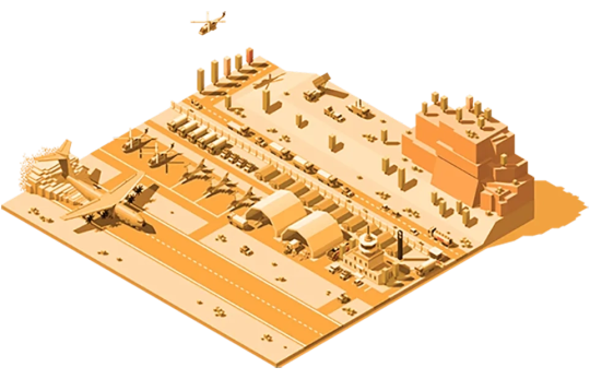
I'm excited to share my latest in-depth analysis on how Geographic Information Systems are revolutionizing defense operations worldwide. As the author of "Mapping Tomorrow: Navigating to the World of Geographic Information System," I've explored how cutting-edge geospatial technologies are transforming military capabilities across multiple domains. In this comprehensive blog post, I examine six critical case studies that demonstrate the strategic impact of advanced GIS implementation: Indo-Pacific Maritime Domain Awareness systems integrating satellite surveillance with oceanographic modeling Humanitarian demining operations enhanced through AI-driven terrain analysis and probability mapping Urban warfare planning revolutionized by high-fidelity 3D modeling and subsurface infrastructure mapping South Asian border security monitoring leveraging multi-sensor integration and cross-border incident mapping Military humanitarian assistance powered by damage assessment automation and resource optimization Electromagnetic spectrum operations treating digital signals as mappable terrain The article also explores emerging trends that will shape the future of defense GIS, including quantum computing applications, edge computing for disconnected operations, and advanced human-machine teaming in spatial analysis. As conflicts become increasingly complex and multi-domain, superior geospatial intelligence has emerged as a decisive factor in both conventional military operations and asymmetric warfare. The organizations that most effectively leverage these capabilities will maintain significant advantages in our increasingly contested world.
View On WordPress
#ai#aiindefense#artificial-intelligence#asymmetric warfare#battlespace management#command and control systems#common operating picture#defensemapping#defensetechnoloy#dronemapping#education#environment#force multiplier technologies#force protection#geographicinformationsystems#geoint#geospatialinelligence#gis#intelligence fusion#intelligence preparation of battlefield#lidar#military decision support systems#military modernization#militaryapplications#multi-domain operations#operational planning#predictiveanalysis#RemoteSensing#strategic intelligence#technology
0 notes
Text
This in-depth exploration of Geographic Information Systems with Artificial Intelligence (GeoAI) shows how this revolutionary technology is transforming spatial analysis across industries. From urban planning and disaster management to precision agriculture and retail intelligence, GeoAI combines machine learning, deep learning, computer vision, and spatial data to solve complex geographic problems with unprecedented accuracy and efficiency. This post covers the three core pillars of GeoAI: spatial data infrastructure, AI algorithms, and computational resources, while tracing its evolution from manual mapping to today's autonomous systems. Readers will discover key technologies driving innovation, including computer vision for earth observation, NLP for geographic information retrieval, and reinforcement learning for routing optimization. I request you to have a read and engage with the post, mentioning what do you think where will the Geospatial Industry be in the upcoming years until 2030. Do share it within your professional networks and spread the word of GeoAI and how it is transforming the Geospatial industry.
#ai#ArtificialIntelligence#DeepLearning#DigitalTransformation#FutureofTechnology#GeoAI#geographicinformationsystems#Geospatial#gis#Innovation#locationintelligence#MachineLearning#RemoteSensing#SpatialData#technology
0 notes
Text
Where maps meet technological advancements—explore how GIS and IoT weave a living tapestry of smart cities, sensing change, guiding growth, and echoing the rhythm of a smarter tomorrow.
#digitaltwins#environmentalmonitoring#geospatialinnovation#geospatialtechnology#gis#gisiotintegration#internetofthings#locationintelligence#realtimegis#smartmaps#spatialanalytics
0 notes
Text
Digital Shadows: How Spatial Computing Is Creating an Intelligent Duplicate of Our World This blog post explores how spatial computing technologies are creating a digital twin of our physical world with far-reaching implications. The post discusses how the convergence of augmented reality, computer vision, and AI is enabling devices to understand and interact with physical spaces in unprecedented ways. Key points include: - Spatial computing creates persistent digital layers that mirror and enhance our physical environment - The technology relies on advanced mapping, 3D reconstruction, and object recognition capabilities - Applications span industries from urban planning and architecture to retail, healthcare, and entertainment - Privacy and security concerns emerge as our spaces become increasingly digitized and monitored - The future vision includes seamless integration between digital and physical worlds, with intelligent systems that anticipate our needs based on spatial context The post concludes by highlighting both the transformative potential of this technology to improve how we interact with our environment and the need for thoughtful implementation that respects privacy and human agency.
#artificial-intelligence#digitaltwins#education#geographicinformationsystems#geospatialinelligence#geospatialtech2030#technology
0 notes
Text
The Metamorphosis of Geospatial Technologies: Mapping the Path to 2030
In the rapidly evolving digital landscape, geospatial technologies stand at the precipice of a profound transformation—one that promises to redefine our relationship with spatial data and revolutionize countless industries. As we navigate through 2025, emergent technological paradigms are already reshaping the foundations of this field, with the trajectory toward 2030 signaling a period of…

View On WordPress
#ai#artificial-intelligence#digitaltwins#education#geographicinformationsystems#geospatialinelligence#geospatialtech2030#GISfuture#maps#spatialcomputing#technology
2 notes
·
View notes