#GeospatialScience
Explore tagged Tumblr posts
Visit Tumblr Blog
Explore Tumblr blogs with no restrictions, modern design and the best experience.
Last Seen Tumblr Blogs


Fun Fact
Tumblr was the first site to host the blog for President Barack Obama in 2011.
Text
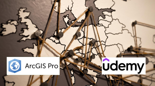
ArcGIS Pro Made Easy! Learn GIS Mapping & Analysis with Udemy
🗺️ New to ArcGIS Pro? This course makes learning GIS fun and easy! Gain real-world skills in mapping, spatial analysis, and geospatial data handling with hands-on exercises.
🔥 GET DISCOUNT 48% OFF (ONLY $12.99 FROM $19.99) – LIMITED TIME, ENROLL NOW !
📌 Start today & become a GIS expert in no time!
#GISbeginner#ArcGISProTutorial#SpatialAnalysis#ArcGISProtraining#LearnMapping#GISdata#GeospatialScience#CartographyTips#GISlearning#UdemyGIS🚀
0 notes
Text
Geospatial Reasoning: New Approach To AI Spatial Analysis

How artificial intelligence is improving scientific research for practical benefit.
Geospatial reasoning gives intelligent maps a voice and cognitive process. You can ask it simple questions like a friend.
Google research teams employ AI to answer basic scientific questions and study quantum computing, geospatial science, biological science, and neurology.
Artificial intelligence has historically driven scientific progress at Google, and the current rate is unmatched. AI's advancements have accelerated and expanded the "magic cycle" of research from breakthrough to practical impact.
AI boosts human creativity. Google teams are using AI to answer basic scientific questions and broaden the range of possibility, yielding new insights into life and innovative solutions to humanity's biggest issues. To accelerate scientific discoveries, collaborate with academics and industry. It also gives partners all technologies and instruments for study.
Recent Google Research findings in these four areas have major scientific and social ramifications.
Improving disease treatment with biological science
AI's promise to democratise science, personalise medicine, and expand biological and medical research fascinates us. This AI co-scientist wants to accelerate biomedical therapy discovery. This multi-agent system uses AI's ability to synthesise information and perform complex reasoning to help scientists produce fresh research ideas and hypotheses using plain language.
A multimodal version of AMIE, a medical diagnostic dialogue AI agent, was published in Nature. It can interpret visual medical data for more accurate diagnosis. AMIE is based on MedPaLM and other medical language models.
Using embedding models for digital pathology, dermatology, and chest x-rays, the developers created TxGemma, a set of open models to improve therapeutic development. To help developers build medical AI apps, it keeps supporting Health AI Developer Foundations.
Genomic research is also used to diagnose rare disorders and investigate genetic susceptibilities. Researchers can correlate genomic variants with REGLE, an unsupervised deep learning algorithm. In collaboration with Personalised Pangenome References, researchers released new DeepVariant models. When analysing genomes with many ancestries, these models reduce errors by 30%.
Neuroscience research is improving brain understanding
Have also progressed brain science and connectomics in the previous decade. The first method for mapping neurones and their connections in brain tissue using commonly available light microscopes, LICONN, was published in Nature yesterday by Google Research and ISTA. LICONN will enable connect omics research in more labs worldwide.
In collaboration with Harvard and HHMI Janelia, the developers released the Zebrafish Activity Prediction Benchmark (ZAPBench) beyond neural connections. Over 70,000 larval zebrafish brain neurones were recorded for this benchmark. Scientists can now study the relationship between dynamic neural activity and structural circuitry in a vertebrate brain. The dataset and benchmark are publicly available to help neuroscientists model brain activity more accurately.
In collaboration with Princeton University, NYU, and HUJI, investigations examined the similarities and differences between deep language models and the human brain in natural language processing. This study suggests that deep learning models may offer a new computational framework for brain neuronal code decipherment.
Addressing global concerns via geospatial reasoning
Google Research speeds up geographical problem-solving by making important information more accessible. The first FireSat satellite was launched to fight wildfires. The high-resolution data, updated globally every 20 minutes to build the constellation to over 50 satellites, will help scientists comprehend wildfire propagation and emergency responders notice flames early. Companies have improved climate resilience and crisis response with Flood Forecasting and WeatherNext AI models.
The new Geospatial Reasoning research project uses generative AI and geospatial foundation models to locate actionable knowledge using a conversational interface. It builds on prior Population Dynamics and trajectory-based mobility core models, as well as weather, floods, wildfires, Open Buildings, and SKAI models. Geospatial reasoning benefits public health, integrated business planning, urban planning, climate research, and others.
Quantum computing nears practicality
For over ten years, it has been working towards constructing huge quantum computers that can solve impossible problems. This Willow chip, with mistake correction and cutting-edge performance, is a milestone. On World Quantum Day, stressed its progress towards practical applications.
In collaboration with Sandia National Laboratories, researchers found that a quantum algorithm might better simulate sustained fusion processes. This could enable fusion energy with its large-scale clean energy potential. It demonstrated a breakthrough hybrid method to quantum simulation that opens the door to future scientific discoveries that will advance quantum research.
AI's potential is being realised in several sciences. Developers will keep asking the most critical questions and solving intractable issues to find scientific discoveries that can aid billions.
#geospatialreasoning#biologicalscience#geospatial#neuroscience#scientificresearch#GeospatialScience#technology#TechNews#technologynews#news#govindhtech
0 notes
Text
Geoinformatics Colleges in India: A Comprehensive Guide
Are you passionate about geospatial technology and its applications? Do you want to pursue a career in geoinformatics? If so, you've come to the right place! In this article, we will explore the top geoinformatics colleges in India and provide you with all the information you need to make an informed decision about your future.

What is Geoinformatics?
Before we dive into the details of geoinformatics colleges in India, let's first understand what geoinformatics is all about. Geoinformatics is an interdisciplinary field that combines geography, geology, computer science, and information technology to analyse and interpret spatial data. It involves the use of various tools and techniques to collect, store, process, analyse, and visualise geographic information.
Courses offered for Geoinformatics
If you're interested in pursuing a career in geoinformatics, it's important to know what courses are available and what they entail. Here are some geoinformatics course details offered by geoinformatics colleges in India:
1. Bachelor's Degree in Geoinformatics
A bachelor's degree in geoinformatics is the first step towards building a successful career in this field. This course typically spans over three to four years and covers a wide range of topics such as GIS (Geographic Information System), remote sensing, spatial analysis, database management, and cartography. Some colleges also offer specialised courses in areas like environmental management and urban planning.
2. Master's Degree in Geoinformatics
If you want to further enhance your knowledge and skills in geoinformatics, you can pursue a master's degree in this field. A master's degree program usually lasts for two years and provides advanced training in areas such as geospatial data analysis, geodatabase design, web mapping, and geospatial programming. Many colleges also offer research opportunities for students who wish to delve deeper into specific topics.
3. Diploma/Certificate Courses
Apart from bachelor's and master's degree programs, there are also several diploma and certificate courses available for those who want to gain specialised knowledge in specific areas of geoinformatics. These short-term courses focus on topics such as remote sensing applications, GIS software, and spatial data analysis.
Top Geoinformatics Colleges in India
Now that we have a basic understanding of geoinformatics and its course details, let's take a look at some of the top geoinformatics colleges in India:
Indian Institute of Remote Sensing (IIRS)
Indian Institute of Remote Sensing (IIRS), located in Dehradun, Uttarakhand, is another renowned institute that offers excellent programs in remote sensing and geoinformatics. The institute is affiliated with the Indian Space Research Organization (ISRO) and provides world-class training and research opportunities to students.
National Institute of Technology (NIT) Warangal
National Institute of Technology (NIT) Warangal offers a comprehensive program in geoinformatics at both undergraduate and postgraduate levels. The institute has state-of-the-art facilities, well-equipped laboratories, and experienced faculty members who are actively involved in research projects.
Symbiosis Institute of Geoinformatics (SIG)
Located in Pune, Maharashtra, SIG is one of the premier institutes for geoinformatics education in India. It offers a variety of undergraduate, postgraduate, and diploma programs in geoinformatics. The institute has a state-of-the-art infrastructure, experienced faculty members, and strong industry connections, making it an ideal choice for aspiring geospatial professionals.
Scope of Geoinformatics
After completing your education in geoinformatics, you'll have a wide range of career opportunities to explore. Here are some possible MSc geoinformatics scopes:
1. GIS Analyst: As a GIS analyst, you'll be responsible for collecting, analyzing, and interpreting geographic data using GIS software.
2. Remote Sensing Specialist: Remote sensing specialists use satellite imagery and other remote sensing techniques to gather information about the Earth's surface.
3. Spatial Data Scientist: Spatial data scientists analyze spatial data using statistical techniques to derive meaningful insights.
4. Urban Planner: Urban planners use geospatial technology to develop plans for land use, transportation systems, and urban development.
5. Environmental Consultant: Environmental consultants assess the impact of human activities on the environment using geospatial tools.
These are just a few examples of the career paths you can pursue with an MSc degree in geoinformatics. The demand for skilled professionals in this field is growing rapidly, both in India and abroad.
Conclusion
Geoinformatics is a fascinating field that offers exciting career opportunities for those who are passionate about spatial data analysis and interpretation. By pursuing a degree in geoinformatics from one of the top colleges mentioned above, you’ll gain the necessary knowledge and skills to excel in this field. We recommend SIG from Pune as it offers the perfect blend of education and experience you need for your career ahead.
Remember to thoroughly research each college’s curriculum, faculty expertise, infrastructure, and industry connections before making a decision. Good luck with your academic journey!
1 note
·
View note
Photo

#Repost @somas.sbu: If you want to find the #scenicstudyspots at @stonybrooku, check out Megan Gallagher's map from Dr. Donna Selch's 2018 GSS 105 course! . Here are the highlights: . In the library, there is a place called the STACKS, where you can have a nice single desk with a charger that overlooks the campus through the windows. . At the @stallercenter, there are nice areas upstairs & on balconies that overlook fountains and the STALLER STEPS, another cute area. . A beautiful place to study is in the HUMANITIES atrium where you can quietly study surrounded by plants & warmth & sunlight. . In Roth Quad, there is a small dining area that has a @Starbucks & a (good) Subway. If you go upstairs, there is a larger seating area that overlooks Roth Pond & trees. . ESS courtyard is a lovely place to study & do work when it's warm outside; the trees fully bloom by May & are very easy to climb. . In the SAC there is a little outdoor area in the middle with tables & flowers, making it a quaint area to read/study. . #SBUtiful #scenicstonybrook #farbeyond #gss #geospatialscience #geography #summeratsbu #summer #summertime https://ift.tt/2vTB2IP
0 notes
Photo

Never stop learning #education #homeschooling #family #bibliophile #gis #geospatialscience #archaeology #history #instarunners
0 notes
Text
ArcGIS Pro Made Easy! Learn GIS Mapping & Analysis with Udemy
🗺️ New to ArcGIS Pro? This course makes learning GIS fun and easy! Gain real-world skills in mapping, spatial analysis, and geospatial data handling with hands-on exercises.
🔥 GET DISCOUNT 48% OFF (ONLY $12.99 FROM $19.99) – LIMITED TIME, ENROLL NOW !
📌 Start today & become a GIS expert in no time!
#GISbeginner#ArcGISProTutorial#SpatialAnalysis#ArcGISProtraining#LearnMapping#GISdata#GeospatialScience#CartographyTips#GISlearning#UdemyGIS🚀
0 notes
Text
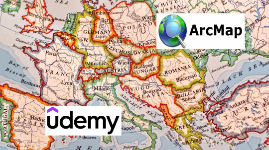
ArcGIS/ArcMap Made Easy! Learn GIS Mapping & Analysis with Udemy
🗺️ New to ArcGIS/ArcMap? This course makes learning GIS fun and easy! Gain real-world skills in mapping, spatial analysis, and geospatial data handling with hands-on exercises.
🔥 LIMITED DEAL: ONLY 7.69 USD from 14.8 USD (48% OFF), Enroll now!
📌 Start today & become a GIS expert in no time!
#GISbeginner#ArcGISArcMapTutorial#SpatialAnalysis#ArcGISArcMaptraining#LearnMapping#GISdata#GeospatialScience#CartographyTips#GISlearning#UdemyGIS🚀
0 notes
Text
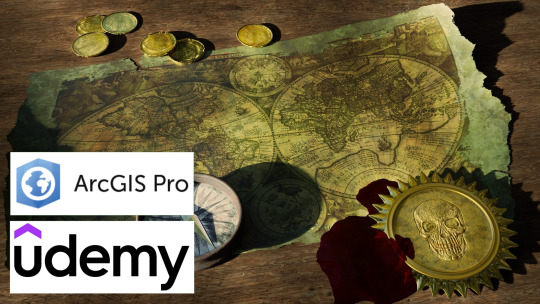
ArcGIS Pro Training – From Basics to Advanced GIS Techniques
Whether you're a beginner or an expert, this ArcGIS Pro Udemy course covers everything you need to know!
📍 Get Discount 48% off (Only $12.99 from $19.99) – Get started today!
#ArcGISProBasics#GISCourse#LearnGISNow#MappingForBeginners#DataVisualization#GISTrainingOnline#GeospatialScience#UdemyArcGISPro#GISMappingCourse#LearnMapping
0 notes
Text
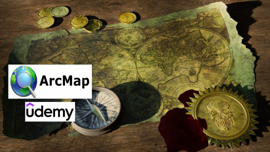
ArcGIS/ArcMap Training – From Basics to Advanced GIS Techniques
Description: Whether you're a beginner or an expert, this ArcGIS/ArcMap Udemy course covers everything you need to know!
📍 ONLY 7.69 USD from 14.8 USD (48% OFF) – Get started today!
#ArcGISArcMapBasics#GISCourse#LearnGISNow#MappingForBeginners#DataVisualization#GISTrainingOnline#GeospatialScience#UdemyArcGISArcMap#GISMappingCourse#LearnMapping
0 notes
Text
ArcGIS/ArcMap Training – From Basics to Advanced GIS Techniques
Whether you're a beginner or an expert, this ArcGIS/ArcMap Udemy course covers everything you need to know!
📍 ONLY 7.69 USD from 14.8 USD (48% OFF) – Get started today!
#ArcGISArcMapBasics#GISCourse#LearnGISNow#MappingForBeginners#DataVisualization#GISTrainingOnline#GeospatialScience#UdemyArcGISArcMap#GISMappingCourse#LearnMapping
0 notes