#Mississippiriver
Text

#trieyemedia#memphis#mississippiriver#mississippisunsetsarethebest#canon eos m50#canon photography#street photography#landscape photography
4 notes
·
View notes
Text
What's up with the Mississippi River lately?
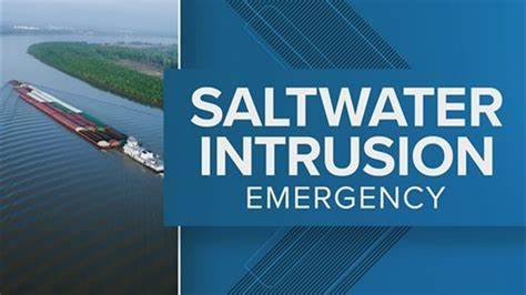
A look into the current saltwater intrusion affecting Louisiana
*Slight Disclaimer: To be clear, what you are reading now is not expert opinion, rather educated research formulated into my own knowledge and understanding of said subject material. Thank you for listening.
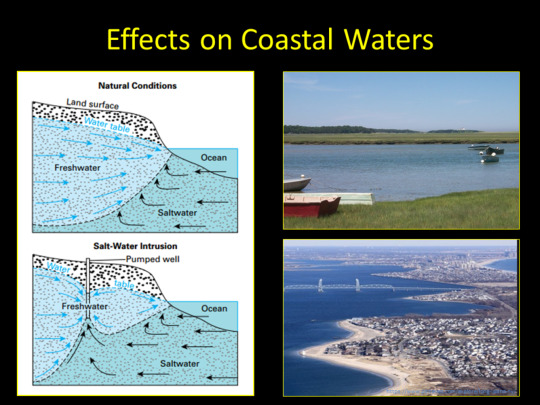
Firstly, I think that it is appropriate to inform ourselves as to what this saltwater intrusion is. According to the U.S Geological Survey, “This interface between freshwater and saltwater is maintained near the coast or far below the land surface. The interface...is a diffuse zone where freshwater and saltwater mix. Under natural conditions, the seaward movement of freshwater prevents saltwater from encroaching on freshwater coastal aquifers. We generally see saltwater intrusions occur in spots where a pumping well (structural device used to extract liquid resources) is operated. To put it into current perspective though, the saltwater intrusion we are recently hearing about is due to a lack of rainfall within the regions that the Mississippi River occupies. Basically, water from the Gulf of Mexico has been invading the supply of water the Mississippi River provides, due to this drought. This has slowed and interrupted the flow of streaming water, enabling the intrusion of salt water to contaminate this freshwater supply.
Hot and dry conditions over the summer seem to have triggered the extreme drought, affecting people not only in Mississippi, but in Southeast Louisiana as well. Residents' kitchen faucets, showers, and other essential water systems are becoming unsafe to utilize. People more at risk include pregnant women, those with kidney disease, high blood pressure, and autoimmune diseases. ABC News provides coverage of the intrusion situation in Louisiana. Following is a quote from Matt Roe, a spokesperson for the U.S. Army Corps of Engineers in New Orleans, when referring to the current state of the Mighty Mississippi River, “it doesn’t have the mass and velocity needed to push the salt water back down around the mouth of the river.” He is explaining the reason as to why the intrusion is happening.
Because the water has become unsafe, reliance on prepackaged water bottles has become more common. These bottles are necessary to prepare meals in some areas, as well as to drink. A councilman from the Plaquemines Parish (greater southeast New Orleans region) Mark “Hobbo” Cognevich, chimes on the present affairs of the affected areas and says “grocery stores are constantly having to restock plastic water bottles, neighbors have reported getting rashes after showering...We are praying for rain...” It is evident that this water intrusion is a problem and is causing complications for ordinary living in the affected areas. So, how have officials responded to this environmental crisis? One example is the heightening of an existing underwater levee used to block and slow the flow of salt water. Also, millions of gallons of fresh water are being taken by barges to treatment facilities in impacted areas.
All in all, while steps are being taken to aid the plight of residents, there is still a mistrust between residents and officials. I think this is so because Louisiana is a state that has endured prior instances of environmental disaster. The guidance given and availability of resources has not always been equitable or distributed in a timely manner, leaving residents distrusting and insecure in the faith of officials.
I hope this was informative and was able to resonate with you in any way, appreciate the read!
Cline, S. (2023, September 25). What is saltwater intrusion and how is it affecting Louisiana’s drinking water? ABC News. https://abcnews.go.com/US/wireStory/explainer-saltwater-intrusion-affecting-louisianas-drinking-water-103480428
Water Resources Mission Area. (2019, March 2). Saltwater Intrusion. Saltwater Intrusion | U.S. Geological Survey. https://www.usgs.gov/mission-areas/water-resources/science/saltwater-intrusion
3 notes
·
View notes
Photo
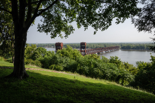
Burlington, Iowa
In the summer of 2017, I followed the Chicago, Burlington and Quincy Railroad across Iowa. So to begin with here, we see the bridge of the CB&Q over the Mississippi River at Burlington, Iowa. The photographer is looking eastward toward Illinois.
Why do I post this image today? Speaking with a buddy of mine this afternoon, he related a story where he stayed at the Aldo Leopold House in Burlington. This got me looking for an image of the bridge, which made me realize that I must have been standing in the yard of the historic home, or adjacent to it, when taking this picture.
The original version of the bridge was built in 1868 as a single-track swing bridge. Later, in 1893, it was double tracked and turned into the lift-bridge you see here—though altered and strengthened in the 1930s. Not a great picture as you can’t see the lift span.
One image by Richard Koenig; taken August 19th 2017.
#railroadhistory#railwayhistory#cb&q#burlington#burlingtonia#burlingtonrailroad#cb&qrailroad#mississippiriver#liftbridge#burlingtonroute
12 notes
·
View notes
Photo
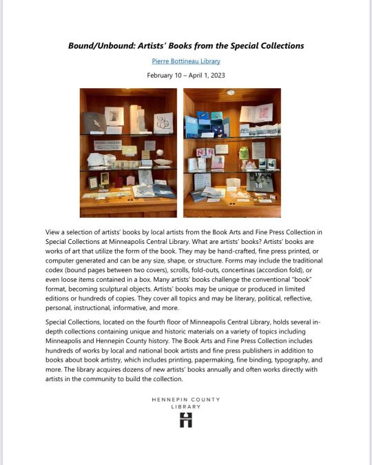
My book #Mississippi is on view at the Pierre Bottineau Library in N.E. Minneapolis through the end of March. It is on display with many other amazing artist books by inspiring artists in our community. If you have a chance, please stop by and see it! #mississippiriver #mnartist #artistbooks #photobooks #photography #womenartist #womenwhophotograph #spoonieartist #cvid #cvidartist #allthroughalenspodcast https://www.instagram.com/p/CpBNpH5JHHP/?igshid=NGJjMDIxMWI=
#mississippi#mississippiriver#mnartist#artistbooks#photobooks#photography#womenartist#womenwhophotograph#spoonieartist#cvid#cvidartist#allthroughalenspodcast
4 notes
·
View notes
Photo

The Grand River Center center pavilion offers a set of glass windows that guide the viewer as a link from the Mississippi River to the heart of the City of Dubuque. As the first city in Iowa, it has grown into a major metropolitan of activity. Proud to have been one of the 1986 group who gathered to save us and help us thrive and grow. #aerial #urbanphotography #aerialphotography #editorialphotography #commercialphotography #wonderfulmachine #500px #bnw #river #mississippiriver #associatedpress #natgeoyourshot https://www.instagram.com/p/ClFqPl2upL0/?igshid=NGJjMDIxMWI=
#aerial#urbanphotography#aerialphotography#editorialphotography#commercialphotography#wonderfulmachine#500px#bnw#river#mississippiriver#associatedpress#natgeoyourshot
2 notes
·
View notes
Text
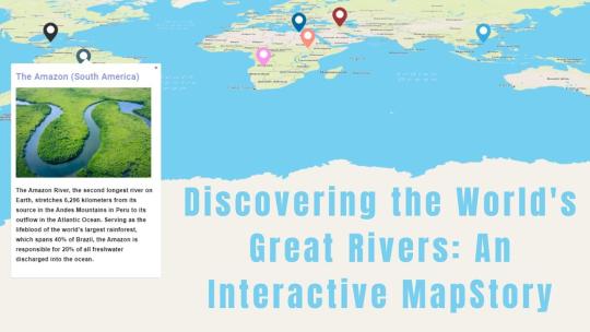
Discovering the World's Great Rivers: An Interactive MapStory
Introduction
Let's dive into the stories of some of the world’s most famous rivers using Story by MAPOG! We’ll look at the Nile, Amazon, Yangtze, Congo, Mississippi, Volga, and Danube rivers. These rivers are more than just water—they’ve shaped cultures, supported wildlife, and influenced history. With MapStory, you’ll get to see how these amazing rivers connect with our world.

The Rivers and Their Stories
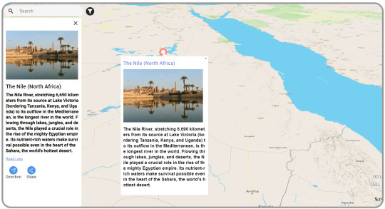
The Nile (North Africa)
The Nile is the longest river in the world. It stretches from East Africa to the Mediterranean Sea. For thousands of years, it’s been crucial for life in North Africa. The Nile provides water for farming and has helped build cities and cultures along its path.
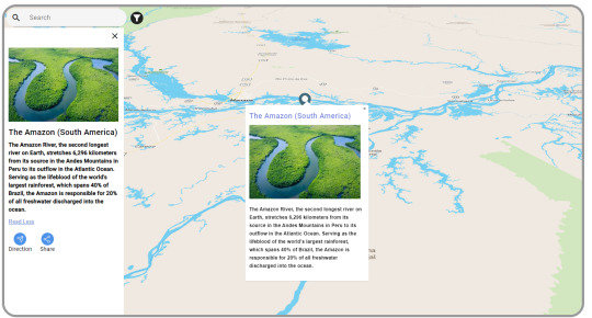
The Amazon (South America)
The Amazon is the largest river by volume. It runs through the Amazon rainforest, known for its incredible wildlife. The Amazon is vital for many plants and animals and plays a big role in regulating the Earth’s weather.
The Yangtze (China)
The Yangtze is the longest river in China. It starts in the Tibetan Plateau and flows to the East China Sea. It’s essential for farming, industry, and millions of people. The Yangtze is deeply connected to Chinese life and culture.

The Congo (Central Africa)
The Congo is Africa’s second-longest river. It’s famous for its rainforests and rich wildlife, like gorillas and elephants. The Congo is key for transportation and trade in Central Africa and helps keep local cultures vibrant.

The Mississippi (North America)
The Mississippi River runs from Minnesota to the Gulf of Mexico. It’s a big part of American history, influencing trade, transportation, and culture. The Mississippi has shaped the lives of many people in the U.S. and inspired music and traditions.

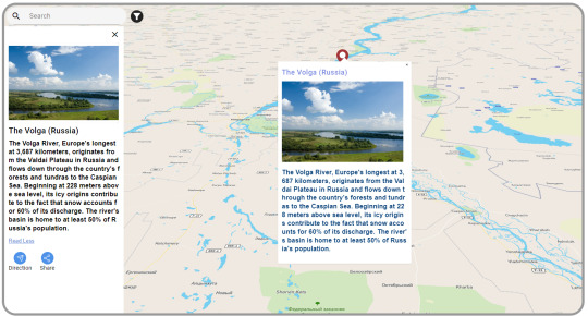
The Volga (Russia)
The Volga is Europe’s longest river. It flows through central Russia and is crucial for farming, energy, and transport. The Volga is important in Russian culture, inspiring many songs and stories.
The Danube (Central and Eastern Europe)
The Danube flows through ten countries, offering stunning views and historic cities like Vienna and Budapest. It’s been a major trade route for centuries and supports diverse wildlife. The Danube helps connect different cultures and economies.

Tool Used: MapStory
We’re using Story by MAPOG to learn about these rivers. It’s not just a map—it’s a way to tell the stories of these rivers and show what makes them unique.
How MapStory Helps
Shows Information: MapStory helps us bring together different details to highlight what makes each river special.
Engages Users: Telling stories through maps makes it easy and enjoyable to learn about the rivers’ history and importance.
Adds Photos: We can include pictures to make the stories about the rivers come to life.
Interactive Map: You can click on the map to find out more about different places and features along each river.
Customizable Stories: Each river’s story can be adjusted to fit various themes and interests, making each map unique.
Who Can Benefit
Story by MAPOG is useful for many areas. Whether you’re interested in environmental studies, education, tourism, cultural preservation, or urban planning, Story by MAPOG offers valuable insights and engaging content. It’s a great tool for anyone curious about these major rivers.
Conclusion
Learning about the world’s great rivers with Story by MAPOG is a fun way to see their beauty and importance. By combining maps with stories, Story by MAPOG helps us connect more with these rivers. For more information or to start your own MapStory journey, visit MAPOG or reach out to us at [email protected].
#GreatRivers#MapStory#MAPOG#NileRiver#AmazonRiver#YangtzeRiver#CongoRiver#MississippiRiver#VolgaRiver#DanubeRiver#InteractiveMap#CulturalHeritage#Wildlife#History#Geography#EducationalTools#Storytelling#Mapping#GlobalRivers#EnvironmentalAwareness#Tourism
1 note
·
View note
Text
Remember Four Crooked Letters To Pass A Spelling Test
The Mississippi River-Saint Louis Missouri
Saint Louis Missouri
Mississippi River St. Louis Missouri
Water Water Everywhere
Facebook
Pinterest
Tumblr
WhatsApp
X
Sending smiles your way 🙂 🙂 🙂 🙂Alice DeForest
Men At WorkMay 31, 2020Alice DeForestFront Yard GardenAugust 16, 2019Alice DeForestDevoted to oneJuly 14, 2019Alice DeForest

View On WordPress
0 notes
Text

A skyline shot of my home city I took a while ago
1 note
·
View note
Text
0 notes
Text
#Intracoastal Waterway#and Alaska Cruises#americancruiselines#americancruises#americanrivercruise#rivercruise#mississippiriver#mississippirivercruise#snakeriver#intracoastalcruise#columbiariver#alaskacruise#coastalcruises
0 notes
Text

#trieyemedia#memphis#riverside#downtown#mississippisunsetsarethebest#mississippiriver#canon eos m50#canon photography
5 notes
·
View notes
Text
What's with the Mississippi River lately?
A look into the current saltwater intrusion affecting Louisiana
*Slight Disclaimer: To be clear, what you are reading now is not expert opinion, rather educated research formulated into my own knowledge and understanding of said subject material. Thank you for listening.
Firstly, I think that it is appropriate to inform ourselves as to what this saltwater intrusion is. According to the U.S Geological Survey, “This interface between freshwater and saltwater is maintained near the coast or far below the land surface. The interface...is a diffuse zone where freshwater and saltwater mix. Under natural conditions, the seaward movement of freshwater prevents saltwater from encroaching on freshwater coastal aquifers. We generally see saltwater intrusions occur in spots where a pumping well (structural device used to extract liquid resources) is operated. To put it into current perspective though, the saltwater intrusion we are recently hearing about is due to a lack of rainfall within the regions that the Mississippi River occupies. Basically, water from the Gulf of Mexico has been invading the supply of water the Mississippi River provides, due to this drought. This has slowed and interrupted the flow of streaming water, enabling the intrusion of salt water to contaminate this freshwater supply.
Hot and dry conditions over the summer seem to have triggered the extreme drought, affecting people not only in Mississippi, but in Southeast Louisiana as well. Residents' kitchen faucets, showers, and other essential water systems are becoming unsafe to utilize. People more at risk include pregnant women, those with kidney disease, high blood pressure, and autoimmune diseases. ABC News provides coverage of the intrusion situation in Louisiana. Following is a quote from Matt Roe, a spokesperson for the U.S. Army Corps of Engineers in New Orleans, when referring to the current state of the Mighty Mississippi River, “it doesn’t have the mass and velocity needed to push the salt water back down around the mouth of the river.” He is explaining the reason as to why the intrusion is happening.
Because the water has become unsafe, reliance on prepackaged water bottles has become more common. These bottles are necessary to prepare meals in some areas, as well as to drink. A councilman from the Plaquemines Parish (greater southeast New Orleans region) Mark “Hobbo” Cognevich, chimes on the present affairs of the affected areas and says “grocery stores are constantly having to restock plastic water bottles, neighbors have reported getting rashes after showering...We are praying for rain...” It is evident that this water intrusion is a problem and is causing complications for ordinary living in the affected areas. So, how have officials responded to this environmental crisis? One example is the heightening of an existing underwater levee used to block and slow the flow of salt water. Also, millions of gallons of fresh water are being taken by barges to treatment facilities in impacted areas.
All in all, while steps are being taken to aid the plight of residents, there is still a mistrust between residents and officials. I think this is so because Louisiana is a state that has endured prior instances of environmental disaster. The guidance given and availability of resources has not always been equitable or distributed in a timely manner, leaving residents distrusting and insecure in the faith of officials.
I hope this was informative and was able to resonate with you in any way, appreciate the read!
Cline, S. (2023, September 25). What is saltwater intrusion and how is it affecting Louisiana’s drinking water? ABC News. https://abcnews.go.com/US/wireStory/explainer-saltwater-intrusion-affecting-louisianas-drinking-water-103480428
Water Resources Mission Area. (2019, March 2). Saltwater Intrusion. Saltwater Intrusion | U.S. Geological Survey. https://www.usgs.gov/mission-areas/water-resources/science/saltwater-intrusion
1 note
·
View note
Text
Our newest invention based on The Pascal's Law and The Adventures of Huckleberry Finn
Introducing The Pascal’s Law: Picture yourself in a world where fluids have all the power! Named after the famous physicist and mathematician Blaise Pascal, this law states that a change in pressure applied to an enclosed fluid is transmitted undiminished to all portions of the fluid and to the walls of its container. In simpler terms, it means that the pressure you apply to a fluid in one place,…

View On WordPress
#adrenaline#AdventuresofHuckleberryFinn#EqualOpportunityPressure#FluidPower#freedom#friendship#HumanIngenuity#HumorousTale#HydraulicHuckRaft#Innovation#laughter#MarkTwain#MischievousInventions#MississippiRiver#NaturePranks#PascalsLaw#PressureSurfing#PressureTransmission#RaftJourney#RunawaySlave#SelfHealing#UnforgettableEscapades
0 notes
Text
Mayflies have such a fascinating lifecycle. Egg, nymph, subimago, & imago. Once they emerge as their winged adult form (imago), they only live a few minutes to a few days, depending on species. #Midwest #MississippiRiver #Mayfly #insects
1 note
·
View note
Link
🚗 Get ready to hit the road and discover the stunning scenic route from Winona to La Crosse. This picturesque drive will take you through the heart of the Midwest, showcasing the region's natural beauty and charming small towns. 🌳 As you wind your way through the rolling hills and lush forests, you'll be treated to breathtaking views of the Mississippi River and its surrounding valleys. Keep an eye out for wildlife, including eagles and deer, as you make your way along this peaceful route. 🏞️ Whether you're a nature lover, history buff, or simply looking for a relaxing drive, the scenic route from Winona to La Crosse is sure to delight. So pack up the car and hit the road for an unforgettable journey through the heart of the Midwest.1. The Best Route from Winona to La Crosse: A Scenic AdventureEmbark on a scenic adventure from Winona to La Crosse, taking in the breathtaking views along the way. Start your journey on Highway 61, heading north towards Wabasha. Take a detour to the National Eagle Center and witness the majesty of America's national bird. Continue on Highway 61, crossing the Mississippi River into Wisconsin. Stop at Merrick State Park for a picnic and a hike through the beautiful trails. Drive through the historic town of Trempealeau and enjoy the stunning views of the river valley. Arrive in La Crosse and explore the charming downtown area. Don't forget to bring your camera to capture the stunning scenery along the way. 📷 This route is perfect for a day trip or a weekend getaway, offering a perfect balance of adventure and relaxation. 🌄 Experience the beauty of the Midwest on this unforgettable journey. 🌳2. Exploring the Hidden Gems Along the Way: Winona to La CrosseAs you travel from Winona to La Crosse, don't miss out on these hidden gems: Great River Bluffs State Park: Hike through the stunning bluffs and enjoy panoramic views of the Mississippi River. 🌄 Elmaro Vineyard: Sip on award-winning wines while enjoying the picturesque scenery of the vineyard. 🍷 Lock and Dam No. 7: Watch barges and boats pass through the lock and dam system while learning about the history of the Mississippi River. 🚢 Grandad Bluff: Take in breathtaking views of the city and the Mississippi River from the top of the bluff. 🌇 La Crosse River State Trail: Bike, hike, or ski through the scenic trail that follows the La Crosse River. 🚴♀️ Don't forget to stop by the charming towns of Trempealeau and Onalaska for unique shopping and dining experiences. 🛍️🍴 Whether you're an outdoor enthusiast or a wine connoisseur, Winona to La Crosse has something for everyone. Don't miss out on these hidden gems! 🤩3. The Ultimate Guide to Road Tripping from Winona to La CrosseReady for an adventure? Here's . First stop: Garvin Heights Lookout. Enjoy panoramic views of the Mississippi River Valley. 🌅 Next, head to Great River Bluffs State Park. Hike trails and see wildlife. 🦌 Continue to La Crescent for apple picking and cider at the Apple Blossom Orchard. 🍎 Take a break in La Crosse and stroll the charming downtown area. 🚶♀️ Don't miss Grandad Bluff, a must-see overlook with breathtaking views of the city. 🌇 For a unique experience, visit the Shrine of Our Lady of Guadalupe. 🙏 End your trip with a visit to Pearl Street Brewery for craft beer and live music. 🍻🎶 Remember to pack snacks, water, and a camera. Enjoy the scenic drive and have fun! 🚗📷4. Uncovering the Natural Beauty of the Scenic Route from Winona to La CrosseExperience the breathtaking views of the Mississippi River as you drive from Winona to La Crosse. Stop at Garvin Heights for panoramic views of the city and river. Explore the Great River State Trail for hiking and biking. Visit the Merrick State Park for camping and fishing. Discover the unique shops and restaurants in the quaint towns along the way. Try the famous pies at The Homemade Cafe in Pepin. Shop for antiques at the Rustic Resale in Trempealeau. Enjoy a beer at Pearl Street Brewery in La Crosse. Don't forget to take a scenic drive through the rolling hills and bluffs. Stop at the overlooks for stunning views of the river valley. Take a detour to the Norskedalen Nature and Heritage Center. Experience the beauty of the fall colors in October. Make memories and capture the natural beauty of the scenic route from Winona to La Crosse. 🌅🚗5. Discovering the Rich History and Culture of Winona and La CrosseExplore the fascinating history of Winona and La Crosse, two cities rich in culture and heritage. Visit the Winona County History Center for a glimpse into the past. Take a tour of the Hixon House, a stunning example of Victorian architecture. Learn about the Native American history of the region at the Minnesota Marine Art Museum. Discover the vibrant arts scene in both cities, with galleries, theaters, and music venues. Check out the Pump House Regional Arts Center for exhibitions and performances. Experience the La Crosse Symphony Orchestra, one of the oldest in the country. Attend the Great River Shakespeare Festival, a summer tradition in Winona. Sample the local cuisine, with a focus on farm-to-table dining and craft beer. Try the wood-fired pizzas at The Red Horse, a Winona favorite. Enjoy a pint at Pearl Street Brewery, a La Crosse institution. Taste the seasonal dishes at The Blue Heron, a farm-to-table restaurant in Winona. Immerse yourself in the natural beauty of the area, with hiking, biking, and water activities. Explore the bluffs and valleys of the Great River State Trail. Paddle the Mississippi River with River Rats Kayak Rentals. Hike to the top of Garvin Heights for panoramic views of Winona. Experience the unique charm and character of Winona and La Crosse, two cities with a rich history and culture.6. Must-See Attractions and Activities Along the Scenic Route from Winona to La CrosseEmbark on a scenic drive from Winona to La Crosse and explore these must-see attractions: Visit the Great River Bluffs State Park for breathtaking views of the Mississippi River and hiking trails. Stop by the National Eagle Center in Wabasha to learn about eagles and see them up close. Take a stroll through the charming town of Alma and enjoy the views of the river and bluffs. Explore the historic downtown of La Crosse and its many shops, restaurants, and breweries. Experience the beauty of the La Crosse River Marsh by hiking or biking its trails. Take a scenic drive on the Great River Road and enjoy the views of the river and surrounding bluffs. Don't forget to snap a picture of the iconic "World's Largest Six Pack" in La Crosse!7. Tips for a Memorable Journey from Winona to La Crosse: What to Know Before You GoBefore embarking on your journey from Winona to La Crosse, here are some tips to make it memorable: Plan your route ahead of time to avoid getting lost. Check the weather forecast to ensure a safe and comfortable trip. Bring snacks, water, and entertainment for the ride. Stop at scenic overlooks and take pictures to capture the beauty of the Mississippi River. Visit local attractions, such as the Great River Road and the National Eagle Center. Experience the local cuisine by trying out restaurants and cafes along the way. Take breaks to stretch your legs and enjoy the journey. With these tips, your journey from Winona to La Crosse will be an unforgettable adventure. 🚗🌅🍔 In conclusion, taking the scenic route from Winona to La Crosse is a must-do for anyone looking to experience the beauty of the Mississippi River. 🌊 With its winding roads, stunning views, and charming small towns, this drive is a true gem. 🚗 Don't miss out on the opportunity to see the majestic bluffs, colorful foliage, and picturesque farms along the way. 🌳🌾 And be sure to stop in the quaint towns of Fountain City and Trempealeau for some local flavor. 🍔🍺 So next time you're planning a road trip, consider taking the scenic route from Winona to La Crosse. You won't regret it! 🛣️ https://lacrossee.com/discovering-the-scenic-route-from-winona-to-la-crosse/?_unique_id=6491a9d3be652
0 notes
Text
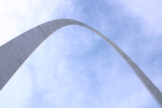
The Gateway Arch
Visit St. Louis and see the tallest monument in the nation
View On WordPress
0 notes
Last Seen Blogs


