#geospatial data
Explore tagged Tumblr posts
Visit Tumblr Blog
Explore Tumblr blogs with no restrictions, modern design and the best experience.
Last Seen Tumblr Blogs


Fun Fact
Tumblr has a low social media market share in South America.
Text
Google BigQuery Geospatial: Analyze Location Data In Cloud

Use Google's new geographic datasets to improve BigQuery analysis.
Geospatial Google BigQuery
Today at Google Cloud Next 25, it unveils Earth Engine and Google Maps Platform geospatial analytics datasets and functionalities. BigQuery, Google's data-to-AI technology, integrates them flawlessly. BigQuery users know the value of data-driven insights, and these new features will let you analyse data from additional sources and leverage geographic data to make faster, more informed choices.
Geographical analytics trends and issues
Due to generative AI, hyper-localization, and strong analytical tools, geospatial analytics is increasing quickly. Despite these developments, many sectors underuse geospatial analytics. Finding fresh, accurate, and full data in an analysis-ready format takes time and resources. Second, because various data sources contribute unpredictability, firms struggle with integration and analysis, requiring extensive planning and transformation.
Finally, building geospatial analytics applications requires expertise and consistency.
How new geospatial capabilities solve these problems
The trustworthy geospatial technology Google Maps Platform improves the lives of over 2 billion users with over 10 million websites and apps. Over the past 15 years, Earth Engine has provided data scientists with over 90 petabytes of satellite images and geospatial data.
Customers want greater insights from the vast geographical data to improve business and sustainability choices. We are integrating a few Google Maps Platform datasets and Earth Engine datasets and analytic tools directly into BigQuery for the first time. This means data analysts and decision-makers may now use BigQuery to access and analyse fresh, vast, and global geospatial data.
These new datasets and capabilities allow:
Novel perspectives, trusted tools: Use Google's new global geospatial data without remote sensing or GIS expertise.
Integration of geographical data with your data yields fresh insights.
Easy data access and discovery: No more data digging. Geospatial data may be examined like other BigQuery datasets.
The first integration of analysis-ready pictures and datasets from Earth Engine, Places, and Street View into BigQuery processes allows customers to leverage data clean rooms to extract insights without releasing raw data.
Imagery insights
The first Experimental Imagery Insights dataset for the US, Canada, UK, and Japan speeds up infrastructure asset management using Street View data's global scale, Vertex AI-powered analysis, and BigQuery's capacity.
This combo lets you utilise Street View pictures to quickly recognise and automatically assess infrastructure assets like road signs and utility poles, with the option to add more attribute types.
Street View photos can assist municipal planners estimate annual road sign repair costs by detecting the quantity and location of sign maintenance needs. Data-driven decision-making, process optimisation, and planning and operational efficiency result from integration.
Locations Analysis
Places Insights provides monthly Google Maps data on over 250 million companies and places to help you make smarter business decisions. This Places dataset provides insights beyond POI information like wheelchair accessibility and pricing range. You will learn more about millions of companies and attractions, such as the location of most coffee shops in a zip code.
BigQuery's data clean room can mix Places data with proprietary data to disclose more about certain places. Understand local market dynamics and find the ideal store sites based on complementary companies' locations are typical use cases.
Roads Management Advice
Roads Management Insights helps public and road authorities improve road network efficiency and safety through data-driven traffic management. Past data analysis reveals traffic trends on your road networks, likely slowness causes, and required action. With real-time monitoring, authorities can respond to sudden speed drops, identify the source, and maybe redirect traffic in seconds.
BigQuery Earth Engine
Earth Engine with BigQuery brings Earth Engine's best geographic raster data analytics to BigQuery. This functionality allows SQL users to do comprehensive geospatial analysis of satellite photography datasets without remote sensing expertise.
ST_REGIONSTATS(), a new BigQuery geography function, reads and analyses geospatial raster data in a given region using Earth Engine. You can now access more Earth Engine datasets from BigQuery to Analytics Hub's Earth Engine datasets, making data access and discovery easier.
Google's geospatial analytics datasets in BigQuery can help make business and environmental decisions like optimising infrastructure operations and maintenance, enabling sustainable sourcing with global supply chain transparency, improving road safety and traffic, and more.
#technology#technews#govindhtech#news#technologynews#cloud computing#BigQuery#geospatial#geospatial capabilities#Geospatial analytics#Bigquery Geospatial#geospatial data#geospatial technology
0 notes
Text
How to Find, Evaluate, and Effectively Use Geospatial Data in GIS: A Step-by-Step Guide
In today's data-driven world, geospatial data has become essential for businesses, researchers, and governments to make informed decisions. Whether you're working in urban planning, environmental science, logistics, or other fields, the ability to locate, evaluate, and use geospatial data effectively in GIS (Geographic Information Systems) can make a significant impact. Here’s a step-by-step guide to help you through the process of working with geospatial data to maximize its potential in your GIS projects.
Step 1: Understanding Geospatial Data and Its Types
Before diving into finding geospatial data, it's essential to understand its forms and applications. Geospatial data represents geographic information, typically in terms of latitude, longitude, and elevation. The data comes in two main types:
Raster Data: Composed of grid cells or pixels, such as satellite imagery or aerial photographs.
Vector Data: Includes points, lines, and polygons, used to represent specific features like roads, city boundaries, and infrastructure.
Understanding which type of data is needed will set the foundation for your project.
Step 2: Identifying Your Data Needs
Define the scope and objectives of your project. Questions to ask include:
What area does the project cover? Identify the geographic scope.
What data variables are required? For example, temperature, elevation, or land cover types.
How recent should the data be? Some projects require real-time data, while others may use historical data.
What resolution or detail is needed? Higher resolution is useful for local analyses, while lower resolution might be sufficient for regional or global projects.
With this information, you can start searching for the appropriate data sources.
Step 3: Finding Reliable Sources of Geospatial Data
Many public and private organizations provide access to geospatial data. Here are some popular sources:
Government Databases:
USGS Earth Explorer: Excellent for US-specific data, particularly for geological and topographic information.
NASA Earth Data: Free datasets for satellite imagery and climate information.
Copernicus Open Access Hub: Provides data from the European Union's Sentinel satellites.
Global Databases:
OpenStreetMap (OSM): A community-driven mapping platform, providing access to vector data like roads and landmarks.
Google Earth Engine: A robust platform offering global-scale geospatial datasets and processing capabilities.
Natural Earth: Free vector and raster map data at different scales for global use.
Commercial Data Providers:
DigitalGlobe and Planet Labs: These companies offer high-resolution satellite imagery and geospatial data, typically on a paid basis.
For more specialized datasets, reach out to academic institutions or industry-specific organizations. Once you’ve identified potential sources, move on to evaluating the data.
Step 4: Evaluating Geospatial Data Quality
Once you’ve sourced your data, it's critical to assess its quality to ensure it meets your project's requirements. Consider the following factors:
Accuracy: Ensure the data aligns with real-world measurements. Vector data should match the geographic reality, and raster data should align with known resolutions.
Timeliness: Is the data up-to-date, or is historical data sufficient? Projects that monitor trends over time might require datasets spanning multiple years.
Completeness: Verify that the dataset covers your entire area of interest without gaps.
Reliability: Look for metadata, which provides details about data collection methods, processing, and sources. Reliable data is usually backed by documentation.
Compatibility: Ensure the data format (e.g., shapefile, GeoTIFF, KML) is compatible with your GIS software. Most GIS platforms support common formats, but it’s best to double-check.
Evaluating data quality can help avoid costly errors and inaccuracies during analysis.
Step 5: Processing and Cleaning Geospatial Data
Geospatial data often requires cleaning and processing to prepare it for analysis:
Projection and Coordinate Systems: Ensure all data layers use the same coordinate system. Misaligned layers can lead to inaccurate spatial analyses.
Data Transformation: Adjust formats as needed to fit your analysis. For instance, raster data might need to be reclassified for thematic mapping, while vector data may require simplification.
Error Correction: Check for and correct errors like missing values or outliers.
Resampling: For raster data, resampling may be necessary to match different resolutions across datasets.
These steps prepare your data to integrate seamlessly in GIS, minimizing errors during analysis.
Step 6: Conducting Geospatial Analysis in GIS
Once the data is clean and ready, GIS provides powerful tools to analyze and interpret it. Here are a few common types of geospatial analysis:
Spatial Analysis: Use tools like overlay, buffering, and spatial joins to find relationships between different datasets. For example, analyze how close schools are to certain environmental hazards.
Temporal Analysis: For time-based data, use temporal analysis to observe changes over time. This is useful for tracking urban growth, deforestation, or climate patterns.
Statistical Analysis: GIS platforms offer statistical tools that allow you to quantify spatial patterns, helping in hotspot analysis or population density mapping.
Predictive Modeling: Create models that use spatial data to predict future trends, such as urban sprawl or wildlife habitat migration.
Each type of analysis provides unique insights to support data-driven decisions.
Step 7: Visualizing and Presenting Geospatial Data
Good visualization makes data insights accessible. Use GIS tools to create clear, informative maps, and customize visualization elements:
Layering and Symbology: Adjust colors, symbols, and labels to represent different data types clearly. For example, use blue for water bodies and green for vegetation.
Classification: Group data into meaningful categories, like low, medium, and high elevation, for better interpretation.
Legends and Scale Bars: Include legends, scale bars, and north arrows to make maps easy to read and understand.
Presenting data in visually appealing formats enhances comprehension and effectively communicates your findings to stakeholders.
Step 8: Sharing and Storing Your Geospatial Data
Once your analysis and visualization are complete, you may want to share it with others or store it for future use:
Export Options: Most GIS platforms allow you to export maps in various formats, such as PDFs, JPGs, or online interactive maps.
Data Sharing Platforms: Platforms like ArcGIS Online and QGIS Cloud make it easy to share data and maps with collaborators.
Data Storage: Geospatial data files can be large, so store them in a secure location. Cloud storage solutions like Google Drive, Dropbox, or Amazon S3 provide scalable options.
Following these steps ensures that your data is preserved and accessible for future projects.
Final Thoughts
Working with geospatial data requires a blend of technical skills and attention to detail, but the potential insights are invaluable. Choose experienced partner like Magnasoft who hold decades of experience, industry connections, and advanced tools. From sourcing quality data to advanced analysis and visualization, Magnasoft supports every stage of your GIS project, empowering you to make data-driven decisions confidently and effectively.
Start your next GIS project with Magnasoft and unlock the power of precise, reliable geospatial data! For more insights and tips, follow Magnasoft’s updates as we continue to lead in GIS solutions.
0 notes
Text

Optimizing Networks for Efficiency: Strategies and Best Practices
In the ever-evolving landscape of telecoms, network optimization is now a focus for service providing companies searching to enhance performance and offer extraordinary service quality.
The Role of Fiber Management
Fiber Management is a cornerstone of current network optimization. As fiber optic networks become the backbone for worldwide connectivity, managing these assets efficiently is important. Fiber management is the systematic management and control of fiber optic cable, connectors and the associated infrastructure to ensure uninterrupted data transmission.
Click to read more.
Originally published: https://leptonsoftware.com/optimizing-networks-for-efficiency-strategies-and-best-practices/
#lepton maps#lepton software#gis mapping#location intelligence#fiber network#network optimization#telecom solutions#gis#maps#3d map#gis tool#data visualization#geospatial data#geo-fencing#geospatial intelligence#fiber management#fiber planner#fiber planning#fiber design#smartinventory#networkaccess#leptonsoftware
0 notes
Text
FOI release: discussion paper on Measuring Impact of the Geospatial Commission
Post: 8 August 2024
New blog post on my website:
FOI release: discussion paper on Measuring Impact of the Geospatial Commission
0 notes
Text

When the only thing you need after a 10h work schedule is to know the distance between two imaginary towns so you can accurately calculate the time to travel between them given the average horse speed so that you can accurately reference this in one line of a fic

4 notes
·
View notes
Text
i really thought the society & sustainability class would be my fave this quarter but NAY. map city baby.
#my prof for that class is way cooler & better at teaching#AND they said we could make shit up for our final project as long as we demonstrate an understanding#of geospatial data and arcGIS#the example they gave was setting parameters for preferred dragon dens and mapping where one might like to live#anyway im also learning just like. way more#i think i prefer working with data over the more... social science side of environmental science#the social science aspect is ofc important but thats not really what im in school for. i dont think i need a degree in that to understand i
3 notes
·
View notes
Text
location intelligence data
Advintek Geoscience is a leading provider of Location Intelligence solutions in Singapore and across ASEAN, delivering advanced geospatial analytics powered by MapInfo Pro and Precisely’s Spectrum Suite facebook.com+15geosciences.advintek.com.sg+15linkedin.com+15. Leveraging powerful mapping, spatial analysis, and real‑time data integration, they help businesses and government agencies uncover hidden patterns, optimize operations, and make smarter decisions .
From supply chain enhancements and site selection to public safety, telecom planning, and smart‑city deployment, Advintek’s scalable, secure platform enables cost optimization, predictive insights, and improved customer targeting geosciences.advintek.com.sg+1sg.linkedin.com+1. Their seamless integration with existing CRM, GIS, and BI systems ensures smooth adoption, while real‑time dashboards and geofencing offer actionable insights on the go geosciences.advintek.com.sg.
Trusted across diverse sectors—including energy, utilities, urban planning, and emergency response—Advintek’s Location Intelligence empowers clients to transform spatial data into transformative business outcomes facebook.com+15
#Location Intelligence Singapore#Geospatial Analytics ASEAN#MapInfo Pro Solutions#Spectrum Spatial Tools#Spatial Data Visualization#Real‑Time Geospatial Insights#location intelligence data#location based intelligence#location intelligence esri
0 notes
Text
Geospatial Analytics Revolution: Transforming Urban Planning, Transportation, and Defense (2025-2030)
Posted on 22nd May, 2025 by Rene Parekh: Author of Mapping Tomorrow The Dawn of a New Geospatial Era Have you ever wondered how your food delivery app knows exactly when your meal will arrive? Or how city planners determine where to place new public transport routes? Or perhaps how climate scientists predict the impact of rising sea levels on coastal cities with pinpoint accuracy? The answer…
#blockchain#defense#digital twins#geospatial analytics#gis#location intelligence#market growth#remote sensing#smart cities#spatial AI#spatial data#transportatiom#urban planning
0 notes
Text
Geospatial Solutions Market Set to Hit $2401.1 Billion by 2035
The global market for Geospatial Solutions is expected to experience significant growth, with industry revenue projected to rise from $488.0 billion in 2023 to $2401.1 billion by 2035. This reflects a compound annual growth rate (CAGR) of 14.2% from 2023 to 2035.
Detailed Analysis - https://datastringconsulting.com/industry-analysis/geospatial-solutions-market-research-report
Geospatial solutions are essential across a wide range of applications, including precision agriculture, urban planning, logistics and transportation, as well as defense and security. The market's growth is primarily driven by the increasing adoption of geospatial technologies in key sectors such as agriculture, urban development, and defense.
Competitive Landscape and Market Leadership
The Geospatial Solutions market is highly competitive, with several key players driving innovation and market penetration. Leading companies in the market include:
Esri
Hexagon Geospatial
Trimble
Topcon
HERE Technologies
Fugro
TomTom
Geo-Insights
Blue Marble Geographics
SuperMap
Mapbox
Cyient
These companies are at the forefront of advancing geospatial technologies, such as artificial intelligence (AI), machine learning, and real-time data analytics, which are helping to meet the growing demand for smarter and more efficient solutions across industries.
Key Growth Drivers and Market Opportunities
The growth of the Geospatial Solutions market is fueled by several factors:
Precision Agriculture: The growing need for efficient land use and sustainable farming practices is driving the demand for geospatial solutions in agriculture, enabling better crop management and resource allocation.
Urbanization and Smart City Initiatives: The increasing push for smart city development and urban planning requires geospatial technologies to manage infrastructure, transportation, and urban environments more efficiently.
Defense and Security: Geospatial solutions are playing a crucial role in defense and security applications, including surveillance, reconnaissance, and situational awareness.
Integration of AI and Machine Learning: The application of AI and machine learning in geospatial data analysis is enhancing the capabilities of these solutions, enabling real-time insights and decision-making.
Demand for Real-time Location Data: The growing reliance on real-time data in various sectors, including logistics, transportation, and emergency management, is driving the adoption of geospatial technologies.
Regional Dynamics and Supply Chain Evolution
North America and Asia-Pacific are the dominant regions in the Geospatial Solutions market. Both regions benefit from strong technological infrastructure, high levels of investment, and significant demand from key industries. However, emerging markets in India, Brazil, and South Africa are becoming increasingly important for market growth, driven by rapid urbanization, industrialization, and the adoption of new technologies.
Despite challenges such as high initial investments, data privacy concerns, and integration complexities, the geospatial solutions market’s supply chain—from data providers and software developers to system integrators and service providers—is expected to evolve to meet these challenges. Companies are also focusing on strategic advancements in developing regions to diversify revenue streams and expand their total addressable market (TAM).
About DataString Consulting
DataString Consulting is a leading provider of market research and business intelligence solutions, offering a comprehensive range of services for both B2C and B2B markets. With over 30 years of combined industry experience, DataString specializes in delivering actionable insights that support strategic decision-making.
The company’s expertise spans multiple industries, providing tailored research services in strategy consulting, opportunity assessment, competitive intelligence, and market forecasting. DataString Consulting helps businesses navigate complex markets and capitalize on emerging trends to achieve long-term success.
#Geospatial Solutions#Geospatial Technologies#Market Growth#Precision Agriculture#Smart Cities#Urban Planning#Logistics and Transportation#Defense and Security#AI and Machine Learning#Real-time Location Data#Industry Trends#Market Leadership#Competitive Landscape#Emerging Markets#Data Privacy#Market Forecast#North America Geospatial Market#Asia-Pacific Geospatial Market#Market Expansion#Strategic Investments#DataString Consulting#Market Research
0 notes
Text
Entrepreneurs Challenge Winner PRISM is Using AI to Enable Insights from Geospatial Data
NASA sponsored Entrepreneurs Challenge events in 2020, 2021, and 2023 to invite small business start-ups to showcase innovative ideas and technologies with the potential to advance the agency’s science goals. To potentially leverage external funding sources for the development of innovative technologies of interest to NASA, SMD involved the venture capital community in Entrepreneurs Challenge […] from NASA https://ift.tt/tBIjbwc
#NASA#space#Entrepreneurs Challenge Winner PRISM is Using AI to Enable Insights from Geospatial Data#Michael Gabrill
0 notes
Text
the funny thing about reading stuff for school is i realize that i don't think i would've enjoyed being a scientist, because i dislike designing experiments
#the reason this is funny is because it's readings for a library science degree#and like.... there are certainly elements of the field that are very heavily science-leaning but it's also easy to avoid those elements#if you so choose#anyway reading about an experiment to utilize personas in order to improve user interfaces regarding geospatial research data?#which going into the article i only understand 'user interfaces' in an academic sense (obviously i know personas in a gaming sense haha)#and they don't actually seem to be defining geospatial research which is....... fun#long story short they outlined their whole process (including initial data collection to properly set up the experiment)#and i just immediately recoiled from the entire concept of doing anything like that ahahahaha
1 note
·
View note
Text
Event: Special AAG Maptimes
In town for AAG 2025? WHAT: Come hang out with Detroit’s shadow geography department (that’s us) to talk Detroit, maps, and geography. Inside scoops, free snacks, and coffee! WHEN: March 24 and 26, 12-2pm WHERE: Prentis Building, 5201 Cass RSVP
#2025#American Association of Geographers#cartography#data#Department of Geography#Detroit#geographers#geography#geospatial#human geography#map#maptime#maptime DETROIT#MaptimeDetroit#urban geography#urban planning
0 notes
Text
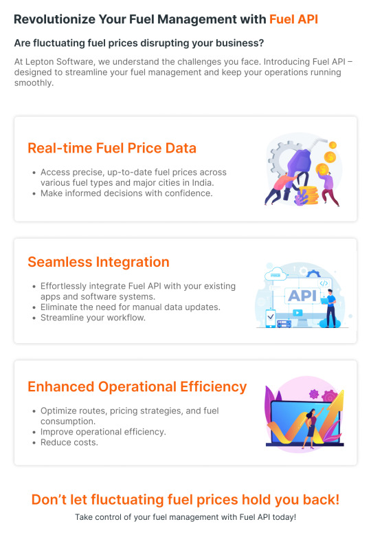
Revolutionize your Fuel Management with Lepton Maps Fuel API
Get Real-Time Fuel Price, Seamless Integration, Enhanced Operational Efficiency and Accurate Data. Click to learn more: https://leptonmaps.com/docs/nearby/fueling_stations
#lepton maps#lepton maps apis#map apis#fuel api#fuel apis#fue station data#real time data#geospatial data#datasets
0 notes
Text
Global Satellite Data Services Market: Key Regional Insights

The Satellite Data Services Market is experiencing rapid expansion, driven by advancements in Earth observation, remote sensing, and global connectivity. As industries worldwide increasingly rely on satellite-generated data, understanding regional market trends is crucial for stakeholders aiming to capitalize on emerging opportunities.
Key Regional Markets Driving Growth
1. North America: Leading the Market with Advanced Infrastructure
North America dominates the Satellite Data Services Market, driven by significant investments in space technology, defense applications, and commercial satellite services. The United States, home to major players such as NASA, SpaceX, and Maxar Technologies, leads the market with robust government initiatives and private-sector collaborations. The increasing demand for high-resolution satellite imagery and analytics in agriculture, disaster management, and environmental monitoring further fuels growth in this region.
2. Europe: Innovation and Regulatory Support Boost Market Expansion
Europe stands as a key player in the satellite data services sector, with the European Space Agency (ESA) and private enterprises actively investing in satellite-based applications. Countries like Germany, France, and the UK are at the forefront, leveraging satellite data for smart cities, maritime surveillance, and climate monitoring. The EU’s Copernicus program plays a vital role in providing open-access Earth observation data, fostering innovation and market expansion.
Download Pdf Brochure: https://www.marketsandmarkets.com/pdfdownloadNew.asp?id=55690321
3. Asia-Pacific: Emerging as a High-Growth Region
Asia-Pacific is witnessing rapid adoption of satellite data services, with countries like China, India, and Japan making significant strides in space technology. China’s ambitious satellite programs, India’s cost-effective remote sensing capabilities (ISRO), and Japan’s advancements in Earth observation contribute to the region's robust growth. The increasing use of satellite data in urban planning, agriculture, and natural disaster management positions Asia-Pacific as a key growth hub.
4. Middle East & Africa: Rising Investments in Space Technologies
The Middle East & Africa region is gradually emerging in the satellite data services market, with growing government initiatives and commercial investments. The UAE, through its Mars Mission and space programs, is strengthening its satellite capabilities, while African nations are leveraging satellite data for agricultural productivity and disaster response. Increased funding and partnerships with international agencies are expected to drive further market growth.
5. Latin America: Expanding Satellite-Based Applications
Latin America is steadily integrating satellite data services across various sectors, including environmental monitoring, disaster preparedness, and telecommunications. Brazil, Mexico, and Argentina lead regional developments, with increased investment in satellite imagery and analytics for sustainable resource management. Collaborations with global space agencies and private enterprises are driving technological advancements in this region.
Market Trends and Opportunities by Region
Growing Demand for Real-Time Data: Across all regions, industries such as agriculture, forestry, and urban planning are leveraging satellite data for real-time decision-making.
Government & Private Sector Collaboration: Partnerships between governments, space agencies, and private companies are fueling market growth, especially in North America and Europe.
Expansion of Small Satellites & Constellations: Asia-Pacific and Latin America are witnessing increased deployment of small satellites, enhancing accessibility to satellite-based insights.
Investments in AI & Big Data Analytics: The integration of AI-driven analytics with satellite data is revolutionizing applications, with strong adoption in developed regions.
Ask For Sample Report: https://www.marketsandmarkets.com/requestsampleNew.asp?id=55690321
The Satellite Data Services Market continues to expand globally, with North America and Europe leading technological advancements, while Asia-Pacific and other emerging regions experience rapid adoption. As industries increasingly rely on satellite-based insights for strategic decisions, businesses must closely monitor regional developments to stay ahead in this evolving market.
#satellite data services#satellite market growth#regional satellite trends#geospatial data market#earth observation services#satellite analytics market
0 notes
Text
Why Atom Aviation is the Leading LiDAR Survey Company in India

In today’s fast-paced world, the demand for precise and reliable data is growing across various industries. One of the most advanced technologies transforming survey work is LiDAR (Light Detection and Ranging). When it comes to LiDAR survey services in India, Atom Aviation stands out as a top choice.
What is LiDAR Surveying?
LiDAR is a cutting-edge technology that uses laser light to measure distances and create high-precision, 3D representations of landscapes, structures, and other objects. The accuracy of LiDAR makes it a crucial tool in industries such as construction, agriculture, forestry, and urban planning.
Why Choose Atom Aviation for LiDAR Surveying?
Atom Aviation, a renowned LiDAR survey company in India, has established a solid reputation for offering top-notch surveying services. Here are a few reasons why Atom Aviation is the preferred choice for businesses seeking reliable LiDAR surveys:
1. Expertise and Experience
Atom Aviation has years of experience in delivering precise and comprehensive LiDAR data. Their team of skilled professionals is well-versed in using advanced drone technology, ensuring that surveys are completed efficiently and accurately. Whether it’s large-scale topographic mapping or detailed infrastructure analysis, Atom Aviation is equipped to handle it all.
2. State-of-the-Art Technology
As a leader in the field, Atom Aviation leverages the latest drone-based LiDAR systems that capture data quickly and accurately. These high-tech systems can cover vast areas and provide detailed topographic information, which is essential for making well-informed decisions in a wide range of industries.
3. Cost-Effective Solutions
Atom Aviation not only offers high-quality LiDAR surveys but also ensures that their services are budget-friendly. By using drones for LiDAR surveys, they reduce the need for costly manual data collection methods, ultimately saving businesses time and money.
4. Quick Turnaround Time
One of the major benefits of using drone-based LiDAR is the speed at which data can be collected and processed. Atom Aviation guarantees a fast turnaround time without compromising on the quality of the results. This makes it an excellent option for businesses that need survey results promptly.
5. Wide Range of Applications
Whether you’re in the construction industry, need forest mapping, or are working on a land development project, Atom Aviation provides LiDAR surveying solutions tailored to your specific needs. The versatility of their services ensures that businesses across various sectors can benefit from accurate, actionable data.
Industries Benefiting from LiDAR Surveying
Construction: LiDAR data helps with precise mapping and 3D modeling, aiding in construction planning and project management.
Agriculture: LiDAR surveys can assist in crop monitoring, soil health analysis, and irrigation planning.
Forestry: LiDAR can create detailed maps of forests, identifying tree heights, density, and canopy coverage.
Urban Planning: Cities can utilize LiDAR data for infrastructure mapping, flood risk assessments, and urban development projects.
Why LiDAR Surveys are Essential
Traditional surveying methods often require manual labor and long hours, making them less efficient and more prone to errors. LiDAR technology, however, provides highly accurate and reliable data while reducing the time and cost involved. By choosing a LiDAR survey company in India like Atom Aviation, businesses can enjoy faster, more precise results that are essential for the success of any project.
Conclusion
In a world where precision and efficiency are crucial, Atom Aviation remains one of the most trusted names in LiDAR surveying in India. Their innovative approach, advanced technology, and commitment to delivering high-quality results make them the go-to company for businesses seeking reliable LiDAR survey solutions.
If you are looking to take your project to the next level, don’t hesitate to contact Atom Aviation today and explore how their LiDAR surveying services can help you achieve accurate, actionable insights.
#LiDAR Surveying#LiDAR Mapping#Geospatial Solutions#Accurate Mapping#LiDAR Technology#Surveying Services India#LiDAR Data Acquisition#3D Mapping India#LiDAR Survey Company#Top LiDAR Companies India#Precision Mapping#LiDAR for Surveying#Geospatial Data Services#Mapping Solutions India#LiDAR Experts
1 note
·
View note