#create a map
Explore tagged Tumblr posts
Visit Tumblr Blog
Explore Tumblr blogs with no restrictions, modern design and the best experience.
Last Seen Tumblr Blogs


Fun Fact
Total funding amounts to $125.3M.
Text
How to Use Interactive Maps for Guided Tours
Have you ever wandered through a historic city, nature trail, or museum and wished for a more immersive way to explore? Traditional paper maps or static guides can only do so much. That’s where interactive maps come in—offering an engaging and dynamic way to enhance guided tours for travelers, history buffs, and adventure seekers alike.
Whether you're organizing a walking tour, a self-guided exploration, or a heritage trail, interactive maps can transform the experience. Let’s dive into how you can create a custom map to make your tour more informative, engaging, and memorable.
What Are Interactive Maps, and Why Use Them for Tours?
Interactive maps are digital maps that allow users to engage with locations by clicking on points of interest, viewing additional details, watching embedded media, and even following guided routes. Unlike static maps, these provide a dynamic experience where users can:
Explore at their own pace – No need to rush; users can engage with locations as they go.
Access rich multimedia content – Add images, audio clips, videos, and historical facts.
Follow customized routes – Tailor itineraries for different interests and experience levels.
Navigate seamlessly – Use GPS integration to guide visitors efficiently.
Imagine walking through a historic district where each landmark on your map comes to life with a short video, archival photos, or an audio story. That’s the power of an interactive travel map.
How Do You Create a Custom Map for a Guided Tour?
Let’s break down the steps to designing a compelling interactive map for guided tours.
1. Choose the Right Mapping Tool
To create a map, you need a custom map creator that allows easy customization and sharing. Platforms like Mapme provide intuitive tools for adding points of interest, embedding media, and designing an engaging user experience.
2. Define the Tour’s Theme and Purpose
What story are you trying to tell? Are you designing a historic city walk, an art gallery tour, or a nature hike? Defining your focus helps structure the map effectively.
Examples:
Historical Tour: Mark key landmarks and add archival photos.
Food Tour: Pinpoint the best local restaurants with reviews and signature dish highlights.
Nature Trail: Highlight scenic viewpoints, rest stops, and flora/fauna descriptions.
3. Add Key Locations and Descriptions
Once your map is set up, start adding key locations. Each point should include:
A clear title (e.g., “Old Town Hall – Built in 1800”)
Engaging descriptions (Tell a story rather than listing facts)
Multimedia content (Photos, videos, and audio clips enhance the experience)
4. Design an Easy-to-Follow Route
Guided tours work best when they follow a logical path. Use waypoints and path-marking features to create a seamless flow.
Tips:
Number your locations in sequence to help users follow along.
Use color coding to differentiate stops (e.g., food spots in blue, historical sites in red).
Offer alternative routes for different interests or accessibility needs.
5. Integrate GPS and Interactive Features
A great tour map should be user-friendly and provide real-time navigation. Adding GPS integration ensures visitors can easily find their way without needing additional directions.
Interactive features to consider:
Augmented reality overlays for a futuristic experience.
Audio guides that play automatically when reaching a stop.
User-generated content where visitors can leave reviews or comments.
FAQs
Q: Can I create an interactive travel map without technical skills?
A: Yes! Many platforms like Mapme offer no-code solutions, allowing anyone to build a professional-looking map without programming knowledge.
Q: Do these maps work offline?
A: Some platforms allow offline access, but many require internet connectivity for full functionality. Consider offering downloadable PDFs as a backup.
Q: How do I share my custom map with users?
A: You can distribute your map via a shareable link, embed it on a website, or provide QR codes at tour starting points for easy access.
Q: Can businesses benefit from interactive maps for tours?
A: Absolutely! Restaurants, museums, and tourism boards can use them to promote local attractions, showcase hidden gems, and enhance visitor engagement.
Enhancing Your Tour with Mapme
If you’re looking for an easy way to build an interactive map for guided tours, Mapme is a great solution. It allows you to create a visually appealing and user-friendly experience with multimedia integration, custom routes, and GPS navigation.
Next time you’re planning a guided tour, think beyond the traditional brochure. A well-designed interactive map can make your tour more immersive, engaging, and memorable.
0 notes
Text


TWD: The Ones Who Live - Finale Opening Scene + Blurred/Faraway
Requested by Anonymous
#the walking dead#the ones who live#twdedit#towledit#tvedit#dailyflicks#dailytwd#michonne grimes#rick grimes#richonnegifs#tvarchive#richonne#otpsource#romancegifs#request#denim rose graphics#i hope you enjoy anon!#I think I created 5 different PSDs trying to get rid of the muted green color wash lol#i always really liked the way they shot this scene#you can tell they went back to the cabin and packed EVERYTHING#they took the black label and the two glasses 😂#there is an open pack of chicken flavor sauce on the table (yes i read the writing lolol before cropping and shrinking)#also i never realized on first watch that was little rj's ax laying beside them and carl's photo#also the drawing mapping out the direction to Jadis's room#just little tidbits to remind us of their journey here#but also everything abt this scene is about UNITY UNITY UNITY#from their actual act of union to the ax being rj's aka the physical embodiment of their union to carl's photo aka who brought them togethe#to their signature weapons laying side by side; to the shot of him sliding the wedding ring on her finger#there was no reason for the ring to be off her finger except to have Rick slide it back in place and reemphasize they are one again#a visual representation of what Michonne declares later in the ep: ‘we are back’
334 notes
·
View notes
Text
Kaiju AU Island Concept
Hello everyone!
I'm technically still on hiatus, but I wanted to share something I had been working on before I made my hiatus announcement.
So as you can tell by the title, I'd been working on sketching out a rough-ish map of sorts for the island that we find ourselves on in the Twisted Kaijuland AU. This was so I could have a better idea on the locations of each area so far, as well as concepts on where exactly important locations are located/could be located!

As you can see, compared to my initial story idea, it's grown from being one big island to several islands connected to the main one (aka the staff's island) to denote each dorm's territory.
Keep in mind that this is still a rough draft so I could get my thoughts down, but I want to at least start developing visuals to help with the storytelling as I get around to properly rewriting the Kaiju!AU.
Some location comments:
Elderclaw/Trein's den is near a waterfall, which was chosen to have a tranquil spot to relax in and enjoy the peace as well as have a source of water to help his aching old bones. It's still elevated enough that even during the rainy seasons, there's no risk of flooding and he stays warm.
Crewelfang/Crewel's den is located under a massive willow-like tree, which is where one may find a myriad of flora and other medicinal fungi or roots that he harvests, though he can and will trade some of what he has in exchange for Ragebloom/Riddle's ability to accelerate the growth rate of herbs, fruit, and fungi he needs.
Shadowdrifter/Sam's nests are a mystery to the researchers, as he's been notoriously difficult to pin down location wise. He's always popping up wherever at seemingly random, yet no one knows where he disappears to when it comes time to rest for the night. Or perhaps...he doesn't rest? That's still a working theory, though many can't help but feel his eyes watching them...even when the cameras are off.
There are research facilities located in various points of the island, and there were supposed to be more, but...I kinda ran out of space while trying to figure out where everything would go, and the sizing of the areas aren't exactly accurate!
Each island is connected to the main staff island through land bridges, some of which only appear at certain times of the day or month (hadn't decided which yet or how to incorporate the mirror transportation magic form the game yet). One way to tell which one you're close to is what's around each land bridge: a lush jungle for Heartslabyul, grasslands for Savanaclaw, topside coral reef like from the first Croods movie (hadn't marked that on there I just realized) for Octavinelle, a beach with gold-colored sand for Scarabia, a noxious woodland with toxic yet beautiful plants and other deadly things, a kaiju graveyard for Ignihyde, and the ship graveyard for Diasomnia. I'll likely add more features to some of these in the future, but for now this is still a rough draft!
There are other locations and features I want to add to the map itself (same with the others once I design them), but I wanted to at least share the progression as I continue working on things one step at a time. Hope you guys enjoy!
#twisted wonderland#twst#twisted wonderland kaiju au#twst kaiju au#twisted wonderland kaiju au worldbuilding#twst kaiju au worldbuilding#apologies if the lines are a bit light since I don't add a lot of pressure to my pencils when I sketch#but hopefully I can get the hang of drawing maps and can create more of these!
60 notes
·
View notes
Text
"contentment in singleness" doesn't require you to stop desiring marriage & family. it doesn't require you to stop pursuing marriage & family.
Christians are called to be content in any situation--that doesn't mean we abandon all our good desires and concrete goals.
contentment is to trust/rest in God's promises to love you, provide for you, and make you holy.
you can do all of those things, and earnestly want and seek a husband.
He who finds a wife finds a good thing, and obtains favor from the Lord. Proverbs 18:22
"Favor from the Lord" meaning, of course, blessing as the result of a life molded by wisdom.
Now, how can one find a good wife without seeking? Seek without wanting? And how can wisdom and contentment be mutually exclusive?
#this post brought to you by the drive home from church yesterday#when I realized that I'm very comfortable (and have been for awhile) where I am#unmarried and unattached but planning to be otherwise#and if I'm always planning for something that never happens? well that's just fine too#I'll have spent my youth becoming the woman I always wanted to be--not for a husband and children but for my parents & the church#and I think it took realizing that I didn't have to give up a good desire before I could *actually* be content#we are called to desire Christ's return always. that doesn't equal discontentment with our lives right now.#Christianity#x#for me it's now as simple as the Created Order fact that MOST people need to marry and procreate to keep civilization from collapsing#and on another level (mapped OVER that fact) it's as simple as God's ordinary means of kingdom-building being families#but goodness knows Christian young people have been inundated with so much overthought on this subject (myself included)#that it's necessary to parse it all out sometimes
131 notes
·
View notes
Text
when i say 'god forbid women do anything' im talking about amerie wadia from heartbreak high
#she's the worst/best person alive depending on who you ask#did she (and her best friend) create a full sex map of all students' activities in the old stairwell? yes. and what about it?#did she punch someone for saying he liked ed sheeran? yes. and what about it?#she didnt do anything wrong!!!#amerie wadia#heartbreak high
342 notes
·
View notes
Text
youtube
video that I think you should watch for the sheer insanity of them modeling and continually duplicating said models to create whatever the fuck is happening in the environment around them. these arent map paintings those little bars n shit r real
#now that i'm thinking abt it they probably created some duplicator generate thingamabob that you can also do in blender#but STILL i was fully convinced these were map paintings in the show but nope#makes me wonder what else was actually modeled that I assumed was a map painting#also its just fun to see the unrendered stuff. and isolated voice lines!! and little deleted lines!! i love it!!#i understand why they got rid of the extra Cutler dialogue but also its soooo sad to hear him say that#tron#tron uprising#save#because i wanna keep rewatching this and understanding it. theres not much behind the scenes on this show okay#tronblr#i ramble#Youtube
38 notes
·
View notes
Text


Sad Jellyfish which can be found by using the chainsaw effect in:
-Forest Pier, Chaotic Buildings, Twilight Park, Monolith Jungle, Doll House, Fantasy Isle, Moonlight Lantern Forest, and Overgrown Condominium
#ynfg#yume nikki fangame#gif#rpgmaker#yume 2kki#urotsuki#ゆめ2っき#wataru#río#noildoof#2i9#61024#it was fun going to each map trying to find this dude#I wonder why chainsaw was chosen specifically to make it him spawn#think this npc was created first by wataru but not 100% sure
37 notes
·
View notes
Text
(good timeline version of the thing I posted before, apparently)
#i don't think vigarde really hugs but the opportunity to create a silly narrative when visiting my page was too good#it's ok guys. he's all better now#*scroll* oh no#lyon fire emblem#lyon#vigarde#fire emblem#feh#fire emblem heroes#i l o v e their designs so much. currently doing all the normal/hard maps i left for this purpose so i can try to +10 duo lyon#i think i can get to around 1.3k orbs by the end of the month which won't be enough unless i get really lucky#but i'll get a good chunk of the way there anyway
255 notes
·
View notes
Text


#I've been staring the mlmask wondering how I'd tackle it#decided to apply materials in blender directly so I can then. select by materials and export the uvs maps#and then create the mlmask based on those#I'm not sure???? how vehicles appearances works and if we can easily use the crystalcoat system now for them#cause I'd love to have multiple apperances ofc#modding yap
27 notes
·
View notes
Text
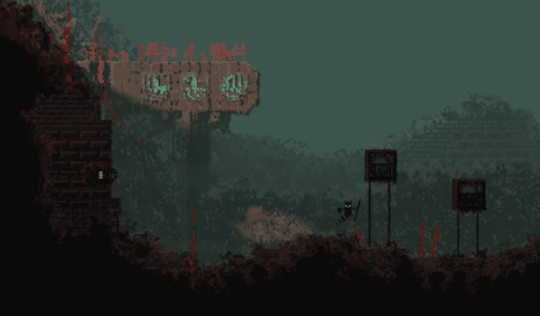
One of my favorite types of Rain World rooms are rooms that supposedly have additional cameras/room connections, but they don't.
What do I mean by this? here is an example:
LF_J01 is one of the rooms that bugged me the most, especially when when I notice it during my countless rain deer rides. It's eye catching and makes you wonder if you can bring a grappling worm all the way from the Underhang just to test your dumb theory, only to realize it's not true and be so disappointed.
Fun fact, Rain World Drought is perfectly using this room's potential: by using it as a connection between your starting region and Farm Arrays.
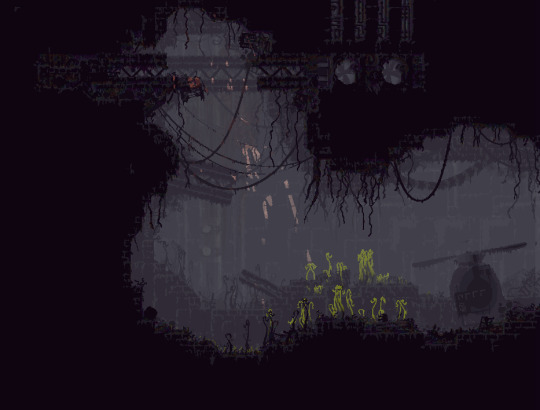
The tutorial room also gets it's own secret, where eventually you find out about it at the start of the Spearmaster campaign. Downpour in fact have a lot of these, and it's one of my favorite additions in this DLC.

Not a secret, just a whole huge region connected through this singular room connection.
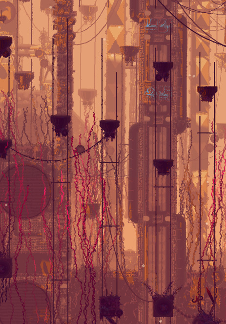
Unfortunately SI_C09 didn't receive any additional room connections from the DLC. I remember the first and only time this room tricked me like the fool that I am, into thinking there is a continuation, and got me to jump cluelessly to the left and fall to my death. I guess it's had to do with how open seems this part of Sky Islands look. Gameplay wise I can understand why it stops there, from that point you guided to go up into the heart of the region. And expanding the room from that point, kind of adds too much to the region and makes it more chaotic and confusing to navigate than it needs to be.
Last but not least, this room always seemed odd to me.
Considering that you climb up towers many times in Rain World, it's not very visually appealing when you can't climb up to a place that looks like it has an upper part.
But in all of the presented rooms, you can quite understand why continuing on the region from there would be weird. You have to create a weird fork in the map that distract the player from actually progressing through the game's entire map. And often it makes them get lost and frustrated. this is one of the common causes that makes new players lose their interest in Rain World.
Although you could also go against that point by claiming that Rain World's core gameplay is exploring and getting lost in the world, or at least is what makes the game so appealing. And expanding the region would help increase that feeling of being lost in a complex simulated ecosystem.
I can still understand that for vanilla Rain World, this game is not for everyone. but I mean if you chose to play Downpour as your first experience, that is kind of your problem. Because the whole point of the DLC is to expand significantly the map of the known world.
uh, um. I think got a little bit carried away, lol. This post is still about silly rooms, but I feel like I can't really talk about cool rooms and regions without talking about their important role in the core gameplay.
#rain world#text#LF_J01 is a special case because you're in the endgame#and probably raiding the rain deer#so creating an alternative path/bonus room is weird#I'm a map freak you can tell#tonight my dear.. I'll treat you with some ROOM ANALYSIS
239 notes
·
View notes
Text
Top 5 Benefits of Interactive Maps in 2024
In the fast-paced digital landscape of 2024, interactive maps have emerged as indispensable tools that go beyond traditional boundaries. In this blog post, we will delve into the top five benefits of interactive maps, focusing on the prowess of map builder and their transformative impact on real estate. Along the way, we'll introduce you to Mapme, an online platform designed to make map creation a breeze.
1. Revolutionizing Map Creation with Map Builders:
The landscape of map creation has evolved significantly with the advent of sophisticated map builders. These tools, such as the user-friendly platform Mapme, empower individuals and businesses to effortlessly create stunning and dynamic interactive maps. With drag-and-drop functionalities and customizable templates, map builders are democratizing cartography, allowing users to bring their visions to life without the need for extensive technical expertise.
2. Engaging Users with Interactive Maps:
In the dynamic world of 2024, interactive maps have proven to be highly engaging across diverse industries. Whether you're planning a trip, exploring a new neighborhood, or seeking a map for real estate options, interactive maps provide a visually compelling and informative experience. Users can zoom in, click on specific points of interest, and access relevant information, making the exploration both interactive and enjoyable.
3. Real-Time Data Integration for Informed Decisions:
The demand for real-time information is paramount in 2024, and interactive maps rise to the occasion. Map builders, including Mapme, facilitate the seamless integration of up-to-the-minute data. This feature is particularly beneficial for real estate professionals, enabling them to create maps for real estate showcasing property listings with current availability and pricing. The ability to integrate real-time data enhances decision-making processes and fosters transparency between stakeholders.
4. Facilitating Collaboration through Map Creation:
Collaboration lies at the core of successful ventures, and interactive maps streamline communication among team members and stakeholders. Mapme, a prime example, offers collaborative features that enable multiple users to work on a map simultaneously. In real estate, teams can collectively create and update property maps, ensuring everyone is on the same page and contributing to project success.
5. Strategic Marketing with Interactive Real Estate Maps:
In the real estate industry, the impact of interactive maps is revolutionary. The ability to create visually appealing and informative maps enhances property marketing efforts significantly. Prospective buyers or tenants can explore neighborhoods, view property details, and even take virtual tours—all through interactive maps. Mapme's intuitive platform facilitates real estate professionals in creating maps for real estate, showcasing properties in a visually stunning and informative way, attracting more attention and potential clients.
In conclusion, the benefits of interactive maps in 2024 are vast and transformative. Thanks to advanced map builders like Mapme, individuals and businesses can harness the power of interactive maps to enhance user engagement, integrate real-time data, facilitate collaboration, and revolutionize marketing efforts, particularly in the dynamic landscape of real estate. As we navigate the future, interactive maps will undoubtedly continue to redefine the way we interact with our surroundings and information.
0 notes
Text
Got distracted by looking through my own idea file again.
"Someone actually drawing a treasure map, not just finding one. Why?"
#writing prompts#who's the map for?#why do they need it?#what are they hiding and why?#who are they hiding it from?#treasure maps#that part of the story you never really see#pirates#they love their treasure maps#but why don't they just spend the money??#create a fleet and a proper hideout or whatever#retire even#sure they don't want someone else to take it from them before they do#but you've got to admit the whole treasure map concept is risky
97 notes
·
View notes
Text

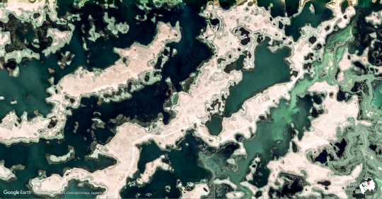
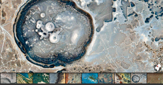

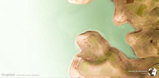

i love earth view from google earth (firefox extension)
33 notes
·
View notes
Text
NEW ILLUSTRATION

I couldn't resist drawing my boy Samuel again ! I'm really proud of the result, I think I did good ! Especially on the background (I usually struggle with backgrounds)
FYI : COMMISSIONS OPEN ! :D
See you laterr~~
#my art#artists on tumblr#digital art#kingdom come deliverance fanart#samuel of kuttenberg#samuel of kuttenberg fanart#kcd2 fanart#kcd2 samuel#i kinda want to create a pendant to this#with john hunched over papers and maps#it will be an occasion to work more on my anatomy and perspective
22 notes
·
View notes
Text


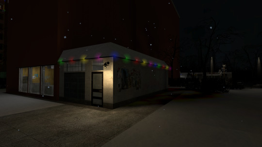

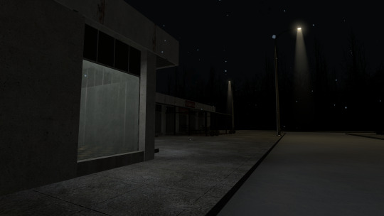
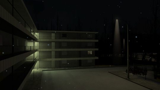

gm_apartment_neighborhood_v2_christmas
created by Mark
#source engine#garry's mod#gmod#half life 2#sandbox#other#hearted#i get the impression this is supposed to be kind of an RP map? a lot of empty interiors#feels like an old sven coop hangout map to me#the use of ambiance in the apartments is super cute too. definitely meant to create the illusion that there's holiday gatherings going on#and yes the pc plays about half of that civil protection video
37 notes
·
View notes