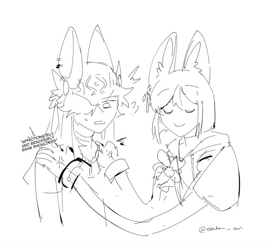
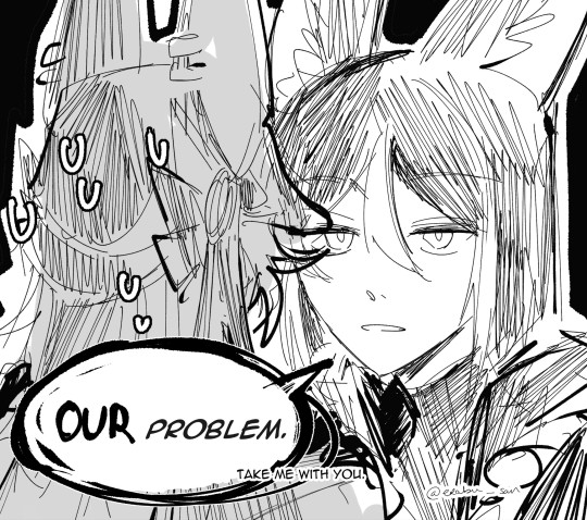
#i hope they interact more
Text
Alone at the edge of a universe humming a tune
With sparkling crystals souls aglow
A part of thee in the key of what we know to be every part without me
Knows only two can make it light
You'll live forever tonight
Snazzy piano intermission
rbs are super appreciated
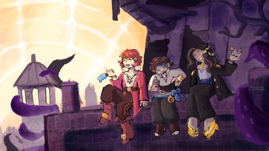
#so uhhh art lol#i think these three are so neat#teehee#i hope they interact more#pirates smp#achilles art moment#hiii tumblr dash i made art#i'm still pirate smp autistic#sorryyyy#scurvyblr#my art#snifferish#imashepttv#shubble#shubble fanart#snifferish fanart#me and the boys hanging out in the cursed isles that may or may not have killed a kite before#pow creations#pirates smp fanart#idk what else to put herr
46 notes
·
View notes
Text
I like to think that Akito helped Mafuyu come to terms with being transmasc.
#These two are so interesting to me#I hope they interact more#mafuyu asahina#akito shinonome#prsk#project sekai#transmasc mafuyu#proseka#can be read as romantic if you want
11 notes
·
View notes
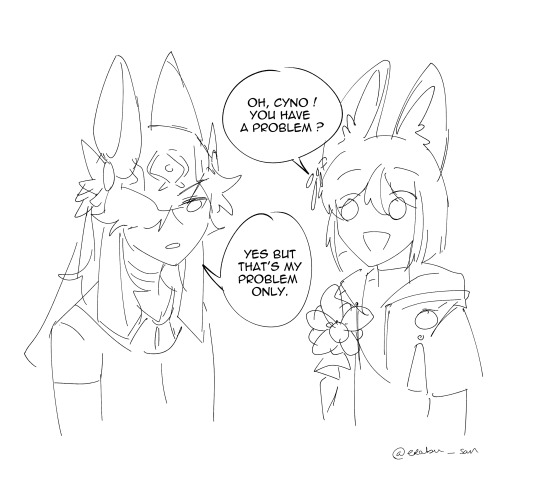
Text

I enjoyed every second of this quest
[This art has platonic intention. Thank you for not tag ship!]
#my art#genshin impact#genshinimpact#tighnari#genshin impact tighnari#daily tighnari#cyno#genshin impact cyno#please do not tag as ship thank you#i have too much words but nothing came out from my mouth#i. i love it so much 😭😭😭😭😭😭#i am way too lazy to write everythin abt it#but gOSH WHEN SOME OF MY BRAINROT/HC BECOMES CANON#NO SPOILER BUT ?!?!?! EVERYTHING ABT THIS QUEST MAKES ME SO HAPPY#sethos ?!?!!! i love him. i need more cyno sethos interaction#i am so sleepy from work oh gosh but i already had idea for sethos comic/fanarr#SETHOS I HOPE HE ENJOYS CYNO'S PUNS#oh i swear if he laughs at cyno's jokes it IS SO OVER FOR ME#and WE GOT THE WHOLE CYNO FRIENDS I-#tighnari. can i talk abt tighnari.#no i wont i am lazy.#good night to them
7K notes
·
View notes
Text
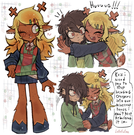
Fwiends...
#deltarune#utdr#noelle holiday#kris dreemurr#fanart#my art#Some noelle and Kris doodles for the funsies#I love these two I hope they interact more...in the happy routes tho
2K notes
·
View notes
Text


I was here when she died...I mean it as a good thing. I think that's how it was supposed to be.

{✩}
#the bear#the bear fx#thebearedit#cinemapix#dailyflicks#dixonscarol#filmtvcentral#televisiongifs#thebeartv#tvedit#underbetelgeuse#userbarrow#userdiana#useremz#userrlaura#userstream#usertina#*edits#marcus brooks#carmy berzatto#carmen berzatto#the bear spoilers#when carmy interacts with marcus#it shows how kind he can be & i hope we'll see#more of that with everyone else next season
1K notes
·
View notes
Text
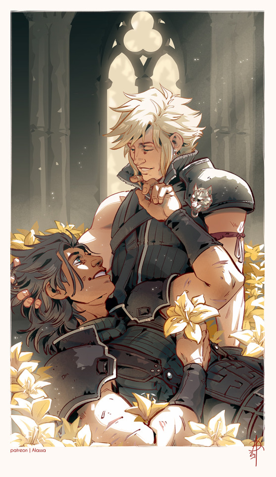
This time...
... I will never let you go
#zakkura#clack#zack fair#cloud strife#ff7#final fantasy 7#ff7 rebirth#one interaction between them is all i ask#i hope for more#but i'm also pretty sober and know that they are down the rare ship road at this point#so#yeah#loved drawing this one though
2K notes
·
View notes
Text
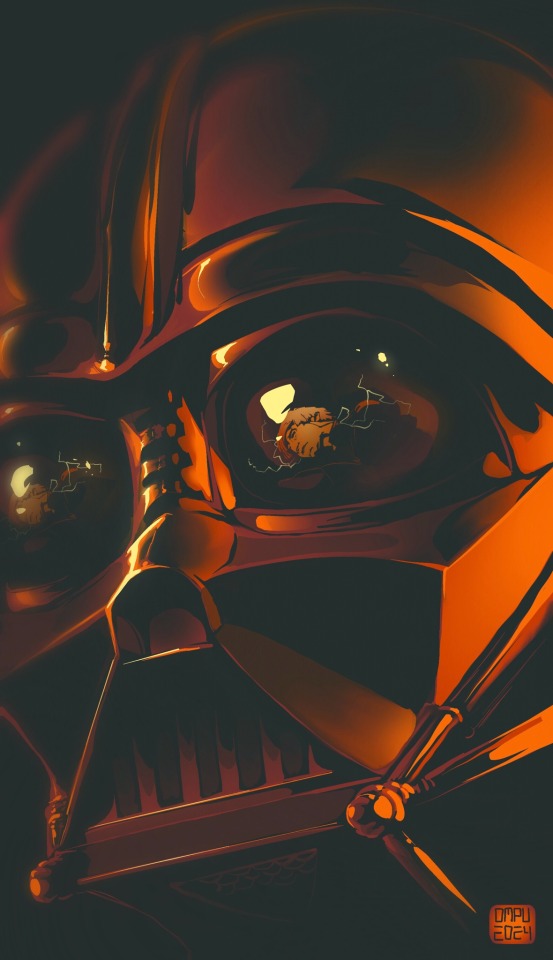
I Can Despair No Further / From Here Each Step is Defiance
REQUESTS / BLOG EVENT
Request from @husborth - Palette #1 - Anakin Skywalker/Darth Vader, Luke Skywalker - Death of the Cynic in Me
#artists on tumblr#fan art#star wars fanart#interactive art week March 2024#anakin skywalker#darth vader#luke skywalker#color palete challenge#huehuehuehue I hope you enjoy#this was surprisingly difficult conceptually— Vader seems more pessimist or fatalistic than cynical#But if there was ever a moment where ‘I cannot change it is all useless to hope’ flipped onto its head into ‘I will act or die trying’#it would be this one#Mine
1K notes
·
View notes
Text
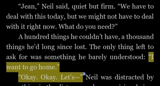
No because Neil is so gentle with Jean I'm gONNA BE SICK
#jean moreau#neil josten#all for the game#the sunshine court#nora said their relationship will be good i honestly hope we get even more interactions like this
530 notes
·
View notes
Text
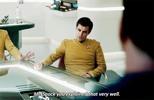

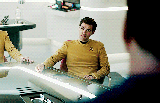

Star Trek Strange New Worlds 2x9 "Subspace Rhapsody"
#i hoped they would interact more this ep but i will take these crumbs#the way he calls him mr. spock already#spirk#star trek#star trek strange new worlds#snw spoilers#jim kirk#spock#strange new worlds#startrekedit#trekedit#mine#gif:star trek
3K notes
·
View notes
Text
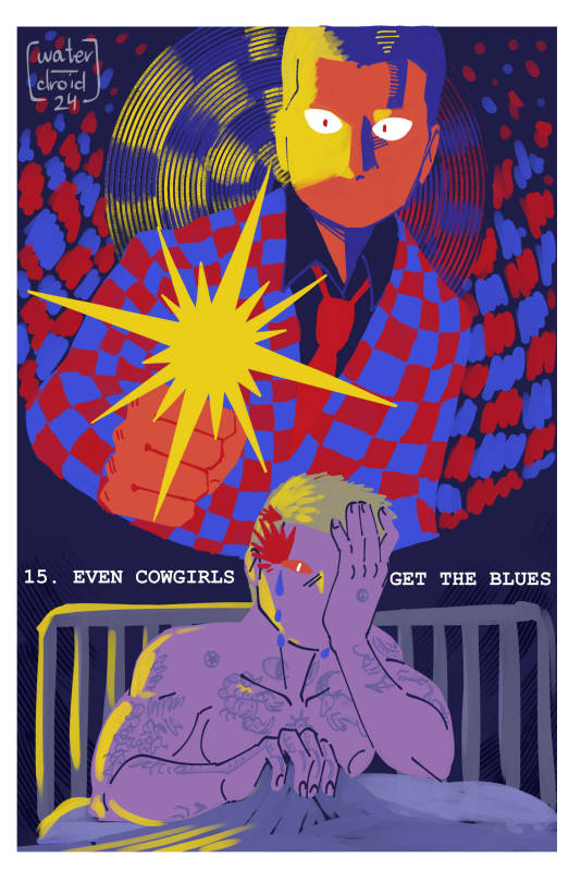
Yeehawgust Day 15: Even Cowgirls Get The Blues 💧
Sam has many, many nightmares about Benny shooting her in the head. They get worse as she gets closer and closer to the Strip...
#yeehawgust 2024#my art#fallout#fallout new vegas#oc: sam rando#courier six#fnv#benny gecko#i love benny as a character. he's SO interesting and i wish we could interact w him more#unfortunately. sam doesn't </3#ask to tag#(?)#anyways i hope tumblr doesn't smite this from orbit because there's like. a vague line thats insinuating a nipple
616 notes
·
View notes
Text
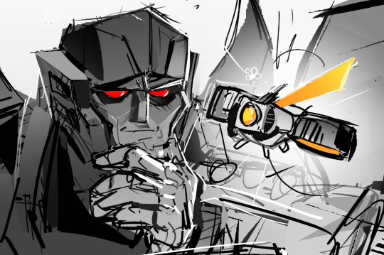
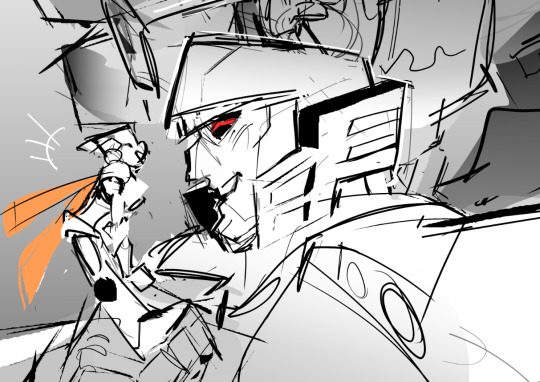
Hanging out with Dad #3
Bonus flustered version lmao;
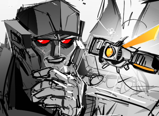
#robot#transformers#megatron#earthspark#I hope we get more of them interacting next season there's so much to process from the finale LOL)#twitch malto
2K notes
·
View notes
Text


I enjoyed every second of this quest
This art has platonic intention, please don't tag ship
#my art#genshin impact#genshinimpact#tighnari#genshin impact tighnari#daily tighnari#cyno#genshin impact cyno#please do not tag as ship thank you#i have too much words but nothing came out from my mouth#i. i love it so much 😭😭😭😭😭😭#i am way too lazy to write everythin abt it#but gOSH WHEN SOME OF MY BRAINROT/HC BECOMES CANON#NO SPOILER BUT ?!?!?! EVERYTHING ABT THIS QUEST MAKES ME SO HAPPY#sethos ?!?!!! i love him. i need more cyno sethos interaction#i am so sleepy from work oh gosh but i already had idea for sethos comic/fanarr#SETHOS I HOPE HE ENJOYS CYNO'S PUNS#oh i swear if he laughs at cyno's jokes it IS SO OVER FOR ME#and WE GOT THE WHOLE CYNO FRIENDS I-#tighnari. can i talk abt tighnari.#no i wont i am lazy.#good night to them
1K notes
·
View notes
Text

quick lmhs itafushi because god help me i have Not been able to get the concept of yuuji smiling/laughing into kisses out of my head
jjk atla!au with @philosophiums
#my art#jujutsu kaisen#jjk#itadori yuuji#fushiguro megumi#itafushi#fanart#jjk fanart#yuuji#megumi#jjk atla!au#atla!au: art#lmhs#shade skin with green without making the characters look Nauseous challenge#...success???? i mean i sure HOPE success :'>#i blocked in a green (bc lmhs i...usually block in a green...) but then i thought. i will try putting hints of it on the skin Also#and i like it !!! i fr one do not think they look seasick#i love lmhs itfs because the colour scheme is so Earthy (pun intended). moss green... warm browns... my beloveds <333#but even more than that#i love love loVE. drawing yuuji looking at megumi like he is all that exists in the world#bc i Also look at megumi like he is all that exists in the world#also im sure this is a common artist thing to have designated Spots fr characters when drawing them interacting#like fr me . normally when i draw itfs interacting in any way (read: smooching) i default to putting megu on the Right#so this admittedly threw me a bit GHSGJ#anyway!!! i realized it has been a whole WEEK since my last lmhs itfs and that simply will not stand.#my quOTA D: D: D: my self imposed QUOTA#i am going to get a bad grade in long term passion project :( sam is going to kill me and then Fire me#speaking of sam i shant say much but yuuji is currently experiencing The Horrors(tm) in draft1 so he can have a distraction :3 my treat#one of us has to be nice to him and it seems it is my turn#anyway i amn eepyyyy goodnight smile :)
590 notes
·
View notes
Photo
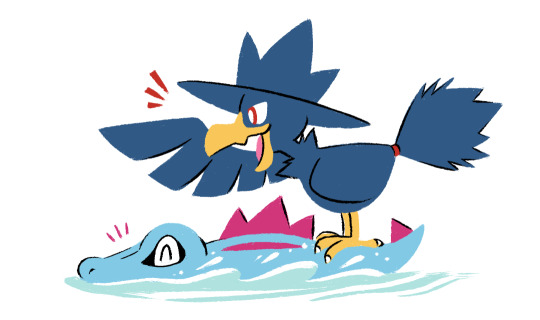
Totodile & Murkrow ko-fi doodle for Trevor!
#artists on tumblr#pokemon#totodile#murkrow#gotchibam arts#aaaaaaaaa sorry if this is many-months late!!#I hope you still like it!#the reason im getting slower w/ finishing these is bc most of the remaining requests are more than one pkmn and#putting multiple characters in one pic takes more time bc I have to think the interaction / poses for each of them @_@#my brain can only do so much these days
5K notes
·
View notes
Text
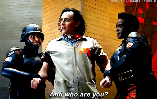
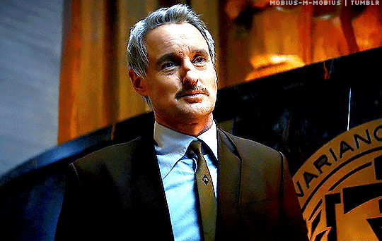

I can rewrite the story.
Loki 1x01 // 2x05
#mobius#loki#lokius#mcuedit#lokiedit#marveledit#owen wilson#tom hiddleston#loki spoilers#it's about WHO!!!!!#hope everyone's good bc i'm a wreck right now lol#no way did i expect to go into s2 and find some of the most beautiful interactions a ship of mine will ever have or go on such a wild ride#but that's exactly what happened and everyone here has been such a huge part of that too#have loved spending this time meeting new friends and being in awe of so many amazing talents!! truly never had more fun#and now there's just one more time left to say fingers crossed and see y'all when it's all said and done#here's to mobius being the character of all time for all time always and lokius side by side where they belong 💖#loki s2 spoilers#owenwilsonedit#marvel#dianagifs
2K notes
·
View notes
Text
"The world's coral reefs are close to 25 percent larger than we thought. By using satellite images, machine learning and on-ground knowledge from a global network of people living and working on coral reefs, we found an extra 64,000 square kilometers (24,700 square miles) of coral reefs – an area the size of Ireland.
That brings the total size of the planet's shallow reefs (meaning 0-20 meters deep) to 348,000 square kilometers – the size of Germany. This figure represents whole coral reef ecosystems, ranging from sandy-bottomed lagoons with a little coral, to coral rubble flats, to living walls of coral.
Within this 348,000 km² of coral is 80,000 km² where there's a hard bottom – rocks rather than sand. These areas are likely to be home to significant amounts of coral – the places snorkelers and scuba divers most like to visit.
You might wonder why we're finding this out now. Didn't we already know where the world's reefs are?
Previously, we've had to pull data from many different sources, which made it harder to pin down the extent of coral reefs with certainty. But now we have high resolution satellite data covering the entire world – and are able to see reefs as deep as 30 meters down.
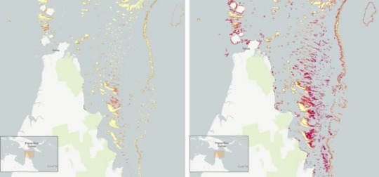
Pictured: Geomorphic mapping (left) compared to new reef extent (red shading, right image) in the northern Great Barrier Reef.
[AKA: All the stuff in red on that map is coral reef we did not realize existed!! Coral reefs cover so much more territory than we thought! And that's just one example. (From northern Queensland)]
We coupled this with direct observations and records of coral reefs from over 400 individuals and organizations in countries with coral reefs from all regions, such as the Maldives, Cuba, and Australia.
To produce the maps, we used machine learning techniques to chew through 100 trillion pixels from the Sentinel-2 and Planet Dove CubeSat satellites to make accurate predictions about where coral is – and is not. The team worked with almost 500 researchers and collaborators to make the maps.
The result: the world's first comprehensive map of coral reefs extent, and their composition, produced through the Allen Coral Atlas. [You can see the interactive maps yourself at the link!]
The maps are already proving their worth. Reef management agencies around the world are using them to plan and assess conservation work and threats to reefs."
-via ScienceDirect, February 15, 2024
#oceanography#marine biology#marine life#marine science#coral#coral reefs#environment#geography#maps#interactive maps#ai#ai positive#machine learning#conservation news#coral reef#conservation#tidalpunk#good news#hope#full disclosure this is the same topic I published a few days ago#but with a different article/much better headline that makes it clear that this is “throughout the world there are more reefs”#rather than “we just found an absolutely massive reef”#also included one of the maps this time around#bc this is a really big deal and huge sign of hope actually!!!#we were massively underestimating how many coral reefs the world has left!#and now that we know where they are we can do a much better job of protecting them
429 notes
·
View notes
Last Seen Blogs

seohwang
SKZ, Seventeen & Ateez

robsontraderr
🔗faturecerto.com

dreamsaslightasfeathers
dreamsalas

dreaming-to-be-happy
One life is all you get

yourbestiethejestie
Certified Zevlor Lover