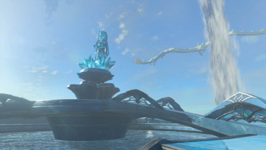
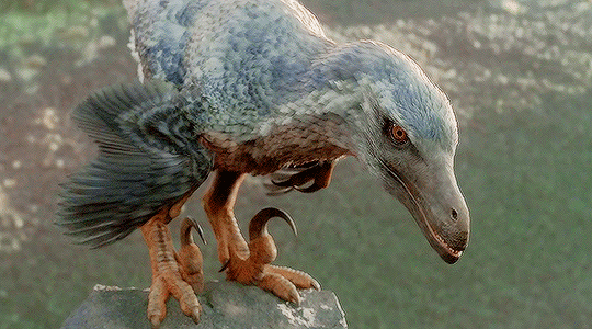
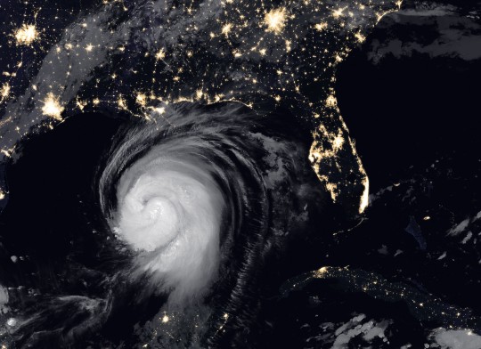
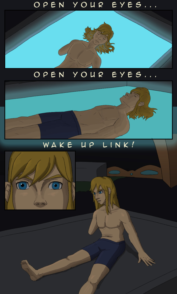
#the great plateau research station
Text

278
~If you like this comic, give it a like and reblog!~
#cotf#champions of the force#comic#278#fan comic#au#star wars#the legend of zelda#breath of the wild#link#the epona#the great plateau research station
8 notes
·
View notes
Note
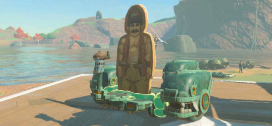
What's going on with the Dueling Blights Lake and the Red Mass Station?
Dueling blights lake is the site of a slow-motion battle between two rival organic growths.
The Red Mass is a giant multicellular organism. It doesn’t behave intelligently, so despite its odd appearance and unclear taxonomy, most people accept it as a very large, strange plant (or fungus, or tumor, or whatever it is).
The black goop is the Red Mass’s opponent. Its tendrils are composed of fungus-like tissue similar to the stuff in lizards’ channeling system. It grows thick in the mounds beneath the Great Plateau. It seems to be consuming the red mass, or at least trimming it back.
Red Mass station is an oil-rig-like research outpost that’s keeping tabs on the situation.
33 notes
·
View notes
Text
Finding Her - Chapter Photos
Finding Her has a header photo for each chapter, taken using the in-game camera. These photos were inspired by the chapter contents or recreating one that Link takes in that chapter (if I could manage it!). Here they all are in one place!
Chapter 1

Log is accompanied by a picture of a Zonai Steward Construct. Its large, see-saw head is angled slightly to the side, as if perplexed.
Chapter 2

A photograph of a soft brown mare, saddled and ready for travel. Link is sitting in the saddle, smiling at the camera. The immediate next photo is a self-portrait taken by a Hylian Guard, Scorpis, the camera too-close to his face as he tries to snap a picture of himself and Link, who is waving to the camera from his horse.
Chapter 3

A photograph taken from Impa’s hot air balloon of the geoglyph of Hyrule Ridge, depicting a large figure with long ears and an outstretched hand.
Chapter 4
A photograph of the huge dark cloud that stretches high into the atmosphere. It is encircled by two dozen or so floating wooden structures.
Chapter 5
A photograph taken from the underside of a Lightroot, its sturdy vines wrapping around the central orange tuba and rising up towards the surface above.
Chapter 6
A photo of the Gorondia, the Fire Temple, emerging from the Depths. It is flanked by lava falls and seems carved from the bedrock itself. Unseen to the photographer is a small, ghostly figure of a young woman, with blonde hair and green eyes, standing on an upper level of the enormous structure. She looks at the camera with a blank expression.
Chapter 7
[Kakariko Village - this photograph is not depicted in the chapter]
Chapter 8

A photograph of a lone house in Hateno, in the old pre-Calamity style. It has a single chimney and a rendered brick exterior. Beside the house is a small garden with a large oak tree and a pond that glints in the moonlight. There are frogs in the water, strategically located beneath a concert of fireflies that have gathered at the pond.
Chapter 9

[Penn at Wetlands Stables - this photograph is not depicted in the chapter]
Chapter 10
[Mipha's Court - this photograph is not depicted in the chapter]
Chapter 11
A photograph of a Zonai contraption: a cart with a steering stick and two small wheels attached. There is a Zonai rocket attached to each wheel. The vehicle looks as fast as it is flimsy.
Chapter 12

A photograph of the Great Plateau with its evergreen trees and rolling landscape. The Temple of Time is in the foreground, ahead of a gentle hill that rises towards the overlook leading into the Shrine of Resurrection. A campfire is burning, just off the pathway up the hill.
Chapter 13

A photograph of the painted mural in the Gerudo underground shelter, a determined Riju standing before it. She is deep in thought, a hand to her chin. There is no hint of fatigue on her features.
Chapter 14
[Purah at Lookout Landing - this photograph is not depicted in the chapter]
Chapter 15
A photograph of Lurelin Village and the Pirate Ship on its shores. The huge, horned skull on the bow leers with blank menace. On the ship, a group of bokoblins and their boss bokoblin dance and jeer.
Chapter 16

A photograph taken from the Thunderhead Isles of the Popla Foothills to the north. The Light Dragon is seen flying just below the clouds. There's a sense that, no matter where someone is in the world, the dragon’s light would shine upon them. It's a familiar feeling, like the light that shone from Hyrule Castle when its Princess called out to— wait. No, stop that. That’s— what are you talking about? The feelings aren't familiar at all. It’s just a dragon. Nothing more. This isn't even a good photo. It’s blurry, and dark, and should just be deleted.
Chapter 17
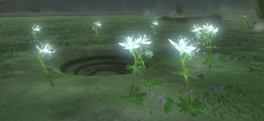
A photograph of a ring of Silent Princesses. They grow tall, strong and radiant, and are clustered around a small shallow in the ground. At the centre, a dragon tear awaits.
Chapter 18
[Josha at her research station - this photograph is not depicted in the chapter]
Chapter 19
[Penn at Washa's Bluff with the Light Dragon overhead - this photograph is not depicted in the chapter]
Chapter 20

[Rist Peninsula as the sun rises - this photograph is not depicted in the chapter]
22 notes
·
View notes
Text
Events 2.20 (after 1940)
1942 – World War II: Lieutenant Edward O'Hare becomes America's first World War II flying ace.
1943 – World War II: American movie studio executives agree to allow the Office of War Information to censor movies.
1943 – The Saturday Evening Post publishes the first of Norman Rockwell's Four Freedoms in support of United States President Franklin Roosevelt's 1941 State of the Union address theme of Four Freedoms.
1944 – World War II: The "Big Week" began with American bomber raids on German aircraft manufacturing centers.
1944 – World War II: The United States takes Eniwetok Atoll.
1952 – Emmett Ashford becomes the first African-American umpire in organized baseball by being authorized to be a substitute umpire in the Southwestern International League.
1956 – The United States Merchant Marine Academy becomes a permanent Service Academy.
1959 – The Avro Arrow program to design and manufacture supersonic jet fighters in Canada is cancelled by the Diefenbaker government amid much political debate.
1962 – Mercury program: While aboard Friendship 7, John Glenn becomes the first American to orbit the Earth, making three orbits in four hours, 55 minutes.
1965 – Ranger 8 crashes into the Moon after a successful mission of photographing possible landing sites for the Apollo program astronauts.
1968 – The China Academy of Space Technology, China's main arm for the research, development, and creation of space satellites, is established in Beijing.
1971 – The United States Emergency Broadcast System is accidentally activated in an erroneous national alert.
1979 – An earthquake cracks open the Sinila volcanic crater on the Dieng Plateau, releasing poisonous H2S gas and killing 149 villagers in the Indonesian province of Central Java.
1986 – The Soviet Union launches its Mir spacecraft. Remaining in orbit for 15 years, it is occupied for ten of those years.
1988 – The Nagorno-Karabakh Autonomous Oblast votes to secede from Azerbaijan and join Armenia, triggering the First Nagorno-Karabakh War.
1991 – In the Albanian capital Tirana, a gigantic statue of Albania's long-time leader, Enver Hoxha, is brought down by mobs of angry protesters.
1998 – American figure skater Tara Lipinski, at the age of 15, becomes the youngest Olympic figure skating gold-medalist at the 1998 Winter Olympics in Nagano, Japan.
2003 – During a Great White concert in West Warwick, Rhode Island, a pyrotechnics display sets the Station nightclub ablaze, killing 100 and injuring over 200 others.
2005 – Spain becomes the first country to vote in a referendum on ratification of the proposed Constitution of the European Union, passing it by a substantial margin, but on a low turnout.
2009 – Two Tamil Tigers aircraft packed with C4 explosives en route to the national airforce headquarters are shot down by the Sri Lankan military before reaching their target, in a kamikaze style attack.
2010 – In Madeira Island, Portugal, heavy rain causes floods and mudslides, resulting in at least 43 deaths, in the worst disaster in the history of the archipelago.
2014 – Dozens of Euromaidan anti-government protesters died in Ukraine's capital Kyiv, many reportedly killed by snipers.
2015 – Two trains collide in the Swiss town of Rafz resulting in as many as 49 people injured and Swiss Federal Railways cancelling some services.
2016 – Six people are killed and two injured in multiple shooting incidents in Kalamazoo County, Michigan.
1 note
·
View note
Text
AT THE END OF THE EARTH - A Modern ‘Lost World’ Setting
The Lost World is perhaps the most well known archetype for dinosaur stories. By some miracle of geography, whether it’s a mysterious plateau, a remote island, a hidden valley or caverns in the centre of the earth, prehistoric life has survived into the modern age & has been discovered by explorers from the outside world.
Many of them come from or are inspired by old pulp adventure novels by the likes of Jules Verne, Edgar Rice Burroughs & Arthur Conan Doyle & tend to carry that legacy with them. There’s a certain retro fantasy vibe that comes with these stories, which isn’t at all a bad thing. They’re high-flying adventures with dashing heroes & thrills abound, but they also carry a little outdated thematic baggage. They’re an heirloom of the colonial age when white, western civilization ventured out into lands unknown, proudly staked their claim & immediately sought to subjugate its inhabitants & exploit its resources.
So how do you do a modern take on the lost world? How do you make it relevant to the world at present? Well, here’s my attempt.
As the 21st century pushes forwards, man made climate change is causing widespread chaos. Across the world, reliable weather systems are breaking down, crops are failing & low-lying settlements are flooding. Famine & the need for habitable land has seen a mass exodus of refugees fleeing their homes & fierce conflicts breaking out over habitation.
As the world warms, the geography of Antarctica has changed dramatically. The great ice sheets that once blanketed the far south are melting away. Research stations built on the ice have been abandoned as they fall into the sea, while those on solid ground make an astonishing discovery. The rising temperatures & increasing rainfall have not only thawed the Antarctic continent, but revived an ecosystem frozen beneath it. A land of steep mountains & valleys, temperate rainforests & boggy marshlands. And Dinosaurs!
It turns out that during the cataclysmic extinction event at the end of the Mesozoic, the great & terrible reptiles on the southern continents fled the disaster into the sheltered valleys of Antarctica where they outlived their northern cousins. Since Antarctica froze over during the Cenozoic era, they share this land with other strange animals that evolved in the aftermath. Bone-crushing marsupial predators, herds of early hoofed mammals, huge carnivorous birds & giant ground sloths.
Despite the hazards, the prospect of a whole continent of habitable land is a beacon of hope for displaced peoples, so a relocation program begins. Being the closest land to Antarctica, Argentina offers up its southern tip as a gateway to the Antarctic peninsula, & begins ferrying refugees to newly established settlements. But then, the British intervene! By the terms of the 1959 Antarctic Treaty, the British & Argentine claims to the frozen continent overlap, & the British government decides that an influx of foreign refugees on British territory is tantamount to an invasion!
[This might sound on-the-nose over-the-top evil, but less than a week after I wrote this the UK’s home secretary literally called refugees on the south coast an invasion. Satire is dead & the world is a joke.]
So conflict arises once again. With the UK refusing to ratify the 2048 renewal of the Antarctic treaty, battleships start to fill the southern seas as nations defend their claims to the most valuable land on the planet. Beneath the surface, Antarctica has untapped reserves of valuable resources, including oil, coal & rare-earth minerals. The megacorporations with their power & political sway, even in the face of a global crisis, can’t overcome their hunger for profit & campaign to plunder the new land for all its worth. Tensions are high. There are stand-offs between naval fleets & ground troops, backed by corporate funding to take hold of Antarctica’s natural wealth. A war for the south pole seems imminent.
Then the winds change. Refugees & defectors from their home nations decide enough is enough. The ignorance & greed that plunged the human race into crisis now threatens its only hope of a safe future, so a revolution rises amidst the conflict. Self-declared Antarctic citizens, united by their desire for sustainable survival, they now fight to protect their new home from the political & corporate powers that see this land of plenty at the end of the earth as just another exploitable opportunity.
#fantasy#lost world#dinosaur#story#worldbuilding#prehistoric#future#scifi#science fiction#pulp#pulp fantasy#antarctica#climate change#speculative biology#speculative evolution#nanowrimo#nanowrimo22
16 notes
·
View notes
Text
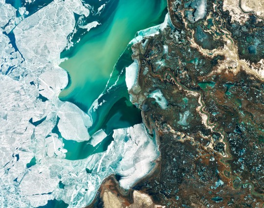
Amazing Earth: Satellite Images from 2020
In the vastness of the universe, the life-bringing beauty of our home planet shines bright. During this tumultuous year, our satellites captured some pockets of peace, while documenting data and striking visuals of unprecedented natural disasters. As 2020 comes to a close, we’re diving into some of the devastation, wonders, and anomalies this year had to offer.
NASA’s fleet of Earth-observing satellites and instruments on the International Space Station unravel the complexities of the blue marble from a cosmic vantage point. These robotic scientists orbit our globe constantly, monitoring and notating changes, providing crucial information to researchers here on the ground.
Take a glance at 2020 through the lens of NASA satellites:
A Delta Oasis in Southeastern Kazakhstan
Seen from space, the icy Ili River Delta contrasts sharply with the beige expansive deserts of southeastern Kazakhstan.
When the Operational Land Imager (OLI) on Landsat 8 acquired this natural-color image on March 7, 2020, the delta was just starting to shake off the chill of winter. While many of the delta’s lakes and ponds were still frozen, the ice on Lake Balkhash was breaking up, revealing swirls of sediment and the shallow, sandy bed of the western part of the lake.
The expansive delta and estuary is an oasis for life year round. Hundreds of plant and animal species call it home, including dozens that are threatened or endangered.
Fires and Smoke Engulf Southeastern Australia
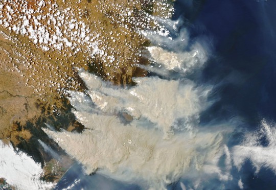
A record-setting and deadly fire season marred the beginning of the year in Australia. Residents of the southeastern part of the country told news media about daytime seeming to turn to night, as thick smoke filled the skies and intense fires drove people from their homes.
This natural-color image of Southeastern Australia was acquired on January 4, 2020, by the Moderate Resolution Imaging Spectroradiometer (MODIS) on NASA’s Aqua satellite. The smoke has a tan color, while clouds are bright white. It is likely that some of the white patches above the smoke are pyrocumulonimbus clouds—clouds created by the convection and heat rising from a fire.
Nighttime Images Capture Change in China

A team of scientists from NASA’s Goddard Space Flight Center (GSFC) and Universities Space Research Association (USRA) detected signs of the shutdown of business and transportation around Hubei province in central China. As reported by the U.S. State Department, Chinese authorities suspended air, road, and rail travel in the area and placed restrictions on other activities in late January 2020 in response to the COVID-19 outbreak in the region.
A research team analyzed images of Earth at night to decipher patterns of energy use, transportation, migration, and other economic and social activities. Data for the images were acquired with the Visible Infrared Imaging Radiometer Suite (VIIRS) on the NOAA–NASA Suomi NPP satellite (launched in 2011) and processed by GSFC and USRA scientists. VIIRS has a low-light sensor—the day/night band—that measures light emissions and reflections. This capability has made it possible to distinguish the intensity, types, and sources of lights and to observe how they change.
The Parched Paraná River
Though a seemingly serene oasis from above, there is more to this scene than meets the eye. On July 3, 2020, the Operational Land Imager (OLI) on Landsat 8 captured this false-color image of the river near Rosario, a key port city in Argentina. The combination of shortwave infrared and visible light makes it easier to distinguish between land and water. A prolonged period of unusually warm weather and drought in southern Brazil, Paraguay, and northern Argentina dropped the Paraná River to its lowest water levels in decades. The parched river basin has hampered shipping and contributed to an increase in fire activity in the delta and floodplain.
The drought has affected the region since early 2020, and low water levels have grounded several ships, and many vessels have had to reduce their cargo in order to navigate the river. With Rosario serving as the distribution hub for much of Argentina’s soy and other farm exports, low water levels have caused hundreds of millions of dollars in losses for the grain sector, according to news reports.
Historic Fires Devastate the U.S. Pacific Coast
Climate and fire scientists have long anticipated that fires in the U.S. West would grow larger, more intense, and more dangerous. But even the most experienced among them have been at a loss for words in describing the scope and intensity of the fires burning in West Coast states during September 2020.
Lightning initially triggered many of the fires, but it was unusual and extreme meteorological conditions that turned some of them into the worst conflagrations in the region in decades.
Throughout the outbreak, sensors like the Visible Infrared Imaging Radiometer Suite (VIIRS) and the Ozone Mapping and Profiler Suite (OMPS) on the NOAA-NASA Suomi NPP satellite collected daily images showing expansive, thick plumes of aerosol particles blowing throughout the U.S. West on a scale that satellites and scientists rarely see.
This image shows North America on September 9th, 2020, as a frontal boundary moved into the Great Basin and produced very high downslope winds along the mountains of Washington, Oregon, and California. The winds whipped up the fires, while a pyrocumulus cloud from the Bear fire in California injected smoke high into the atmosphere. The sum of these events was an extremely thick blanket of smoke along the West Coast.
The Sandy Great Bahama Bank
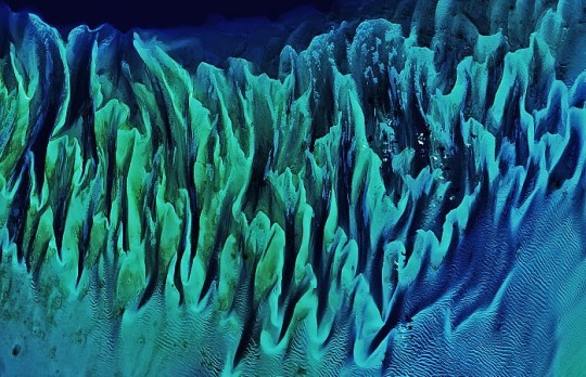
Though the bright blues of island waters are appreciated by many from a sea-level view, their true beauty is revealed when photographed from space. The underwater masterpiece photographed above is composed of sand dunes off the coast of the Bahamas.
The Great Bahama Bank was dry land during past ice ages, but it slowly submerged as sea levels rose. Today, the bank is covered by water, though it can be as shallow as two meters (seven feet) deep in places. The wave-shaped ripples in the image are sand on the seafloor. The curves follow the slopes of the dunes, which were likely shaped by a fairly strong current near the sea bottom. Sand and seagrass are present in different quantities and depths, giving the image it’s striking range of blues and greens.
This image was captured on February 15th, 2020, by Landsat 8, whose predecessor, Landsat 7, was the first land-use satellite to take images over coastal waters and the open ocean. Today, many satellites and research programs map and monitor coral reef systems, and marine scientists have a consistent way to observe where the reefs are and how they are faring.
Painting Pennsylvania Hills
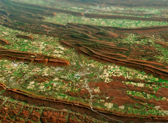
Along with the plentiful harvest of crops in North America, one of the gifts of Autumn is the gorgeous palette of colors created by the chemical transition and fall of leaves from deciduous trees.
The folded mountains of central Pennsylvania were past peak leaf-peeping season but still colorful when the Operational Land Imager (OLI) on the Landsat 8 satellite passed over on November 9, 2020. The natural-color image above shows the hilly region around State College, Pennsylvania overlaid on a digital elevation model to highlight the topography of the area.
The region of rolling hills and valleys is part of a geologic formation known as the Valley and Ridge Province that stretches from New York to Alabama. These prominent folds of rock were mostly raised up during several plate tectonic collisions and mountain-building episodes in the Ordovician Period and later in the creation of Pangea—when what is now North America was connected with Africa in a supercontinent. Those events created the long chain of the Appalachians, one of the oldest mountain ranges in the world.
A Dangerous Storm in the Night
Ominous and looming, a powerful storm hovered off the US coastline illuminated against the dark night hues.
The Visible Infrared Imaging Radiometer Suite (VIIRS) on NOAA-20 acquired this image of Hurricane Laura at 2:20 a.m. Central Daylight Time on August 26, 2020. Clouds are shown in infrared using brightness temperature data, which is useful for distinguishing cooler cloud structures from the warmer surface below. That data is overlaid on composite imagery of city lights from NASA’s Black Marble dataset.
Hurricane Laura was among the ten strongest hurricanes to ever make landfall in the United States. Forecasters had warned of a potentially devastating storm surge up to 20 feet along the coast, and the channel might have funneled that water far inland. It did not. The outcome was also a testament to strong forecasting and communication by the National Hurricane Center and local emergency management authorities in preparing the public for the hazards.
A Windbreak Grid in Hokkaido
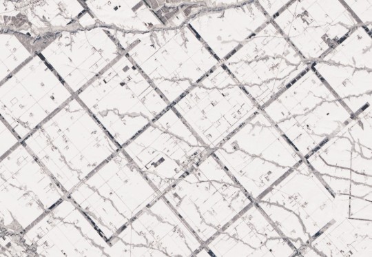
From above, the Konsen Plateau in eastern Hokkaido offers a remarkable sight: a massive grid that spreads across the rural landscape like a checkerboard, visible even under a blanket of snow. Photographed by the Operational Land Imager (OLI) on Landsat 8, this man-made design is not only aesthetically pleasing, it’s also an agricultural insulator.
The strips are forested windbreaks—180-meter (590-foot) wide rows of coniferous trees that help shelter grasslands and animals from Hokkaido’s sometimes harsh weather. In addition to blocking winds and blowing snow during frigid, foggy winters, they help prevent winds from scattering soil and manure during the warmer months in this major dairy farming region of Japan.
Shadows from a Solar Eclipse

Formidable, rare, and awe-inspiring — the first and only total solar eclipse of 2020 occurred on December 14, with the path of totality stretching from the equatorial Pacific to the South Atlantic and passing through southern Argentina and Chile as shown in the lower half of the image above. The Advanced Baseline Imager (ABI) on Geostationary Operational Environmental Satellite 16 (GOES-16) captured these images of the Moon’s shadow crossing the face of Earth.
The “path of totality” (umbral path) for the eclipse was roughly 90 kilometers (60 miles) wide and passed across South America from Saavedra, Chile, to Salina del Eje, Argentina. While a total eclipse of the Sun occurs roughly every 18 months, seeing one from any particular location on Earth is rare. On average, a solar eclipse passes over the same parcel of land roughly every 375 years. The next total solar eclipse will occur on December 4, 2021 over Antarctica, and its next appearance over North America is projected for April 8, 2024.
For additional information and a look at more images like these visit NASA’s Earth Observatory.
Make sure to follow us on Tumblr for your regular dose of space: http://nasa.tumblr.com.
#NASA#Earth#science#earth pictures#planet earth#solar eclipse#eclipse#oceans#solar system#planets#space#satellite#stunning photos
2K notes
·
View notes
Text
Flora and Fauna of Talath Dirnen, the guarded plain and the River Narog
Flora and fauna of Arda masterlist
Disclaimer: I used both what we can extrapolate is likely indigenous to the region based on descriptions of the landscape and climate as well as my own headcanons and inspirations and reference books on similar habitats as well as books like The Atlas of Middle Earth and The Flora of Middle Earth
I really love working on and researching these! and as always feel free to ask more, even if I've already done a place I'd always enjoy going into more detail of tacking a more specific kind of life there
Given that Tolkien was inspired in his plains and grasslands of a wide variety of places, everywhere from China to Britain to Northern Africa and the US, I’m imagining a wide range of biodiversity here in this plateau especially given the proximity to these two rivers. I don’t think that all of his grasslands have life from all these places necessarily but I do think there is the potential for more biodiversity.
The Talath Dirnen was a plateau between two great rivers, the river Narog and the river Sirion and located Northeast of Nargothrond. It is described in the book as a mostly open plateau but with hills that were utilized for watch stations and some small forested areas.
The hills and open plain are made up of a variety of species including apera, Coleanthus, reed sweet grass, melica, veldtgrass,��sages, weeping alkaligrass, and many species in the daisy family. Wild strawberry and musk strawberry, hawthorn, thistles, and meadowsweet are more possibilities for the more shrub like areas around the hills.
We don’t know a lot about the climate so it’s difficult to speculate on the forested areas but if I had to guess I’d say they were mostly deciduous ,broad leaved trees. Rain tree and wild berry (the common name for a species) are possibilities.
River birds like loons, egrets, osprey, herons, cranes, teals and bobwhites nest closer to the banks of the two rivers.
As parts of the river Narog is underground, there are many unique species found there including salamanders like olms, cave amphipods, species of subterranean Nemacheilidae, Viviparous brotula, and Ictaluridae, and roosting bats as well as a variety of more invertebrates.
(I’m planning on going into the River and Mouths of Sirion in another post if there’s interest.)
(And I am so tempted to put something like a Paleoparadoxia in one of the rivers but alas I don’t think that quite fits the climate.)
And birds that nest in the flatter grasslands and hills like pheasants, killdeer, meadowlark, grasshopper sparrow, sedge wrens, bobwhites and plover.
As I said before there are many different places Tolkien took inspiration from in his grassy plateaus so there’s a wide variety of possible wildlife especially as we don’t know much about the climate.
Anything from different species of Hedgehogs, badgers or foxes (all three have representing species Europe, Northern Africa and Southern Asia where Tolkien was primarily inspired in his grasslands) deer or gazelle, giant ground sloths, at least one species of large wild cat, perhaps creatures like wildebeests occasionally pass through on migration routs.
24 notes
·
View notes
Text
Expunged- Part I
The radio crackled in Chao's ship as he flew toward the location of the distress signal at light speed, he could just barely make out what it was saying but he was able to decipher the coordinates. He jolted out of light speed as he passed by the atmosphere of Jupiter, the titanic jovian cast a shadow on him so dark that if he didn't have lights he would not be able to see much. He looked over at another green colored moon that orbited the planet, Io was lost to the Darkness now. As he kept going the navigation system told him he was getting closer to the signal. That's when he realized where it was coming from and why there was so much static. The icy moon of Europa slowly orbited on Chao's left.
Chao was apprehensive as he was pulled into the planet's orbital gravity, the last time he was here was not pleasant. He had come here on a mission to scope out a new arena for his Crucible, all he found was a ship frozen in ice, broken in half and a Clovis Bray machine gun prototype. Along with a heap of trouble, it was a notoriously bad place for his kind. He couldn't leave now though, he'd already come this far and wasn't backing out if he could help whoever it was on the radio.
The ship sat down on a snowy plateau, the wind was blowing it everywhere and Chao could barely make out where he was going, not only that but the armor he wore was not fit for this type of weather. The cold didn't effect him of course, he was an Exo but the snow was so deep and his helmet had no thermals. He took off the navigation system from his ship and clipped it onto his belt as his Mark blew in the wind. Then he set it to where it would alert him if he was at his destination. For now he grabbed his pulse rifle, No Feelings and trudged through the snow following the lights on the other side of the ridge that shone through the blizzard.
He made his way toward the lights and the radio static began to come through a little clearer. Though the howling wind still made it hard to tell what was being said, he knew he was close, he saw the remains of an old facility captured in the icy surface. The front of it seemed like it was torn open by someone... or something. He proceeded with caution and kept his weapon close by as he descended down into the cavern that used to be enclosed but was now at the mercy of the treacherous weather. He turned on the light on his helmet to see better as he walked down the stairs and out into an area that reminded him of Titan's Arcology. Golden Age maybe, sleek designs. It was a miracle this place was still running after all this time. He stepped through the hallway and the door mechanism showed a green light before sliding open. The blinding light from the next room poured in and Chao's blue eyes whirred as they adjusted to let less light in. Pointless for Exos other than having to keep them as accurate to humans as possible. Chao stepped through the door to the giant room and he looked on what he saw with worry. First thing he saw was the logo. Clovis Bray Exoscience. Second thing he saw was the Crux. The loudspeaker gave a three toned trill before he heard a voice.
"Welcome home my robotic savior. I trust that you... recognize where you are now." Chao gave a nod, though it was small.
"I am the one who sent the distress signal, however I am not in any danger no, on the contrary I am perfectly content right where I am."
"And where might that be?" Chao tried seeing if he could figure out what was going on.
"Not sure... I seem to be surrounded by late uh- experiments of what this facility studied back in our Golden Age. All by the great Clovis Bray the First, father of Clovis Bray the Second and grandfather to Ana and Elsie Bray. One of the greatest minds of our time, for you see he was never afraid to do what needed to be done for the betterment of humanity. You were once researched here to travel the cosmos and beyond, however we all know that is not possible with the means you attempt now... shame. Instead you were created for something more dire, you Chao-5 were built for war." Chao didn't hear the door lock behind him as the voice monologued.
"All Exos were built for war, but that doesn't mean we all followed what we were created to do." The voice laughed at that.
"Really? So toting around high powered weapons and wielding Light and Dark against those that seek to win isn't for war?"
"I serve to protect the last of humanity, I do not use my Light with reckless abandon, I use it to shield those who cannot carry one of their own." Chao said firmly.
"Your track record says otherwise." The voice challenged. "Chao-4, Vanguard reprimand: War Crimes. Quote: Using Striker powers against enemy force innocents. Chao-4, Vanguard reprimand: Misuse of power and broken Crucible rules. Quote: Blatant disregard for teammates lives, four injured, 2 killed." Chao stood still, he couldn't speak.
"Sounds like that fight is still inside you. It hasn't gone anywhere, no maybe how many times you try to reset yourself you were created to do battle. You are an Exo, it is your prime directive, the Clarity that Clovis used still remains after all this time." The voice was behind him now it Whispered in his audio sensors.
"You've merely directed your fighting toward a different cause. Now I am going to do the same." Chao couldn't move, he was trapped in an overshield of shadow that encased him. The voice came into view, a Warlock draped in shadow, Awoken, his hair almost looked like Ken's. He fired a round from Chao's own pulse rifle into his chest plate and it shattered. The Warlock hooked up a cord to one of the nearby work stations and began to scroll through Chao.
"Don't worry, just like you've lived your whole life... you won't feel a thing. You will fight for us now Chao-6."

Hey everyone look content! Soo I know I haven't written in a while, school has been really rough and honestly it's just been kinda a sucky time in my life right now so writing some darker stuff hasn't been on my list but Beyond Light has been super fun and I got a ton of new ideas in the works now that I've read the lore, starting with Chao here soooo yeah idk how to end this but uhhh something something Stasis Go Brr
#destiny#destiny oc#destiny 2#bungie#destiny the game#destiny exo#beyond light#clovis bray#fireteam misfits
8 notes
·
View notes
Text
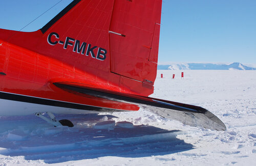
Basler to the Beardmore 1: You See a Plane, You Take It
As always, the original post is up at the official blog – the formatting definitely works there, if you are having issues with it here.
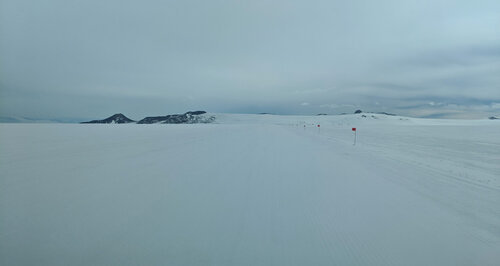
When planning my research trip with the Antarctic Artists & Writers Program, I had to make a wishlist of places to visit. One of the more important ones was the Beardmore Glacier, the route by which Scott and his men climbed from the Ross Ice Shelf (or, as they called it, the Barrier) to the Polar Plateau. It's one of the largest glaciers in the world, but is hardly visited anymore so is rarely photographed, and despite the blessing of Google Image Search, I had too poor a sense of it to draw a journey up or down it with any confidence.
Setting foot on the Beardmore turned out be prohibitively demanding, logistically, but there are regular LC-130 flights between McMurdo Station and the Pole which traverse the Beardmore en route. The plan we made was for me to get on one of those, and snap as much as I could from one of the small windows as we flew.
November 2019 turned out to be a terrible time for Pole flights – if the weather was OK at Pole, there was a problem with the planes, or vice versa. However, the weather delays worked in my favour, because they affected not only Pole flights, but one particular season-opening flight, which had been bumped so many times that it still hadn't gone when I turned up. That meant I could get a seat.
The big flights ffor the USAP’s operations in East Antarctica – cargo and passenger flights on/off continent, and to major stations like Pole and WAIS Divide – are handled by the New York Air National Guard, and their fleet of enormous military airplanes, namely a C-17 and small handful of LC-130 Hercules. There are lots of smaller trips from McMurdo to satellite stations, and these are serviced by Kenn Borek Air, a Canadian company which operates out of Calgary, Alberta. At the start of every season, they fly their fleet of Twin Otters and Baslers down the length of North and South America, then leapfrog depots down the Peninsula and thence to various hubs including McMurdo. From there they move people and stuff where they need to go, and also restock those fuel depots. There was one depot flight that remained to be done, and it happened to be to a cache near the base of the Beardmore, so they agreed to take me along.
I was not the only extra job tacked on to the flight. After depoting the fuel, we were to scout out a camp in the Transantarctic Mountains which had been in regular use until a some fierce winds a few years ago had scoured great furrows in the landing strip. Was it landable again? What state was the camp in? We would find out. They also wanted to scope out a historic site that left no physical trace, to get updated intel on its condition. Then we would fly north again via the Beardmore and the coordinates for One Ton Depot.
As soon as the Basler had finished her more pressing engagements, we were put on alert for the depot run. Everything in Antarctica is weather-dependent, and that can change on a dime, so one is always on standby. Because they needed to make the most of the Basler's time, they would put two missions on for any given day, then the one with the best prospects would be activated. For five days I was ready to go – breakfasted, fully suited up, lunch packed, ECW bag to hand – at 7 a.m., in case my flight was the one that was going. Flight status would be announced on the screens at the entrance to the Galley.

For four mornings I joined the poor Thwaites Glacier team anxiously hanging on the screens – they were trying to get out to WAIS Divide (the high point of the West Antarctic Ice Sheet, from which they would catch a flight to the Thwaites camp) where the weather had been abominable for a month. One of those mornings my flight was activated and I got all the way out to the airfield only for it to be called off at the last minute because of a change in forecast for the depot site. But finally, the fifth morning, it was all systems go!
There are two airfields that serve McMurdo: Phoenix, which is designed to take the massive C-17s on a packed snow runway where they can land with wheels, and Williams Field, of groomed snow, for ski'd aircraft. The extra special thing about Williams Field is that it's more or less where Scott's 'Safety Camp' was located – so named because it was far enough onto the ice shelf not to break up and float out to sea – so the view to Ross Island from there would have been very familiar to our explorers. On the day of my false start, while waiting to find out that the plane wasn't going after all, I got to take some good pictures of the view from there. It was also a good day to get a sense of the 'bad light' that obliterated contrast on the snow and made navigation difficult:
The Sea Ice Incident took place between us and the conical hill to the left! Wild!
Anyway, Try no. 5 was on a much nicer day. Here is the magnificent bird with her spanking new paint job:
It was a funny experience – I mean, besides sharing the fuselage with many hundreds of gallons of flammable liquid – in that it was an island of Canada amidst all the Americans. The crew all lived in BC when they weren't in Antarctica, and next to my seat were the usual set of flight safety brochures, in English and French, just as if we were flying out of Calgary.
Our pilot was named Steve, and I learned from him that, if you're training to be a pilot in Canada, you have to do your qualifying hours in the North. Most people put in their time and then get a comfortable job flying passengers between major southern cities, but Steve liked the North so much he stayed and stayed, until he got the job with Kenn Borek and ended up South. As much as I feel obliged to make a facetious quip about my flammable fellow passengers, I can honestly say I have never felt safer in an airplane than this one. This was just as well, as one of the first things we did once we were in the air was rather exciting.
The Basler is a workhorse, and one of the Antarctic planes (though I never found out if it was this one) had actually flown in WWII – they just keep going and going. However, the hydraulics that lift the landing gear were designed to lift just the landing gear, not the landing gear plus 650-pound skis, so in order to get them up we had to lose some weight. And we did this by climbing steeply up and then nose-diving, bringing us temporarily closer to zero G. We had to do this every time we took off, and it took 2-3 goes to get the skis up successfully. You'd expect someone with a history of nervous flying and a sensitivity to motion sickness to find this unpleasant, but it was just plain awesome.
This post is getting long already, so I will describe our errands in detail over the next two posts. I really must take the time here, though, to give my regards to Kenn Borek Air. I don't think anyone in Canada knows how absolutely vital they are to everything that gets done in Antarctica; their vermillion planes keep camps supplied and people moving around, and are the everyday lifeblood of the continent, in the most literal circulatory sense. Steve and the Basler may possibly have saved the Thwaites Glacier project this season – after a month of delays getting people and freight out to the field camps, it was reaching a point where they might have called off the massive international project for this year. But they allocated the Basler to the WAIS flights and Steve landed it in conditions that the NYANG wouldn't – the Basler couldn't fly nearly as much cargo as a Herc, but they got enough out there that some work could begin. I haven't seen this mentioned in any of the Thwaites coverage and I'm sure it hasn't been covered in Canada, but for a country that doesn't even have a national Antarctic program, they should be mighty proud of the central role their people play in making other countries' programs happen.
#antarctica#travel#airplanes#aeroplanes#beardmore glacier#mcmurdo station#usap#kenn borek air#basler#dc-3#aviation#williams field#photos
33 notes
·
View notes
Text
“Your Highness, we found something. And I think you’re gonna wanna have a look at this.”
********
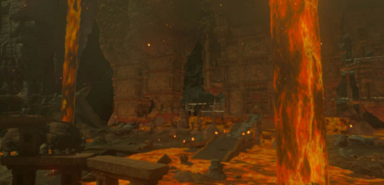
Princess Zelda’s entourage was escorted into the underground chamber. Link and Impa stood on either side of her as guards, while Purah and Robbie led them all down into the excavation site. Several Sheikah were working on digging through the ancient technology artifacts, pausing in their work only to let the Princess and the others through.
Filing down a natural stone hallway carved into the mountainside, they came upon a chamber with an ancient technologically advanced tub. It was dry and unused.
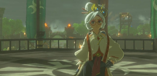
Purah sidled up to the machine and gave her lecture with her usual Purah flourish, “Your Highness, the tub that you see before you is a very special bit of ancient technology that we have uncovered. Deciphering the ancient runes that we have found, we have discovered that the ancient Sheikah named this fantastic device “The Shrine of Resurrection.”
Princess Zelda blinked, as she considered both the device and the name, “Shrine of Resurrection? A most curious name.”
“Yes!” exclaimed Purah, slapping the tub with her hand, “We are in the middle of discovering more details, but we are fairly confident that we know what this device was even used for. And it's absolutely fascinating.”
Zelda leaned in curiously to look on the inside of the tub, “And what have you found?”
Robbie stepped up, pulling out his notebook, “From what we have translated, the ancient Sheikah were deadly serious in trying to build powerful weapons that would somehow stop the Calamity that they had reason to suspect would happen in their lifetime. That's what the Divine Beasts, the shrines, everything our ancestors built, were for. This device is no different, built as a sort of weapon, but a weapon with a very unique ability that we didn’t even think was possible.”
Princess Zelda nodded politely, “This is a very curious weapon indeed, it doesn’t even look like a weapon. Please go on, my interest is immense.”
Impa gathered a couple of crates so that Link, Zelda and her could listen to the excited ramblings of her sister in more comfort. Sitting down, Zelda motioned for Purah to continue, “You see your highness, imagine if you will, when on the battlefield, there are bound to be casualties of course! Your numbers dwindle and maybe even your prized fighters are out of commission. That’s not good! That’s where this little beauty comes in!”
Purah twirled herself to the terminal and activated the device with the Sheikah Slate. The machine whirred to life and a strange glowing blue liquid began to fill the reservoir. The Trio looked into the tub as the blue liquid swirled and splashed along the sides.
Robbie came up and stuck his hand in the liquid, scooping some out and letting it drip back down into the reservoir. He wiped his wet hand onto his shirt to dry it off and stuck it out for the Princess, “Here, your highness, feel my hand.”
Impa eyed Robbie with great suspicion while Princess Zelda tepidly reached out to shake Robbie’s semi dry hand. “Your hand... it's so soft and smooth.” Zelda said, now rubbing the back of Robbie’s hand, the texture visibly younger.
“You see your Highness,” Purah continued, scooping the water onto her own hands and rubbing it over her arms, “This chamber has unimaginable healing properties. Scrapes get healed almost instantly, cuts within seconds, burns within minutes, wounds within hours. A soldier with a broken bone could theoretically be healed within a day.”
“That’s amazing!” exclaimed the Princess.
Impa too had a look of surprise on her face, her ancestors were certainly full of surprises. “That is truly a wonderful machine, but what use it is to us now? We could have used it during the War of the Calamity for sure, but it’s over.”
Robbie raised his finger in protest, “There will always be a need to heal, even during periods of peace time, Impa.”
Purah continued the thought, “Just because our ancestors used their technology for war doesn’t mean that we can’t repurpose their inventions for our needs. But I do agree, that this little discovery would have been useful much earlier.”
Zelda nodded her head in agreement, as she remembered the fierce battle that had happened the year before. She turned to her other side to look at Link, her champion knight, “Link? You’ve been awfully quiet this whole time, do you have any thoughts about this?”
Link shook his head, as he stared at the swirls of blue liquid. A machine that could heal a soldier to near perfection... a machine that could keep someone fighting...forever.
Purah barreled into the conversation again, visibly excited and vibrating with anticipation, “Also, Your Highness, we have made yet another discovery just a few days ago!”
“Another discovery?” asked Zelda, caught with surprise at the onslaught of news.
“Yes yes!” Purah exclaimed. “So, you see how this is just one machine of resurrection right?”
They all nodded their heads, continuing to follow along with Purah’s animated ramblings. “Well, a few days ago, we discovered that deeper within this Plateau, farther down in this excavation site, there is another cavern. It was well hidden, and it if hadn’t been for a fluke, we might never have discovered that it was there at all.”
Robbie interjected with his own high-spirited dialogue, “And do you know what we found in that cavern? We found other resurrection machines! Loads of them! There are enough chambers in there to sustain a sizeable army!”
“That’s--” Princess Zelda grabbed her hand to her chest, “That’s unbelievable!”
“Come, come, your Highness, we’ll show you the machines!” Purah said, grabbing the Princess’s hands and leading her away, Impa nervously going after her sister. Link and Robbie followed after.
*****
They were deep underground, the Sheikah researchers were few and stationed away from the site. A minimal number of lights had been set up, just enough to get around, but not so many that vision wasn’t a struggle in the expansive cavern. The site had just been unearthed, so Purah, Robbie and their team had not had the chance to do much of anything. It was practically untouched.
There were rows and rows of machines, the same make and model that Purah and Robbie had shown off before above them. But, whereas the machine that had been demonstrated was in pristine working condition, these machines did not look like they had been as lucky. It was obvious that the cavern had suffered from the instability of Mother Nature. Some chambers had been covered in mud, or broken with falling boulders. Some were eaten with rust, covered in lichen. Water dripped from the ceiling onto the delicate inner workings of the machines, a sure sign that repairs needed to be done, if they could be done at all.
Purah and Robbie poked through the rows of Resurrection Chambers, less animated and more absorbed in curiosity. Princess Zelda also wandered the great cavern with Impa close at hand. Link left them to chat to themselves, talking science, talking tech, talking Sheikah mechanics and runes. Link cared only so much as Zelda cared about that stuff, but to him, it was only interesting as far as if he was being made to use it.
Through the darkness, the chambers gave eery, shadowy silhouettes. More like coffins. Rows and rows of headstones, meant for soldiers, to give them unlimited life to keep fighting. An undead army? Link shivered. Why did that thought unsettle him so? Purah. Robbie and even Princess Zelda were excited to use the chambers to heal, but... was that really what these things were for?
Link moved farther into the cavern, examining the shrines. They all seemed to be out of commission. Link perked up his ears, he heard a faint humming coming from the darkness. A whirring, at precise, regular intervals. Something mechanical. There was no way one of these machines still worked, right? It's been 10,000 years since anyone had even seen this chamber.
Link stepped lightly, trying to follow the faint sounds off in the distance. He came upon a machine, the same as all the others, the lid closed tight, covered in lichen. Link put his hand onto the chamber, it felt warm and gave faint vibrations as if being supplied with power. He placed his ear next to it, the whirring of machinery unmistakable. This machine was in use!
Link ran back towards the others, waving to get their attention.
“Link?” Princess Zelda came up to him to better understand his motions, “What is it? You found something?”
Link nodded and grabbed the Princess’s hand, urging her to follow after him. Link was a man of few words, but Zelda both understood and encouraged Link’s communication. They quickly came to the chamber that had the buzzing sounds, Link placed Zelda’s hand on the chamber to feel for herself.
‘Oh! It’s warm.” she said, placing her head closer to hear the subtle clicks the chamber gave off.
Purah, Robbie and Impah came running after, to see what was the matter.
“This chamber,” Princess Zelda straightened up, “It’s in use!”
6 notes
·
View notes
Text
Frostfur Episode 6: Grim Forecast
We’ve put a lot distance between us and the ghost city of Winterhome. Thanks to Emmy, these new sleds make it easier for us to schlep supplies. Of course, I’m not too excited to be pulling it, given the weight of the cargo is heavy, along with the warthog, for most of the journey. Carly has to suffer, too, but she’s carrying less than I’ve got. Just shows how gender really plays a role in an apocalyptic ice age. I just keep pressing onwards with my friends, and not a moment do I ever stop to look back at the city of the dead. We’re bound for New London, now, and we shall not stop. The terrain becomes harder to climb, as the sled of supplies make it difficult to ascend this new slope.
Carly struggles to tug the sleigh, letting out a grunt. “Ugh! This thing is so heavy!”
“Don’t be such a child,” I comment. “Look at me, and all of the stuff I’m hauling. I’ve got more things than you. You’re only carrying half the amount of supplies. You want to carry the rest of this up the mountain?”
“You’re quite the cheeky one. I think I shall suffer with my “half-load” instead.”
“Come on, guys,” Emmy spurts. “Let’s not argue until we’ve made it to our destination.” I pivot my head toward her and ask her how long it would be to reach the city. “We’ve got a while’s journey till we head to New London. We need to be prepared to stop and camp.” A while’s journey? Seems it’ll take longer than I had previously suspected. Then again, where else do we have to go? Our homes are probably buried under mounds of snow, so there’s no going back there, and Winterhome is a lost cause. Does this mean New London will be next?
I turn my head back to the front, only to see a strange silhouette piercing through the fog created by the roaring winds and snow. All my thoughts have shifted from the journey to this new shadow, causing me to stop in the snow.
The cat halts beside me, noticing my mood. “What is it, Zach?” My mind is too fixated on this particular object to give an answer, yet she and Emmy look beyond the misty atmosphere and know what has me at surprise. As the winds slow for a bit, we start to make out the features of this strange shadow; a tall building with some peculiar devices on the roof. It’s most likely a weather station set up by the scientists from Winterhome. “What is that?”
“It looks to be a weather station,” Emmy answers. “A team of scientists have set up here to keep tabs on the weather. Maybe we should check it out.”
“What?!” spurts Carly. “What in God’s name could possibly be in there that we’d stop and delay our arrival in New London?”
“Perhaps some of the contraptions survived, and could help us on our journey,” the warthog explains.
Those devices could actually prove to be useful. Another thought crosses my mind. “There may be some food there, too. It could take us longer to reach New London.”
“I don’t know,” Carly responds. “It doesn’t seem too safe up there.”
“You have nothing to worry about, Lass,” I assure her. “You have a trained soldier at your disposal by your side. I won’t let anything bad happen to you or Emmy, I promise.” The cat lets out a sigh, feeling defeated as her vote has been outnumbered by her two friends. She accepts our encouragement, and the two of us proceed to the weather station.
It’s quite a struggle with the prevailing winds and bombardment of snow pellets, as well as the mountain’s slope with the heavy supplies weighing us back. Yet, all these factors, despite slowing us in every way, do not prevent us from reaching the flat plateau. It takes us probably about a minute and a half to battle the elements and an additional couple of seconds to reach the door, then a few more seconds to knock it with the butt of my rifle and walk inside, after tying our sleds to some support beams outside. Holding my torch up, we begin to comb the entire shelter, seeing anything that could be of use. Up on the roof of the station, we can see the silent city of Winterhome, still standing in the distance as we’re far away from it. As the three of us continue wander around, we check everything and everywhere, searching the area for any signs of life as well, yet we see none. There’s nobody here, but everything seems to be operational. What were these scientists working on?
On the desk nearest to my right, I notice several notebooks, opened and filled with scrawled writings. These must be the notes the scientists were working on. Looking through the already-opened pages, they predict that the great cold is going to get much worse. What’s more troubling is that the observations ended abruptly months ago. They were tracking the weather and knew that it was coming… I wonder what else they recorded. Flipping through the entire book, I scan every written entry and record of knowledge, piecing together what was gathered and how it all happened. Emmy and Carly join my side as we all learn how the eternal cold had started:
The great mountains of Krakatoa and Mount Tambora have been very active, spewing ash up into the skies, creating thick smog. The blackened clouds hovered into the atmosphere, covering about seventy percent of our world’s atmosphere. The large “blanket” was responsible for dimming the sun, causing the temperatures to drop and bring in an early winter. As the writings go on, the scientists have reported hearing news of massive crop failures and the deaths of millions. Many had flocked to churches and places of worship to ask God for forgiveness of their sins in an effort to reverse the catastrophic events, but it was too late. Anarchy and unrest spread among the world, eventually bringing an end to many of the nations. The British Empire and the United States, however, created a pact to develop several installations, known as the “generators”, to act as heating city centers in the north. Their locations were thought out because of the rich coal deposits discovered in the icy artic. This was both nations’ last attempts of saving their populations and rebuilding society.
“This is not a happy story,” comments Carly. “Not one I’d want to read before bed.”
“That’s because it’s not meant to be,” explains a feminine voice from behind. We quickly turn around to see a purple rabbit standing before us, dressed warmly in an attire much similar to Emmy’s, suggesting she’s one of the scientists who was working here. Her wide, emerald eyes and long, smiley mouth with two teeth showing give us an eerie feeling. My arm wraps around to grasp my rifle, which rests firmly on my back. “How interesting for a couple of souls, such as you three, to enter a now-abandoned place.” Emmy and Carly inch closer to me, nearly hiding behind my back, making it more difficult for when I pull my gun out. “Did I frighten you? I did not mean to, for I get that quite frequently. I won’t hurt you, do not fret. My name’s Brook, and I am pretty friendly.”
“Where are the scientists who ran this place?” asks Emmy.
“They’re all gone,” the rabbit says. “Left this place behind as soon as the frost came in, taking everything but the equipment. There’s not a can of spam or even a crumb of bread left. So, if you are looking for food, you will find none. I was part of the research team, but I came back here to salvage anything that could be of benefit to my survival. Who are you three, might I ask?” We formally introduce ourselves to her. “Zach, Emmy, and Carly. Pleasure to meet you three. Any reason you have come here? Perhaps for shelter?”
“Somewhat,” I answer. “We’ve stopped here to see if we could find anything useful to help us with our journey to New London.”
“New London?” Brook repeats. “I don’t believe I’ve heard that name before. Is this a new settlement being developed?”
“Yes,” Emmy answers, taking a step away from my leg. “It is the location for London’s citizens to evacuate to. You see, we’ve just come from Winterhome, and we’re-”
“Winterhome?!” she interrupts. “You three manage to escape like the others?” Others?! What does she mean by that? There are other survivors? “I’ve heard what had happened there. Everything fell faster than the snow.”
“Actually,” Carly begins. “We weren’t in Winterhome when the chaos happened… We were supposed to be there, but we found everyone was dead.”
“Not everyone,” Brook tells us. “Many have fled the city after the explosion. Some did not survive in the frostland, though. It’s hard to adapt to the change in what nature had switched to.”
My paw relaxes from my rifle and returns to my side. I feel bad for this poor woman, being alone and out to fend for herself. The next thing I say will cause my friends to balk at me. “Hey, why don’t you come with us to New London?” Both the warthog and cat quickly dart their eyes at me. They must think I’m mental, which I was right.
“Accompany you lot?” she asks. “What is there in New London? A chance to survive?”
“A chance to live,” I respond.
“Zach,” Emmy whispers. I lean my head closer to her. “Are you sure you can trust this rabbit? I don’t feel too secure with her.”
“As with I,” adds Carly. “I know she’s out here by herself and I feel bad as well, but I don’t know if it’s a good idea.”
“Where is your compassion?” I question them both. “The world has plunged into a never-ending winter and many are still struggling to survive. There doesn’t seem to be any hope left in people. When I joined the army, I pledged to my country and the people that I’d help those in need and strengthen their will to fight on. For the Lord’s sake, come with us, Brook, please.”
“You have much heart,” Brook replies. “I shall come with you, then. Lead the way.”
I then turn to Emmy and Carly. “Shall we continue to New London, then?” They nod. We leave the comfort of shelter and ready our sleds. With our new companion, her help is much appreciated, aiding us in pulling the supplies with us as we venture to our destination. I just hope New London is set up and in well-working order, because that city is our last chance any of us have to surviving our new reality.
6 notes
·
View notes
Text
269
~If you like this comic, give it a like and reblog!~
#cotf#champions of the force#comic#269#au#fan comic#star wars#the legend of zelda#breath of the wild#age of calamity#link#the great plateau research station#the shrine of ressurection
16 notes
·
View notes
Photo
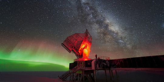
Best place on Earth to see stars is in Antarctica Stars viewed from a place called Dome A in Antarctica can finally be seen without their twinkle – which means in much greater detail. Have you ever wondered why stars twinkle? It’s because turbulence in the Earth’s atmosphere makes light emitted from the star wobble as it completes its lightyears-long journey to the lenses in our eyes and telescopes. But now scientists from international research institutions including UNSW Sydney have found the best place on Earth where – with the help of technology – we can view distant stars as they really appear, without the distorting twinkle. And it happens to be situated due south of Australia’s Davis Station in Antarctica, on a plateau 4000 metres above sea-level called Dome A. In research published today in the journal Nature, scientists showed that the conditions at the plateau lend themselves perfectly to viewing stars from Earth with greatly reduced interference from atmospheric turbulence. According to UNSW Science’s Professor Michael Ashley, who was part of the research team of scientists that designed, built and set up a small telescope system at Dome A, the findings represent a fantastic opportunity to obtain better observations of the universe from ground-based telescopes. “After a decade of indirect evidence and theoretical reasoning, we finally have direct observational proof of the extraordinarily good conditions at Dome A,” says Prof Ashley, an astronomer with UNSW’s School of Physics. “Dome A is the highest point in the central plateau region of Antarctica, and the atmosphere is extremely stable here, much more so than anywhere else on Earth. The result is that the twinkling of the stars is greatly reduced, and the star images are much sharper and brighter.” The telescope that was installed at Dome A – the KunLun Differential Image Motion Monitor – was 25cm in aperture and placed on an eight metre platform. The height of the platform was crucial because it raised the telescope above the steep temperature gradients near the ice. As Prof Ashley explains, turbulent eddies build up when wind moves across a changing topography such as mountains, hills and valleys. “This causes the atmospheric turbulence which bends the starlight around so by the time it hits the ground, it's all over the place and you get these blurry images.” Boundary layers But, he says, Dome A in Antarctica is a plateau that is almost dead flat for many hundreds of kilometres in every direction, making its atmosphere very stable. It's also at an altitude of more than 4000 meters – much higher than Mount Kosciuszko. “There is this very slow wind that blows across the plateau which is so smooth that it doesn't generate much turbulence,” Prof Ashley says. “What little turbulence there is we see restricted to a very low ‘boundary layer’ – the area between the ice and the rest of the atmosphere. “We measured the boundary layer thickness at Dome A using a radar technique about a decade ago and it's about 14 meters, on average, but it fluctuates – it goes down to almost nothing, and it goes up to maybe 30 metres.” The team found that by setting up their telescope on an 8-metre platform, it protruded past the boundary layer about a third of the time. Last year between April 11 and August 4 the telescope took photos every minute, and obtained 45,930 images taken when the boundary layer was lower than the 8-metre platform, it reported in Nature. Prof Ashley says it was very challenging to finally obtain the readings and images that confirmed Dome A to be the premier location on earth to see into the depths of the cosmos. “It was very difficult because the observations have to be made in mid-winter with no humans present. UNSW played a crucial role in designing and building the infrastructure that was used – the power supply system, computers, satellite communications – which was managed by remote control.” Ground vs satellite telescopes But if the atmosphere plays such havoc with our instruments on Earth, wouldn’t a satellite – such as the Hubble Telescope, launched back in 1990 – be ideal for such a job? Prof Ashley says there are a couple of good reasons why a ground telescope set up at Dome A would be the better option. Beyond the obvious savings in dollars, there are also savings in time. “Satellites are a lot more expensive,” Prof Ashley says, “we’re talking maybe factors of 10 to 100 times the cost. But another advantage of making Earth-based observations is you can always add the latest technology to your telescope on the ground. Whereas in space, everything is delayed. And you can't easily use a lot of modern integrated circuits because they're not radiation hardened. So you end up with space lagging the technology on the ground by 10 years or more.” Another advantage of using a telescope at Dome A rather than anywhere else on the planet is that smaller and fainter stars are suddenly much more observable thanks to the better resolution. “Basically this means that for a given size telescope, you're going to get a lot better images at Dome A. So rather than build a big telescope on a non-Antarctic site, you could build a smaller one and get the same performance, so it's cheaper.” Polar nights There is also a strategic advantage in the location of Dome A – which is 900km from the South Pole – over other areas on Earth at more hospitable latitudes. Being so far from the equator, polar nights of 24 hours or more of darkness in mid-winter open up a much wider window to view stars. “If you were to observe a star in say, Sydney, from when it rises to when it sets, you can only observe it for maybe eight hours a night,” Prof Ashley says. “Whereas in wintertime at Dome A you can observe a star continuously. And for some projects like searching for planets around other stars, the fact that you can observe them continuously means you can find planets around them much more effectively.” Looking ahead, Prof Ashley says he would like to continue the research with UNSW’s Chinese partners, and notes that China has an impressive and growing record in Antarctic scientific research. But he wonders whether Australia recognises the great potential that Dome A represents in space research. “Dome A is a superb site for astronomical observations, and we should make every effort to participate in an international project to put a large telescope there to take advantage of the conditions. “With Antarctica being so close to Australia, it is a tremendous opportunity,” he says.
3 notes
·
View notes
Photo
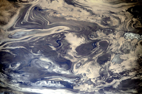
The Dasht-e Kevir
One does not typically think of deserts in aesthetically pleasing notions. Yet this image of the Great Salt Desert in Iran, which was captured by astronauts on the International Space Station, makes a barren wasteland look like an abstract painting, with lines and curves intersecting and bisecting each other in seemingly fractal patterns.
Also known as Dasht-e Kavir (literally translated from Persian as “desert of salt-marsh”), this vast desert stretches across the Iranian Plateau with an area of about 77,600 km2. As hinted by its name, Dasht-e Kavir has a wealth of salt domes, which were formed from evaporation of an ancient ocean that had once covered the landscape. Because salt is relatively less dense than most rocks, its burial by any new rock can be short-lived as the salt can press against the overlying weight, forming domes. Wind, rain, and other physical processes can erode away at the salt domes, cutting away through cross-sections and exposing the complex layering visible in the image.
Of course, like any desert, its climate is one of extremes. The dry heat of Dasht-e Kavir often alternates with severe storms that shape the desert’s salt marshes through intense cycles of evaporation, inundation, and erosion. Much of the landscape is uninhabitable due to the harsh environment, making it a pristine hinterland perfect for desert and salt dome research.
-DC
References and further reading https://earthobservatory.nasa.gov/images/83438/kavir-desert-iran https://www.universetoday.com/110872/believe-it-or-not-this-is-stunning-blue-landscape-is-a-desert-as-seen-from-space/amp/
Photo Credit: NASA Earth Observatory
108 notes
·
View notes
Text
Tennessee Trip 2020
[ MEMO FOR READER: So, I’ve been looking to sell my house and find a place to live that suits me more. It’s beautiful where I live in Florida, but there is so little opportunity. The people are rude. And if I’m being honest, there is a lot...a ton of bad juju here for me. You know the saying “You can’t heal in the same environment that you got sick in?” Well, it’s true. I got “sick" in Florida when I was a little girl and that bled on into my preteen and teenage years. That, however, is a story for another time. The environment here is chaotic, cloudy, dark, and seeping with negativity. Not to mention, I’m 22 years old and I’ve lived here my whole life. It really is time to move on and find something better for me. It’s time to be happy. With that being said, I’ve done plenty of research on other states and chose one that seemed the best fit (jobs, opportunities, nature, events, city life, general contentment of residents) and Tennessee seemed to be the one. The only thing I could not grasp in my “woman by the ocean since birth” mind was the true difference in landscapes/altitudes. “Mountains”, I thought. No big deal. It wasn’t until I was there I really got to understand what mountains were. ]
On Thursday, January 30th, Ian and I packed the car up with our clothes and road snacks and headed for the hills first thing in the morning. We took the scenic route (suggested by his mother). That, later on, we learned was a mistake and I’ll explain why. First entering Alabama, it was what you would expect. Flat, grassy, sunshiny, and pastures along the highways. A time or two I got a god awful whiff of something. That’s when he chuckled and said, “That’s cow manure, baby. Home sweet home!” Yes, Ian is from Alabama originally. I thought it was a monstrosity, but hey, different cultures I suppose. We trekked through Ian’s hometown area near Auburn which was nice for him to see once more. I wasn’t all that into the pasture-like parts of Alabama until we reached further up north. Northern Alabama was beautiful! While you’re still in Alabama, you’re dipping into a different landscape as your approach the Tennessee line. You’re climbing altitude slowly and it becomes more hilly. We were somewhere near Decatur when the hills stretched for miles and I became flabbergasted. “Mountains!” I screeched with a silly grin on my face. Ian had to soothe my pride once more. “Baby, those are hills.” I was a little disappointed that I wasn’t seeing mountains, because they certainly looked mountainous to me; compared to what I’ve seen my whole life. “They look like mountains to me”, I replied. Then he counteracted with the term, “Baby mountains”. I was okay with that. The Alabama foothills is a place I could be. Sure, no ocean like I’m used to, but the hills and creeks were beautiful. A change in atmosphere. The more we traveled through Alabama, the higher up we got. I was doing just fine until next thing I knew, we were going uphill on a mountain. It was a dwindling, curvy, narrow road with no railing or guards whatsoever. The speed limit was 55. Ian was driving and I was in the passenger seat. I looked down, suddenly, and there was an (estimated) 400 foot drop next to me. I started screaming, totally freaking out, hyperventilating. Naturally, Ian (bless his heart) was laughing. It didn’t bother him one bit. He tried his best to calm me, but nothing could chill me at that point. I laughed with him, only maniacally on my end, because I thought I would die. I wondered how people could drive on these slopes with no protection whatsoever and be fine with it. And at 55 MPH at that! What happens if you lose traction? What happens if someone hits you or you lose steering control? Well, you fall some 400 feet and get crushed in an aluminum can. That’s it. So, at the top of the mountain, there was a gas station. We stopped, I got out, and immediately started losing my balance. The uneven ground and altitude was already messing with my equilibrium. The floors inside of the gas station were cracking, which let me know it’s probably not the best idea to build a foundation on any type of mountainous platform. We gassed up and kept driving a bit; still in Bama. I misread the GPS further down the way that we were passing onto the Tennessee line when we were actually just turning onto another Highway. “We made it!” I yelled in victory, “Sweet Tennessee! Look how beautiful it is! I could cry!” Ian went along with it, but he didn’t realize that we weren’t there yet, either. Heck, it was so mountainous that neither of us could tell a difference at the time. Then I realized, and felt dumb. We pulled over at the next station, “Pak N Sak” in Anniston, Alabama where we both had to pee, but there were no public restrooms. They were kind enough to let us use them, anyway. The stretch after that would lead us up further north, nearing the Tennessee line.
I’d guess it was around 6 or 7 pm when we crossed the Tennessee state line, because the sun had set and it was beginning to get dark. We had been travelling much longer than what we’d accounted for, but we couldn’t stop then. We had to get to our destination. Most of Tennessee was totally dark. What I do know is, the “real” mountains were overwhelming to me. Seeing them in the dark, outlining the black sky, being all the way at the bottom and driving through induced a claustrophobia attack as well as altitude sickness. Joy! Taking Highway 59 all the way from the Tennessee state line to our final destination (Crossville, Tennessee) was a bit intimidating. I couldn’t see much of anything at all other than the dark outline of the mountains in the dark sky. I’m telling you, you couldn’t see a thing. Just the cars behind and coming your direction. Where I’m from, there is always some source of light. When the moon is out, the reflection over the Gulf is enough to see where you’re going. And there’s street lights everywhere. You can see flat land for miles. But in Tennessee? All you see is towering mountains and darkness (at night). We took Highway 59 for miles, and miles, and miles. We were on that stretch forever.
After traveling for 10 hours, we made it to our destination. Crossville, Tennessee. I picked Crossville out of my research on the state, and it seemed like the best fit for me. Again, my mind didn’t quite grasp how seriously the altitude change could/would affect me. My grandfather had always gotten sick in the mountains; so much so that he had to come home early every time (like,the two times he tried and never went back). Crossville Tennessee, or Cumberland County, is in a plateau, so I thought that that may make things better for me. Well, I was wrong. I was stumbling, disoriented, and quite honestly felt hungover. We checked into the hotel room that I’d reserved before the trip. For a Super 8, I was thrilled! Yes, a Super 8. The place had wonderful reviews and great prices. (I’ve had horror stories at Super 8′s, but was willing to give this one a shot - and I’m glad I did!) It was very clean, in the perfect location, and comfortable. I was pleased. In the hotel room, I was stumbling and exhausted out of my gourd. Me and Ian were starving from travelling all day (we packed snacks, but never stopped to eat). He offered to go scavenging out for food while I took a shower. We didn’t care what we ate at that time, so he ran to get Sonic. Every time I closed my eyes in the shower, I felt like I’d fall over. Anywho, we ate our dinner together and enjoyed every moment of it. We were out like a light shortly after that.
Day one “officially” in Tennessee (Friday, January 31st). I woke up at 6 AM, sat on the side of the bed with a dizzy spell, leaning forward then back like a drunken sailor. Yeah, couldn’t go back to sleep. I’m not an early bird, but the vertigo apparently was. The original plan was to stay in Tennessee for two days and get a feel for it. See the opportunities. Look out for jobs. Check the areas. Check out houses. Go nature seeking, that kind of thing. Unfortunately, I knew that night and the morning (day one in TN) that it wasn’t for me. I’m an honest gal, and it just wasn’t fittin’. I wanted to take that day to go home. I stood up, pondered life a bit, and texted my grandmother. She was very understanding and supportive, reminding me that the mountains was not for my grandpa, either. I laughed silently thinking of him being affected just like me up there; we were so much alike, and I missed him terribly. Finally, Ian woke up around 8 AM and I told him I wanted to go home. We went over our options. “I think you will adjust to it”, he said. Yeah, that’s what he said when we got into the state and I woke up with a dizzy spell. It was so bad, and I was still claustrophobic even in the hotel room thinking about it, so I disagreed. I knew it was something I would not get used to. In the end, I knew I had to make a decision before checkout time. So I told him we could find a few things to do despite my mountain sickness (mostly so I wasn’t entirely ruining the trip, and to be fair, I wanted to give the dang place a shot as much I could). With that being said, we took our time that day and took it easy. Breakfast was delicious at the nearest McDonald’s. Yes, a Florida girl WILL admit that even their food and sweet tea is better. I got my coffee, Ian got his tea, and together we enjoyed breakfast. The mountain sickness was actually going away a bit, so I enjoyed it while it lasted. The people were so friendly and smiley. They were kind and genuine. “They don’t act like they want to kill someone or themselves over here”, Ian pointed out. It was true. We were in a totally different environment. The heaviness, the negativity, the darkness that came from Florida had been released from both of us. It was so clean and peaceful. We loved it. A totally different vibration about Tennessee. So then naturally, I started to feel better. Mountain sickness residing, good breakfast in my belly, I could see daylight around me unlike the night before, and the people were awesome. “Maybe this is something I could get used to”, I thought. Over breakfast, we decided on what to do next. I’d so badly wanted to see their nature side of things; creeks, waterfalls, hiking trails, etc, so I googled the nearest state park. Cumberland Mountain State Park was closest. From my copious amounts of research, I’d placed Fall Creek Falls at the top of my list, but it was further out. Still in Crossville, but further than where we were. So, Cumberland Mountain State Park it was. Only five minutes away. In the five minutes it took to get to the park, my mountain sickness made a glorious return. Thanks, extreme uphill then massive dipping downhill roads, with a hint of sharp long turns that made my head spin!
Cumberland Mountain State Park is a smaller park compared to others, but I figured that was a good thing considering all of the altitude changes and my sickness; I wanted to take things slow. Plus, it was still big for me to go out and see what Tennessee had to show. The lady in the information office was very helpful, marking a map and sharing places to go and things to see. Down the hill from the office, the walking trail began around the emerald lake. It was so beautiful. It was emerald from afar, but once you got closer to it, you could see to the bottom. Seeing the different layers in the earth as we walked was amazing. Back home, there is sand for miles. Barely any rock. If you see rock, it’s by the jetties or piers. This was actual earth I was seeing, and it was amazing. Mountainous all around us through the walking trail, and the beautiful lake in the center. A little further down, we discovered a breathtaking creek. Now, I’m a creek girl. All out. I’ve always loved the sound of trickling water. I love rocks. It’s not something I get to see back home, either. Sure, I get to see the Gulf and I see bays on a regular basis...and swamps. But the trickling nature of rocky creeks will never compare! I stood by on the bridge that went over the creek while Ian hiked up the creek side. I wasn’t quite that ballsy yet. It was new to me for sure. I’m very drawn to creeks for some reason. Out of every naturey thing in the world, give me a creek, and my dreams will come true. Past the outstanding creek that trailed into the lake, we found an upward hill; a hiking trail. I wanted to see just how far back I could go. We took the upward trail (very steep) and within minutes I felt queasy. The air was thinning and I felt clammy, so we came back down. A little disappointed in myself because I so badly wanted to go further and explore. My body said no. After the hill that I failed to hike, we crossed over a neat suspension bridge that stretched out over the lake. We stopped and admired it’s beauty for a moment. They offered paddle boat and canoe rentals which was a nice addition to the park! After the suspension bridge, we walked past the camping grounds and on around to the other end of the lake. At the opposite end, near the beginning of the park, was the Cumberland Mountain Dam. Curving around to the dam, we were met by a flock of geese. They flew in over the water; one using his webbed feet as gliders. I thought that was hilarious! “Looks like a pair of ice skates”, I chuckled to Ian. Yes, again, these are the simple kind of things that I never saw in Florida. I was accustomed to pelicans flying over the water for miles, and then plopping their chubby bodies flat into the water when they were ready to stop. Once of foot, the geese were coming after us. They were hungry! So we picked up the pace, and headed over to the top of the bridge that goes over the dam. Off behind the bridge were steep steps that took you down the side of the dam. From there, you could see the water (very closely) gushing out. Feeling quite unbalanced on my feet, this was a challenge. Ian did just fine! He held my hand and helped me down. Although it took a little longer than most (more than likely) and a little hesitation, I was damn determined to get as close as possible to the falling water. I wanted to see it! One or two times, I did a little scoot on my butt just because that made more sense than walking on my own two feet! The water as it fell from the highest point of the damn on into the lower creek was stunning. The sound was truly mesmerizing. I loved watching the water gush forcefully through the damn, fall slickly down the mountain, and crush on into the lower creek. It was the perfect meditation spot. After a while of admiration, I got vertigo again. Sitting halfway off the high cliff and watching the water fall down messed with my sense of balance. So after while, we had to move on. And yes, I scored a baby pine cone (don’t have those in Florida) and a rock from the park.
FUN FACT: Everywhere I travel to, I collect a rock and write (in sharpie) where it came from, what the trip was for, names, and dates.
I’d been house hunting in Tennessee before I was aware of the mountain sickness that I’d experience, and there was one in particular that I promised myself I would check out whether I liked the mountains or not. A beautiful log cabin home off of Lake Tansi in Crossville. Although I was certain the mountains would not be home to me, I wanted to go see the home just to say I did. That was our next destination after the park. I called the realtor I’d been talking to about the home, “Hey, uh. I’ve gotten some bad mountain sickness, but I still want to come look at the house. Are there like...towering mountains where it’s at?” He sounded puzzled on the other end (yeah, not like I was in a mountain state or anything, huh?) and thought about his answer before telling me that they weren’t going to be bad considering Cumerland County is in a plateau of Tennessee. I somehow took his word, even though he didn’t quite understand where I was coming from, I later understood. Yeah, the mountains were still pretty high. They were a bit further away compared to driving on Highway 59, but still intimidating. And the altitude was still an issue nevertheless. The house itself was beautiful. I am glad I checked it out for my own sake, because the top floor was not structurally sound. Most of the house was put together by cutting corners and using cheaper materials. Even if I would’ve loved Tennessee, that wouldn’t have been “the one”. The location was gorgeous, though! Right off of the lake. I’m very glad to say that I got to see it and experience it in person. For anyone looking to live in Tennessee, check out Lake Tansi. It’s a very quiet, peaceful neighborhood in the plateau. It’s beautiful. It’s safe. Just minutes from downtown Crossville. You stop what you’re doing and just listen - You’ll hear the birds chirping, bees buzzing, and the breeze slowly moving through the open space. If you’re good with the mountains, I do believe you’d find your piece of Heaven there.
Last stop in Tennessee: Meet my good online friend, Barbara. Barb lives in Whitwell, Tennessee. Thankfully, that was one of the towns we were to pass through on the way back home. Barb and I have been online friends for quite some time. We have many mutual friends (all of which I’ve yet to meet in person, but some day I will!) One of my goals in life, paired with traveling, is to meet my best friends who are long distance to me. While they’re long distance, they’re very special people in my life. We all talk as though we are family; always keeping in touch, can call at any time no matter what, always there for you. Miles apart, but very close in heart. Barb is an incredibly sweet woman who I’d met through my other online friends. Because of her health problems, she couldn’t always be around to chat like myself and the rest. Whenever she was available, though, she was/is the life of the party. After leaving Lake Tansi, Barb called me and we decided to meet up. I was about an hour out from Whitwell. We met at a gas station in Whitwell. When I pulled into the parking lot, her face lit up like a light, and I’m sure mine did too. I got the best hug in the world! We were both able to be proud in the fact that after knowing each other for so long on the internet, we were finally meeting in person. And honestly - it was an amazing experience! Friends can be miles and miles apart, but the best ones will never leave you behind. The truth is that there is always opportunity to meet the ones that mean the most to you. And on that day, I was able to accomplish just that!
Waving our sweet goodbyes to Tennessee, we crossed the state line and quickly hovered back on over to Alabama. I was already feeling relieved to be on flatter ground. Still hilly, but hills were fine. Not mountains. Ian and I had discussed that Northern Alabama may be better for me in terms of moving, so we agreed that we’d stay overnight in Decatur, Alabama and get a feel for it there. Of course, there’s plenty of places to choose from in Northern Alabama, but he felt as though I’d enjoy Decatur. And he was right (from the one night we stayed there). It was late by the time we made it there and checked into a hotel room, and oh my word, it was freezing! We were both starving by the time we checked in and unloaded, so we agreed on dinner at Olive Garden. We were slam in the city limits of Decatur; right off the highway, so there were options galore. Right up the road from the hotel, Olive Garden was packed. Like, really packed. We were both so tired and hungry by then that we said “Screw it” and chose the quickest option - pizza. I throw Pizza Hut on the GPS, and it takes us up the highway to a shopping plaza where Pizza Hut doesn’t exist! So we’re circling around the plaza for ten minutes trying to find the place. Nothing. Finally we say goodbye to the GPS and discover a nearby Pizza Hut EXPRESS. How convenient. It was even closer to the hotel room than the Pizza Hut that the GPS was trying to send to us! All we could do was laugh our hideous, miserably exhausted laughs and hug each other. We ordered and waited, then took the pizza back to the hotel room to devour.
The next morning (Saturday, February 1st), I took my precious time waking up. No dizzy spells YAY! I was thrilled that I got a full night’s rest and no more bad vertigo. We were still at higher altitude being in the northern parts of Bama, but nothing like in Tennessee. I felt much better and I was on a roll. The funniest part about my morning was doing my business in the bathroom and hearing every word from the room over through the vent above the toilet. “Benadryll then?” “What the hell is your problem?” “I don’t know which one is better!” “Stop raising your voice!” “Grrraaahhhh!” Checkout time was at 12 PM (yes, this hotel gives you an hour extra, how nice!) but we were packed and out by 11 PM. Stopped for breakfast at McDonald’s again (most importantly my coffee) and hit the road towards home. I knew we wouldn’t have time to check out much of Northern Alabama, because it was important we got home. Ian started a new job on Monday, and he needed Sunday to rest, get his sleeping schedule right, and wake up at 4am the next day. From the brief time we were there, I did like Decatur. Exiting Decatur, we crossed the Tennessee River all the way on through to the other side of town. It was magnificent! Not to mention, there was so much life around. People walking and jogging all along the river. People smiling. Just like Tennessee, there was a lot more going on and happier people than back home in Florida. The Tennessee River was calm and slick; beauty for miles. I didn’t want to leave.
I didn’t want to waste ALL opportunity for cool things on the way back home, so we made a pit stop in Antique City, Alabama. Also known as Brundidge, Alabama. It was advertised on a billboard along the highway, and I love antiques, so it was a must! Brundidge was right off of the highway; a very small community. We quickly understood why it was called Antique City! All of the buildings were preserved from the early 1900s. Antique shops on every corner. I’d gone with the GPS’s suggestion of an antique store (yes, I gave the GPS another chance) and went with the one that had been visited the most according to Google. The precious gem was tucked behind a corner wall of a building, almost missed it. From the parking lot were two very old cabins from what had to have been the late 1800s. These are my estimates of age, but they can’t be too far off! I opened the front door to the main cabin with great care. “I just open it up?” I asked Ian, because no one seemed to be around, and the building seemed fragile. Inside, we discovered a plethora of true antique goodies. Vintage signs covered the walls, calendars, advertisements, cardboard cutouts, and more. In the back corner of this open concept cabin was an aged, very squared mattress with a quilted blanket on a cast iron frame from the 20s or 30s. I grazed my hand over the quilts to take in all of the age that lived in every fiber; imagining what it must have been like to knit your own bedding back in those days. My eye immediately caught a calendar on the wall behind the bed. It was a cardboard piece that read in bold letters at the top, Today is your LUCKY day! The calendar (original paper) was below the header, pinned in through the cardboard. The year reads 1954. The first page on the calendar in black letters reads Saturday, December 18th split with Sunday, December 19th. Underneath the date, in red letters, reads “LUCKIES” make ideal Christmas Gifts. And below the calendar continues the cardboard, LUCKIES TASTE BETTER (Cleaner Fresher Smoother). And a photo of Lucky Strikes cigarettes off to the side of that. And yes, the calendar goes on until Christmas day, December 25. Each day has a different Luckies related advertisement. How neat! Although I’m not a smoker, I’m totally into vintage advertisements; tobacco ranks at the top. I think it’s beyond unique to see firsthand how natural it was to advertise something that we know today is so deadly. In 1954, it was absolutely normal to advertise tobacco products. They made “the best” gifts. Almost everyone smoked. It was normalized. Today, if you even mention cigarettes, you’re likely to be frowned upon. Of course that is totally understandable given what we know about modern day tobacco products! It is so neat to me the way that time changes. While cautiously flipping through the antique, a woman emerges from the back door. “There’s two more out back if y’all wanna look.” Of course I did! Down the steps, the woman had several of her grandchildren raking leaves and having fun enjoying them. There were multiple other cabins just like the one we’d gone through, but only that one and two others were available for customers. They were placed all about like a little wood house community. Almost like the old timey school yards were set up. Wooden building here, wooden building there, another in the back and off to the side. One in the middle and a few up front. Lots of really old, tall signs throughout the grassy spaces of the yard; mostly from petrol stations. Amoco, Pure, Texaco, Allas, Spur, and more. It really added to the “vintage” of it all. The second building was dark with no power, but all of the doors were left open. I have to say, I was very surprised that the floors didn’t creak when we walked through. For something so old, they were all very structurally sound! They were beautiful. They were history. The second cabin held mostly old furniture; vanity dressers, desks, tables, closets, all from the early 1900s as well. To the back of the yard was the last cabin open to us. More old furniture, old tin cans, posters and signs like in the first cabin, plug-in neon signs, and more. I found a solid, legitimate moonshine jug from the olden days and just had to have it. The problem was, Ian wanted it too (haha!). I told him it could be our first “shared property” so yes, we purchased it. Along with several vintage 32oz glass Pepsi Bottles that the woman sold us as $2 a pop. What a steal! Couldn’t miss out. On the way back to the front, I did in fact purchase the Luckies Strikes calendar. It was too unique to leave behind. A unique antique for sure! In the end, we did good. It was loads of fun just seeing Antique City and discovering something new. It was enjoyable walking through the old buildings and getting a glimpse of all the history. We both agreed we would be back sometime soon.
Home sweet home in Florida! It was late when we got back to town and I just wanted to sleep, but we still had our furbabies to pick up from two different locations. My grandmother was kind enough to watch my chihuahua, Tater, and Ian’s mother was kind enough to watch my pug, Judge. We were very thankful for them to watch the babies while we were away. Because of the pickup, we were on the road for an extra hour and a half. We didn’t have time to think of dinner, so we ate at my grandmother’s house. She had a big pot of homemade spaghetti on the stove - yum! It hit the spot after a long day of travelling. Once we finally made it home around 11 PM, it was a matter of getting ready for bed and falling asleep as soon as my head hit the pillow.
In a nutshell, I loved Tennessee. Don’t get me wrong; it was breathtaking. However, the claustrophobia and altitude sickness ruled out all of the positives for me. It simply isn’t meant for me, and that’s okay. Some things just aren’t meant to be. I’m so glad that I got to have the experience, though. Just the travelling and taking the scenic route (although much longer than expected) was a life experience that I’ll always remember. Seeing the mountains and all of the nature. Getting a feel for the environment (I was blown away by the positive difference). Seeing a house that I thought I’d fall in love with, but was actually the opposite, and that’s why it’s important to always look before you buy. Meeting my good friend, Barb. Getting to stop through Northern Tennessee and see the city as well as the beautiful hills. Seeing the Tennessee River. Antique City. These were all amazing experiences that I’ll always carry with me. The entire point of going to Tennessee was to see if it was truly a place I wanted to be in my future. Turns out, it wasn’t. That only means I keep travelling, scoping out, and searching for the perfect place in this world for me! I am keeping Northern Alabama in mind, although after the trip, I’ve come to the conclusion that somewhere more coastal would be better for me in the long run. Living on the ocean my whole life, I’m not sure that it’s something I can so easily part with. Flat lands are home to me. This has been an amazing experience, and I can’t wait to see what I discover next. As for now, I’ve put a hold on selling my house until I can find the “sweet spot”. I’m glad I could share this journey with you guys! Thank you for reading.
#travel#florida#tennessee#alabama#crossville#decatur#guide#story time#blog#blogger#random#journal#journalist#travels#traveller#mountains#altitude#flat lands#vs#differences#pros#cons#culture
2 notes
·
View notes
Text
Moon mission for an Indian probe
ISRO - Indian Space Research Organisation logo.
July 12, 2019
A few days before the 50th anniversary of the arrival of the first men on the Moon, Mumbai will launch a device on the star of the night.
India launches its second lunar mission on Monday with the objective of becoming the fourth nation to set a plane on the moon, a big step for its thrifty but ambitious space program.
A few days before the fiftieth anniversary of the arrival of the first men on the moon, the Indian space agency ISRO plans to launch on Monday July 15 at 02:51 local (23:21 Sunday) its Chandrayaan-2 mission from the firing point of Sriharikota (south-east from India).
New Delhi has spent $ 140 million - much less than other major space agencies for missions like this - on this expedition to land a lander and a mobile robot on September 6 at the south pole of the natural satellite. located some 384,000 kilometers from the Earth.
Chandrayaan-2 ("Lunar Trolley" in Hindi) will consist of an orbiter, an undercarriage and a rover, for a total weight of 3.8 tons. The whole will be propelled into the atmosphere by a rocket GSLV-MkIII, the most powerful Indian launcher, equivalent to a European rocket Ariane 5.
The fifteen minutes of the final descent of the lander Vikram, planned to land on a high plateau between the craters Manzinus C and Simpelius N, "will be the most terrifying moments because we have never undertaken such a complex mission," K. Sivan, the director of ISRO, recently told the press.
If the mission goes according to plan, India would become the fourth country in the world - after the Soviet Union, the United States and China - to successfully pose a device on the moon. An Israeli probe missed its moon landing in April.
A 27-kilogram Indian rover, Pragyan, should then tread the lunar soil in search of traces of water and "fossil signs of the early solar system," according to ISRO.
The vehicle will run on solar energy and should be able to walk on a lunar day, fourteen days on land. It can travel up to 500 meters.
International influence
This Indian mission is part of a renewed international interest for the Moon. The man, who strode for the last time in 1972, is preparing for his return. The US government has asked NASA to return astronauts for 2024.
The return to the Moon is seen as an essential step in the preparation of manned flights to more distant destinations, in the foreground of which the planet Mars.
The Chandrayaan-2 project is the second lunar mission of the South Asian giant, who had placed a probe in orbit around the moon during the Chandrayaan-1 mission eleven years ago.
The Indian space program has been noted in recent years by its combination of ambition and budget sobriety, with operating costs well below those of its counterparts, as well as its progression at no charge.
ISRO is planning to send a crew of three astronauts into space by 2022, which would be his first manned flight. Its scientists are also working on the development of its own space station, expected over the next decade.
The current Indian Prime Minister, the Hindu nationalist Narendra Modi, pays particular attention to the space program. Beyond scientific research, he sees it as a lever of international influence and constitutive of a great national narrative on the rise of his country of 1.3 billion people.
"A spacecraft mission of the complexity of Chandrayaan-2 sends the message that India is capable of accomplishing difficult technological development endeavors," said Amitabha Ghosh, a scientist who collaborated on NASA's Martian missions.
Expert space at the New Delhi Observer Research Foundation, Rajeswari Pillai Rajagopalan believes Chandrayaan-2 will enhance India's prestige "at a time when international space programs, and especially Asian programs, are increasingly competing ".
For more informations about ISRO and Chandrayaan-2 mission, visit:
Indian Space Research Organisation (ISRO): https://www.isro.gov.in/
Chandrayaan-2 mission: https://www.isro.gov.in/chandrayaan2-home-0
Images, Text, Credits: AFP/ISRO/Orbiter.ch Aerospace/Roland Berga.
Best regards, Orbiter.ch
Full article
17 notes
·
View notes
Last Seen Blogs

nxwyoussemx
WARLOCK


cassette--punk
ARE WE NOT MEN? WE ARE DEVO!
dinoburger
"Make me a MONSTER."

buckscountybankruptcylaw-blog
BucksCountyBankruptcy