#GIS Map
Explore tagged Tumblr posts
Visit Tumblr Blog
Explore Tumblr blogs with no restrictions, modern design and the best experience.
Last Seen Tumblr Blogs


Fun Fact
Average visit duration of Tumblr.com is 10 mins and 25 secs.
Text

me: they're a triangle. they constantly loop around each other. triangles represent stability and unity. if you look deeper into ancient traditions it's a symbol of divinity and a heavenly connection. but also triangles are a reminder of where you have been, where you are, and where you are going. it tells us to learn lessons from the past, live in the present, and use wisdom learned from the past and present to define your future. they're a TRIANGLE.
the server waiting for me to pay: ok that's £6
#squid game#inhun#gihun x inho#457#hwang in ho#seong gi hun#i'm charlie day pointing at maps#this is a joke i promise#i'd never do that to a server
79 notes
·
View notes
Text

128 notes
·
View notes
Text

" ZOMBIR FLOWERS " - psd by zzombette
link : ♡ / f2u with credit / self indulgent
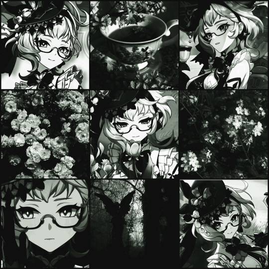
#psd#photopeablr#photopea resources#photopea psd#photopea#psd coloring#green coloring#gradient map#♡。 my posts#hoyo#hoyoverse#emilie gi#emilie genshin#genshin#genshin impact#gi
41 notes
·
View notes
Text

Art class project that I really enjoyed doing, each radial layer from the moon-like figure on the right represents a new type of map.

1st is the moon, which I was originally going to fully fill in, but the shaded face is a very nice look.
2nd is a map showing volcanic hotspots within the ocean along with ocean currents and landmass.
3rd is a map of surface insolation as is important for photosynthetic plants and bacteria.
4th is a map of nuerons meant to indicate complex memory as a mapping strategy as in herds and migrations.
5th is a map of magnetic declination, with a break between north and south facing magnetism near the bottom.
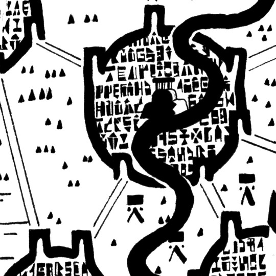
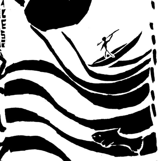
6th and on the right is meant to be a cave painting, with hand-prints and animal figures. The eyes on the top and bottom of the
7th and on the left is stylistically based on maps recovered in ancient times, with an emphasis on features and blocky texturing. The text within the boundaries of the city is a font I'm planning on using in a Monster Hunter project, and is technically in English. (King and Temple are legible in the first couple of lines)
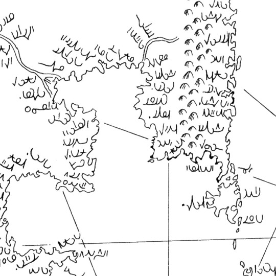
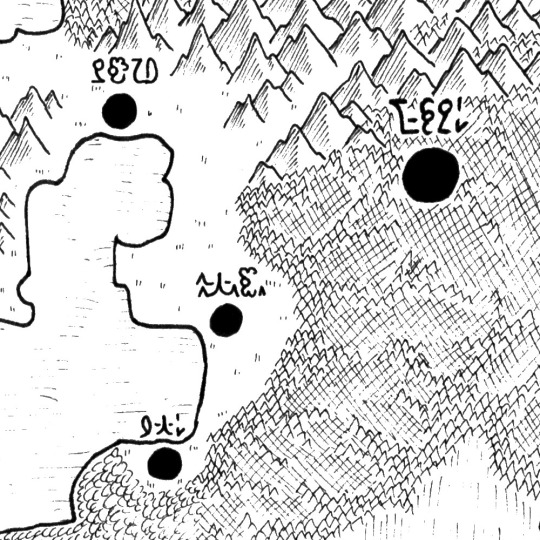
8th and on the right is the standard texturing I used on my PMD maps and features a script based off of my earliest conlang, but is using basically random glyphs. it is meant to be Medieval, and has coastlines which emphasis simple lines and curves.
9th and on the left is a naval map featuring many coastal cities, with their labels written in my main conlang script MAEPS. The coastlines emphasize bays to a major extent, with similarly blocky landmasses as the Medieval map.
10th and on the right is a topographic map with naturalistic coastlines, which sadly was drawn at the wrong scale for it to look good 😔
11th and on the left is a map drawn to emulate the aesthetics of GIS formatting, in particular the mountain and forest texturing which is cropped by the extent of their polygons. The coastlines continue to be naturalistic. The text is a font I'm planning on using in future pokemon projects and is based off of the font used in the gen 8/9 games. (the larger city in the bottom left corner reads Azumarill since I couldn't think of anything else to use)
47 notes
·
View notes
Text


FURINA DE FONTAINE !
like / rb & credit if using
#wanted to play around with gradient mapping with this one#furina#furina layouts#genshin impact#gi#genshin layouts#genshin icons#pink#purple#furina de fontaine
189 notes
·
View notes
Text
Got someone coming to value the house tomorrow but this is my room


Every inch of my room is covered in my interests
#space#london#London Underground#map#Shrek#pride#lgbt#good omens#squid game#seong gi hun#asexual#james marriott#eugene choi#mr sunshine#Paddington#president loki#plants#house
15 notes
·
View notes
Text
maybe it's just bias speaking but i don't get why squid game is in call of duty of all things when i think it would fit dbd (squid game is horror argue with the wall). i know netflix and dbd broke up and only partnered again to bring back stranger things but come onnnn it's free money
16 notes
·
View notes
Text
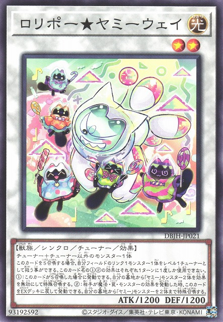
Lollipo★Yummy Way
Looking at this card for a very long time made me realize something: all of the depictions of Snatchy on the Yummy synchro monsters have the light-up/non-white parts of their suit match the specific Yummy type in the card. As in: I noticed that the left arm of Snatchy's suit here matches the pink and green striped raincoat of the Lollipo on the right. Very cute little detail. What’s even cuter, however, is the Yummy looking like a little baby in Snatchy’s arms once again. Just the fact that it’s smaller than the other Lollipos right next to it has convinced me that this one is, in fact, a baby Yummy. Completely baffled by the pure joy being expressed by every Lollipo here. The Cupsies look like they're fleeing in the foreground on their card, and a little sneak peak at the Cooky card shows that they continue to experience the horrors from Snatchy's presence, but the Lollipos???? They're just here to have fun I guess LOL. What's great is that Snatchy seems to be enjoying themselves too! Love that adorable smiling, winking face.
Rating: 10/10, Lollipos have not a care in the world
#Lollipo★Yummy Way#yugioh#yu-gi-oh#ygo#Synchro Monster#Effect Monster#Tuner Monster#Light#Beast#Fell off the map for a little bit there OOPs......#I have returned with renewed conviction to be consistent about posting#I was DEFINITELY better about posting reviews last month than the rest of the year so far so I'm getting there lol
9 notes
·
View notes
Text
69 notes
·
View notes
Text
man I love maps I love geography even spatial analysis and shit I think it's neat and can be valuable but sometimes I have sort of a master's tools crisis about it bc like. I'm in this GIS program and oh turns out that classmate's a cop. that other classmate works in national security. that classmate works for the air force. I look for GIS jobs and it's like "would you like to work for the CIA? would you like to work for Homeland Security? how about Consulting Companies A-Z who are also, incidentally, CIA or DHS contractors??" and no, I really would not like that. that's the last thing I would like. is there anyone out there who would pay me to use these skills to not be evil
#gis/gps/all of that came out of the military and yea you can kind of tell#bro i just want to make maps! or even analyze data i guess! but not in order to help the fucking govt kill or police or surveil people#geography things#skravler
63 notes
·
View notes
Text


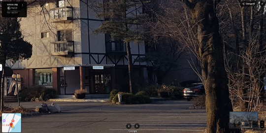
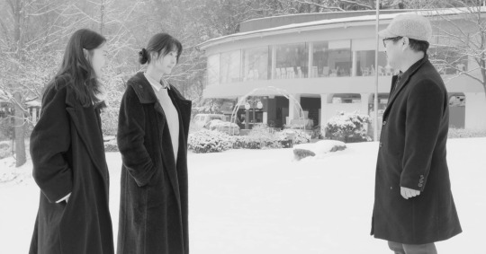
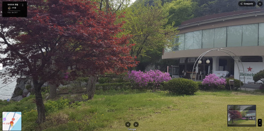
강변 호텔 / Hotel by the River Hong Sang-soo. 2018
Hotel 1312 Bukhangang-ro, Hwado-eup, Namyangju-si, Gyeonggi-do, South Korea See in map
See in imdb
#hong sang soo#hotel by the river#kim min hee#강변 호텔#kwon hae-hyo#yoo joon-sang#gi ju-bong#song seon-mi#hotel#snow#south korea#gyeonggi#namyangju#movie#cinema#film#location#google maps#street view#2018
10 notes
·
View notes
Note
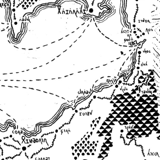
I'm fascinated by the various distanced you have provided us. I'm curious why you chose the road through Ard-galen for the Barad Eithel-Himring route? At least during the Long Peace, wouldn't it be also possible to ride through Ladros and Dorthonion and then head north towards Barad Eithel through the Fen or Serech (and the other way around)? Would that be a shorter route? Or am I being naive and that route would be too mountainous/forest-y/march-y to reasonably ride?
I did consider that! or at least I considered a route through Dorthonion. Let's take a look at the map:
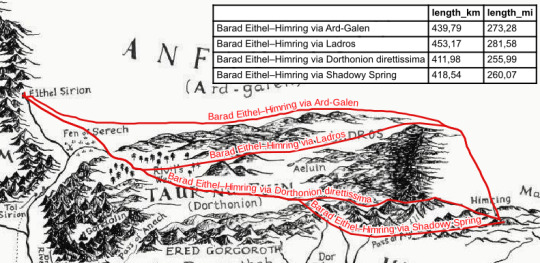
As you can see, the route via Ladros is the longest, because you'd have to go north from Himring, south through the highlands and north again along Rivil. I don't think the Fen itself is viable in the etymological sense :D
The shortest way would be to cross the mountains south of Ladros and that looks like an absolute nightmare! Don't do that!
It may just be possible to cross the mountains east of Ered Gorgoroth? I don't know if this would be faster since there is no pass on the map there. At school I learned a rule of thumb that while usually walking speed is 10–15min per 1km, walking uphill you calculate 10min per 100m of altitude. 6km distance can mean >2h of walking if the terrain is bad! and horses won't help.
Overall, I think that especially during the Siege it would be fastest to go along the northern slopes of Dorthonion where there would be well-maintained roads and way stations for military reasons.
18 notes
·
View notes
Text
forcing myself to take two whole days off from uni before i literally black out and i want to do something fun and gentle and enjoyable so send me a number from 1-30 and one of the following ships for a short lil fic/drabble:
theo x liam
tracy x hayden
kira x malia
alec x nolan
derek x stiles
prompts taken from this list xo
#im so tired of looking at gis i want to create something nice instead#ive spent the last week looking at maps of sewage contamination ENOUGH#thiam#trayden#malira#nalec#sterek#if i hide sterek at the end do you think jack wont cyberbully me about it? seems unlikely tbh#teen wolf fanfiction
7 notes
·
View notes
Text

This is WAY different from my usual art, but I'm posting it anyway! I start GIS masters soon and before then I'm practicing making maps in Esri tutorial projects. I'm trying to do one a day, or at least like every other day. This Arctic Sea Ice Decline map took me around 4-5 hours to make, and I changed it from the instructions because I wanted clearly defined decade chunks rather than a gradient map of ice presence over time lol (also just wanted to see if I remembered how to do it). The tutorial provides data sets to use and it's my job to assemble and analyze the raw data and visualize it using ArcPro into something recognizable.
but yea expect to see more little maps n such I suppose
#art#is this art? Im saying it is#arcgispro#arcpro#map#mapping#maps#arctic#arctic ice#ice#environment#environmental science#aesthetic#wyyrmwood#gis#gismapping#digital#ice cover#data#datascience#data analytics#computer science
6 notes
·
View notes
Text
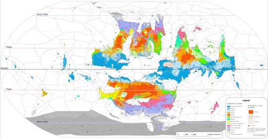
Climatic Map of the 4th World (zooming in is preferable, both to read the key and the names of cities)
10 notes
·
View notes
Text


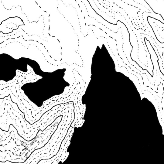
Shaded relief of the Europe. This one will be changed soon with a shaped version where borders will be shown.
If you like our work, want to see our daily updates (or want to say hello to our studio), consider to follow our Instagram or Twitter account. Otherwise if are interested in our prints or have a custom request check our shop.
5 notes
·
View notes