#spatialdata
Explore tagged Tumblr posts
Text
The Ultimate ArcGIS Pro Course – Learn GIS the Right Way with Udemy!
Are you struggling with ArcGIS Pro? Don't worry! This step-by-step Udemy course covers all essential GIS concepts, from basic mapping to advanced spatial analysis. 📊
🔥 GET DISCOUNT 48% OFF (ONLY $12.99 FROM $19.99) – LIMITED TIME, ENROLL NOW !
✨ Start learning today and transform your GIS skills like a pro!
#GIScourse#ArcGISPro#LearnGIS#MappingSoftware#SpatialData#Geography#GISskills#ArcGISProTips#OnlineCourses#UdemyCourse
0 notes
Text
This in-depth exploration of Geographic Information Systems with Artificial Intelligence (GeoAI) shows how this revolutionary technology is transforming spatial analysis across industries. From urban planning and disaster management to precision agriculture and retail intelligence, GeoAI combines machine learning, deep learning, computer vision, and spatial data to solve complex geographic problems with unprecedented accuracy and efficiency. This post covers the three core pillars of GeoAI: spatial data infrastructure, AI algorithms, and computational resources, while tracing its evolution from manual mapping to today's autonomous systems. Readers will discover key technologies driving innovation, including computer vision for earth observation, NLP for geographic information retrieval, and reinforcement learning for routing optimization. I request you to have a read and engage with the post, mentioning what do you think where will the Geospatial Industry be in the upcoming years until 2030. Do share it within your professional networks and spread the word of GeoAI and how it is transforming the Geospatial industry.
#ai#ArtificialIntelligence#DeepLearning#DigitalTransformation#FutureofTechnology#GeoAI#geographicinformationsystems#Geospatial#gis#Innovation#locationintelligence#MachineLearning#RemoteSensing#SpatialData#technology
0 notes
Text
Mastering QGIS & ArcGIS Desktop 10.8: From Beginner to Pro. English Video tutorial, just for $9.99 (NORMAL price $19.9) till 25/02/2025. Get it once and you will get endless access right
Unlock the full potential of QGIS and ArcGIS Desktop 10.8 with this comprehensive guide. Learn essential GIS skills, spatial analysis, and cartography techniques from scratch to expert level. Perfect for students, professionals, and GIS enthusiasts. Tags: #QGIS #ArcGIS #GISMapping #GeospatialAnalysis #GISSoftware #SpatialData #Cartography #Mapping #RemoteSensing
#QGIS#ArcGIS#GISMapping#GeospatialAnalysis#GISSoftware#SpatialData#Cartography#Mapping#RemoteSensing
0 notes
Text

#LiDAR#AutonomousVehicles#3DMapping#SmartCities#SensorTechnology#Innovation#Geospatial#DroneTechnology#AutonomousDriving#SpatialData#automation#industrialautomation
0 notes
Text
3D Reconstruction: Capturing the World in Three Dimensions

3D reconstruction refers to the process of capturing the shape and appearance of real objects using specialized scanners and software and converting those scans into digital 3D models. These 3D models allow us to represent real-world objects in virtual 3D space on computers very accurately. The technology behind 3D reconstruction utilizes a variety of different scanning techniques, from laser scanning to photometric stereo, in order to digitally preserve real objects and environments.
History and Early Developments
One of the earliest forms of 3D scanning and reconstruction dates back to the 1960s, when laser range scanning first emerged as a method. Early laser scanners were slow and bulky, but provided a way to accurately capture 3D coordinates from surfaces. In the 1970s and 80s, raster stereo techniques came about, using cameras instead of lasers to capture depth maps of scenes. Over time, scanners got faster, accuracy improved, and multiple scanning technologies started to converge into unified 3D modeling pipelines. By the 1990s, digitizing entire buildings or archeological sites became possible thanks to the increased capabilities of 3D reconstruction tools and hardware.
Photogrammetry and Structure from Motion
One major development that helped accelerate 3D Reconstruction was the emergence of photogrammetry techniques. Photogrammetry uses 2D imagery, often from consumer cameras, to extract 3D geometric data. Structure from motion algorithms allow one to take unordered image collections, determine overlapping features across images, and reconstruct the camera positions and a sparse 3D point cloud. These image-based methods paved the way for reconstructing larger exterior environments accurately and cheaply compared to laser scanners alone. Photogrammetry is now a widely used technique for cultural heritage documentation, architecture projects, and even film/game production.
Integral 3D Scanning Technologies
Today there are many 3D scanning technologies in use for different types of objects and environments. Structured light scanning projects patterns of lines or dots onto surfaces and reads distortions from a camera to calculate depth. It works well for industrial inspection, small objects and scanning interiors with controlled lighting. Laser scanning uses time-of-flight or phase-shift measurements to rapidly capture millions of precise 3D data points. Laser scanners excel at large outdoor environments like cultural heritage sites, construction projects and full building documentation. Multi-view stereo and photometric stereo algorithms fuse together image collections into full and detailed 3D reconstructions even with untextured surfaces.
Applications in Mapping and Modeling
3D reconstruction mapping applications are widespread. Cultural heritage sites are extensively documented with 3D models to make high resolution digital archives and share artifacts globally online. Forensic reconstruction of accident or crime scenes relies on 3D modeling to understand what happened. Engineering companies use 3D scans to digitally inspect parts for quality control. Manufacturers design products in CAD but validate and improve designs with physical prototypes that are 3D scanned. Cities are mapped in 3D with aerial and mobile scanning to plan infrastructure projects or monitor urban development over time. The gaming and animation industries also reconstruct detailed digital environments, objects and characters for immersive 3D experiences. Advancing computing power allows more complex reconstructions than ever before across many industries.
Ongoing Developments and the Future of 3D
There is continued work to improve the speed, resolution, automation and scaling of 3D acquisition techniques. Multi-sensor fusion and simultaneous localization and mapping (SLAM) is leading to capabilities like interior mapping with handheld scanners. Artificial intelligence and deep learning are also entering the field with applications like automatically registering separate scans or recognizing objects in 3D data. On the modeling side, semantics and building information models (BIM) are merging geometric shapes with metadata, properties and relationships. Advances will open the door to dynamic 3D representations that change over time, interaction with virtual objects through augmented reality and further immersive experiences in artificial worlds reconstructed from real environments. The future vision is seamlessly integrating virtual 3D spaces with our daily physical world.
Get more insights on 3D Reconstruction
About Author:
Money Singh is a seasoned content writer with over four years of experience in the market research sector. Her expertise spans various industries, including food and beverages, biotechnology, chemical and materials, defense and aerospace, consumer goods, etc. (https://www.linkedin.com/in/money-singh-590844163)
#3DReconstruction#ComputerVision#ImagingTechnology#SpatialData#DigitalModeling#Photogrammetry#PointClouds#3DScanning
0 notes
Text
The surveying and mapping market plays a pivotal role in capturing, analyzing, and visualizing geospatial data. It encompasses technologies like GPS, LiDAR, and GIS, driving applications in urban planning, construction, agriculture, and disaster management. With a growing demand for accurate spatial information, the market is evolving rapidly, offering diverse solutions and services to meet the needs of industries worldwide.
0 notes
Photo

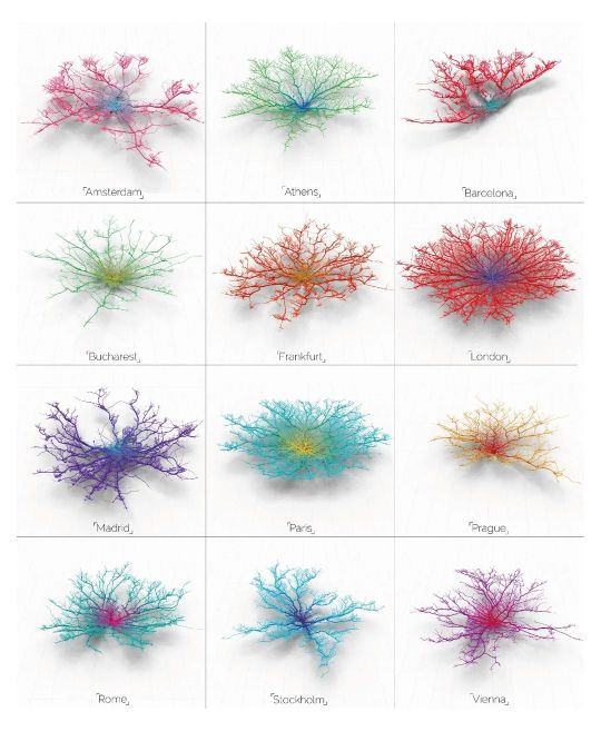
Follow @urbandesign.lab Coral Cities | An Ito Design Lab Concept "For the past six months I have been fascinated by the concept of making city networks look like living corals. The varying patterns of urban forms are inherently dictated by their road network; a complex, seemingly organic connection of links moving people across their city. Like branches of coral they have a pattern and a function, I chose to expose this pattern and manipulate it to become something far more conceptual. Read Less." Project by: @mapzilla_art (Craig Taylor) DM for credits/Removal. . . . . Photoshop Masterclass (2 Days Integrated Workshop) Session Details: • Day 1: 18th of February, 2023 | Urban Mapping • Day 2: 19th of February, 2023 | 3D Urban Visualization 🔗Registration link in the bio Limited Seats available! Early Bird registration ends on 12th February, 2023 . . . . #mapping #urbanplanning #GISmapping #urbandesign #nollimaps #citymapping #geospatial #geography #cartography #spatialdata #cityplanning #dataanalysis #sustainability #landscapearchitecture #smartcities #placemaking #geodata #opendata #mapmaking #urbanism #geospatialanalysis #urbanrenewal #3Dmapping #wayfinding #environmentaldesign #mobility #transportationplanning #urbanregeneration #publicspace #urbandesignlab (at United States) https://www.instagram.com/p/CorxtBRvDuB/?igshid=NGJjMDIxMWI=
#mapping#urbanplanning#gismapping#urbandesign#nollimaps#citymapping#geospatial#geography#cartography#spatialdata#cityplanning#dataanalysis#sustainability#landscapearchitecture#smartcities#placemaking#geodata#opendata#mapmaking#urbanism#geospatialanalysis#urbanrenewal#3dmapping#wayfinding#environmentaldesign#mobility#transportationplanning#urbanregeneration#publicspace#urbandesignlab
0 notes
Photo

Maps data collection & ownership. @Communitech #datahub #DataHubSessions #datascience #spatialdata #visualization #gis #maps #digitaltransformation @CityWaterloo #kwawesome #wrawesome (at Communitech Data Hub) https://www.instagram.com/p/B40IAVvgTM5/?igshid=1llyvfvddalz9
#datahub#datahubsessions#datascience#spatialdata#visualization#gis#maps#digitaltransformation#kwawesome#wrawesome
0 notes
Text
The Ultimate ArcGIS Pro Course – Learn GIS the Right Way with Udemy!
Are you struggling with ArcGIS Pro? Don't worry! This step-by-step Udemy course covers all essential GIS concepts, from basic mapping to advanced spatial analysis. 📊
🔥 GET DISCOUNT 48% OFF (ONLY $12.99 FROM $19.99) – LIMITED TIME, ENROLL NOW !
✨ Start learning today and transform your GIS skills like a pro!
#GIScourse#ArcGISPro#LearnGIS#MappingSoftware#SpatialData#Geography#GISskills#ArcGISProTips#OnlineCourses#UdemyCourse
0 notes
Text
Choosing the right GIS software in 2025: ArcGIS Pro vs QGIS 3 Analyzed I have just published a comprehensive comparison of the two leading GIS platforms as they stand in 2025. The age-old battle between proprietary and open-source solutions continues, but with fascinating new developments! Both platforms have evolved dramatically since 2020, with QGIS closing many historical capability gaps while ArcGIS Pro has leaned into enterprise integration and AI. Is your organization making the right choice? Well, the answer depends on your specific needs, budget constraints, and strategic priorities. Check out my full analysis to help navigate this critical decision for your mapping needs! Please do have a look at the post, leave a like and comment your thoughts and your experiences working with these softwares. Also do let me know which software do you think is worth investing for? Since it is the AI revolution, which software can perform tasks with utmost simplicity and efficiently, ArcGIS Pro or QGIS 3? Let's get the conversation and engagement going. Do comment, like, share and subscribe to my blog. Your engagement would mean a lot to me. Let's map the world for a sustainable future with Mapping Tomorrow. 🗺️ Subscribe to my blog website: https://mappingtomorrow.wordpress.com and get started with Mapping Tomorrow. Your one step can change your future. SUBSCRIBE NOW and be updated ahead of everyone. #ArcGISPro #QGIS3 #GISSoftware #GISComparison #GeospatialSoftware #GISTechnology #SpatialData #GISMapping #GeographicInformationSystems #OpenSourceGIS #ProprietaryGIS #GISPlatforms #MapChat #GISCommunity #SpatialAnalysis #GIScience #GeoTech #GISProfessional #GISCareer #GISJobs #GISSkills #GISEducation #GISCertification #EsriUser #QGISCommunity #OpenSourceCommunity #EsriUC #FOSS4G #UrbanPlanning #EnvironmentalGIS #BusinessIntelligence #LocationIntelligence #DataVisualization #TechComparison #SoftwareReview #2025Tech #OpenSource #TechDecisions #SoftwareEvaluation #MappingTomorrow #ProfessionalDevelopment #TechTrends #IndustryInsights #GISTwitter #MapTwitter #TechTwitter #GISLife #MappingCommunity #TechTools #GISResources #GeospatialTechnology #MappingTools
#ai#arcgispro#artificial-intelligence#cartography#education#environment#geographicinformationsystems#geospatialinelligence#geospatialtech2030#gis#gisanalysis#gissoftware#mapping#qgis#technology
0 notes
Text

Mastering QGIS & ArcGIS Desktop 10.8: From Beginner to Pro.
English Video tutorial, just for $9.99 (NORMAL price $19.9) till 25/02/2025. Get it once and you will get endless access right. Visit:
Unlock the full potential of QGIS and ArcGIS Desktop 10.8 with this comprehensive guide. Learn essential GIS skills, spatial analysis, and cartography techniques from scratch to expert level. Perfect for students, professionals, and GIS enthusiasts.
#QGIS#ArcGIS#GISMapping#GeospatialAnalysis#GISSoftware#SpatialData#Cartography#Mapping#RemoteSensing
0 notes
Link
via Twitter @nageshpolu
0 notes
Text

The Ultimate ArcGIS/ArcMap Course – Learn GIS the Right Way with Udemy!
Are you struggling with ArcGIS/ArcMap? Don't worry! This step-by-step Udemy course covers all essential GIS concepts, from basic mapping to advanced spatial analysis. 📊
⏳ LIMITED-TIME OFFER: ONLY 7.69 USD from 14.8 USD (48% OFF)!👉 Enroll now!!
✨ Start learning today and transform your GIS skills like a pro!
#GIScourse#ArcGISArcMap#LearnGIS#MappingSoftware#SpatialData#Geography#GISskills#ArcGISArcMapTips#OnlineCourses#UdemyCourse
0 notes
Text
Mastering QGIS & ArcGIS Desktop 10.8: From Beginner to Pro.
English Video tutorial, just for $9.99 (NORMAL price $19.9) till 25/02/2025. Get it once and you will get endless access right.
Unlock the full potential of QGIS and ArcGIS Desktop 10.8 with this comprehensive guide. Learn essential GIS skills, spatial analysis, and cartography techniques from scratch to expert level. Perfect for students, professionals, and GIS enthusiasts.
#QGIS#ArcGIS#GISMapping#GeospatialAnalysis#GISSoftware#SpatialData#Cartography#Mapping#RemoteSensing
0 notes
