#Remote sensing
Explore tagged Tumblr posts
Visit Tumblr Blog
Explore Tumblr blogs with no restrictions, modern design and the best experience.
Last Seen Tumblr Blogs


Fun Fact
Forty percent of Tumblr users are between the ages of 18 to 25.
Text

A quick map I made last year for the Month of Maps to highlight the National Parks of Canada. They make up 3.4% of Canada's area, and range wildly in size from Signal Hill or Phillip's Garden focusing on specific archaeological sites to the parks of Nunavut covering entire landscapes. They are often beautiful and deeply meaningful for either cultural or biological reasons, or even just their outstanding natural beauty.
220 notes
·
View notes
Text


good morning!! I‘m reading reading reading, but I’ve already learned a lot during my first 2 weeks of the internship!
I also started to do some of my commute by car - lessens the time I need to get there by ~50%. :( I feel bad for the environment but also I feel better when I don’t sit in a train for over an hour 💀🤝🏻
#reading#studyblr#remote sensing#geography#blogging#Uni#Earth observation#aesthetic#Morning#morning light#commute
58 notes
·
View notes
Text

And maybe a third for extra clickiness.
#sarcasm#sarcastic#humor#dark humor#memes#funny stuff#haha#lol#funny post#funny memes#wisdom#forgiveness#understanding#mind#strength#authenticity#cars#remote sensing#life tips#meaning of life#life#lifestyle#life quotes#life lessons#gacha life 2#meaning#existence#perception#feelings#emotions
39 notes
·
View notes
Text
youtube
REMOTE SENSING IN THE ARTS
2 notes
·
View notes
Text
Franklin Fire - CA - LA Malibu - 2024


Looking at the FranklinFire in Los Angeles County/Malibu area with GOES and MODIS, and the evac areas posted by the county on a terrain map showing just how rugged and difficult this firefight will be.
3 notes
·
View notes
Link
52 notes
·
View notes
Video
Openings and Conclusions 6 by Russell Moreton Via Flickr: Collage on paper, written fragments and images from Peter Greenaway, Josef Albers and Robin Evans. Photo montage of The Physical Self (Greenaway) and Waverley Abbey UK. Visual research as part of The Waverley Project/Obscura and Reading Room. On the horizon, then, at the furthest edge of the possible, it is a matter of producing the space of the human species-the collective (generic) work of the species-on the model of what used to be called "art" ; indeed, it is still so called, but art no longer has any meaning at the level of an "object" isolated by and for the individual. Henri Lefebvre, Openings and Conclusions. from On Installation and Site Specificity (introduction) Erika Suderburg
#Research Collage#Working Notes#Interior Documents#Visualisations#Architectures#Spaces#Place#Embodiments#Practices#Texts#Material#Mappings#Drawings#Site#Localities#Mark Dion#Peter Greenaway#Herzog and de Meuron#Henri Lefebvre#Robin Evans#Kate Whiteford#Colin Renfrew#Remote Sensing#Archaeology#Rodin#Beuys#The Sensitivities of the Physical Self#Josef Albers#Waverley Abbey#Cistercian Monastery
5 notes
·
View notes
Link
#Anthropogenic activities#Degradation of vegetation cover#Indices of spatial structure#Remote sensing#Burkina Faso
2 notes
·
View notes
Text


Atlas of Human Settlements
Inland Empire, CA, 2023
#satellite#segmentation#remote sensing#builtup#atlasofhumansettlements#georgios ouzounis#deep learning#ai#artificial intelligence
12 notes
·
View notes
Text
My first published paper!
Please check out my first published paper contribution! I was involved with the field work portion of this study as part of my master's degree in geography at the University of Utah. It's always exciting to expand my knowledge of geospatial technologies and evolve in the world of environmental science.
#geography#lidar#pinyon-juniper#big data#mapping#science#biomass#university of utah#remote sensing#ecology#environment#professional
4 notes
·
View notes
Text


Three views of the Richibouti River in New Brunswick. The True Colour image, the Normalised Differential Water Index, and the Normalised Differential Vegetation Index. These each show interesting bits of information about the area, but I just posted them up because I like how they look. Sentinel 2 is an optical satellite which provides colour imagery at 10m for some bands. This makes it really useful, because it has a pretty good resolution. The NDWI is wonderful because it shows areas that are wetter, which means that it highlights specific areas, and I have used it to highlight wet spots and waterbodies. The NDVI can highlight vegetation health, but also areas without vegetation.
9 notes
·
View notes
Text

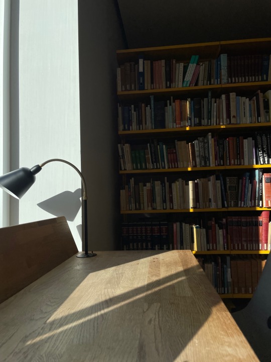
22.09.2023
I realised that I need to brush up my remote sensing knowledge 🫠
#Remote Sensing#studyblr#geography#study#desk#motivation#uni#mine#study setup#studying#study aesthetic#geo#Science#women in stem
163 notes
·
View notes
Text
youtube
A short animation generated from DESIS hyperspectral data (captured from the ISS). Spectral sensitivity increases from the 400-460um (near-UV) range up to 960-1000um (near infrared).
3 notes
·
View notes
Text
LiDAR LiDAR Crocodile
A gator caught hiding beneath the water with the magic of LiDAR. LiDAR (aka Light Detection and Ranging) uses lasers reflected from objects back to the source to reconstruct an environment
Original tweet:
“How cool is LiDAR? Well, it can see gators lurking beneath the surface, so I’d say it’s pretty dang awesome”

6 notes
·
View notes
Text
Post Fire in Los Angeles County

Post fire heat and smoke plume using GOES 18 West Mesocale and Band 7.
3 notes
·
View notes
Text
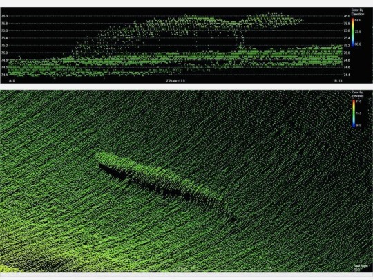
That moment when you know far more about remote sensing than the average populace because of your degree of work. But your not entirely sure if the Victor 6000 sonar has the same regulations or works the same way as the sonar imaging you’ve studied
Because if it does you know why the Atlanta moved away from the direct ship site for a couple of reasons
(Basically in order to scan the area the ship needs to move at the bare basics)
And if it doesn’t you don’t know
2 notes
·
View notes