#equirectangular
Explore tagged Tumblr posts
Visit Tumblr Blog
Explore Tumblr blogs with no restrictions, modern design and the best experience.
Last Seen Tumblr Blogs


Fun Fact
The Tumblr app for Google Glass was released on May 16, 2013.
Text

#360x180#360°#380ita#architecture#beach#building#equirectangular#europa#europe#italia#italien#italy#liguria#ligurien#nature#portofino#ricohthetaz1#sand#tower#vrpanorama#hapephotographix#metropolitanstadtgenua
6 notes
·
View notes
Text
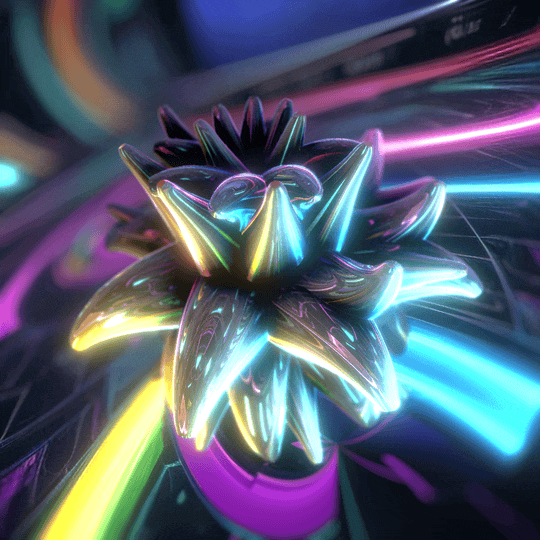
prompted equirectangular environment
#trapcodeTAO#organic#3d#render#loop#visuals#equirectangular#hrdi#environment#after effects#seamless#experiment#creature
20 notes
·
View notes
Text
Embed test. I don’t post often here after the nsfw purge and the photomatt blowup. Find me on fedi.
#animation#blender3d#equirectangular#abstracart#dodecahedron#colorful#blender#abstract animation#perfect loop#seamless loop#loop#seamless#abstract
0 notes
Text
Camera Tweaks (Aryan Raj Adhikari)
The camera projection will be done in a dome for visitors to view and the video will be displayed in a 360 degree format. This is my first time ever working on creation of an immersive 360 image or a video. Thus, before working on the jellyfish, I decided to finalize the camera settings beforehand so that it would not pose problems during the render phase of our animation export.
I researched on few blogs that detail about 360 domes and the principles they employ to project an immersive video. For instance, the camera should and always be a 360 capture and the quality of the render should at minimum be a 4K or an 8K resolution for crisp visual quality.
There are a couple of real life practical examples that demonstrate the visual prowess of a 360 dome projection with the most notable and perhaps the largest inflation dome projection in Miami. It was installed by Broadwell, a global leader in air domes and they hosted over 60,000 guests in a span of 3 days.

Figure 1 (Miami dome projection, (Anon., n.d.))
The fully-immersive video projection set-up was creating with a total of 24 18K Lumen HD Laser projectors from Lumen & Forge and covers an area of 40000 square feet.
Another impressive example of a beautiful projection system can be seen when the Planetarium 1 team opened the world's largest planetarium in 2017 in Western Russia with a dome diameter of 18 metres that utilized Benq LU950 projectors with a brightness of 5000 ANSI lumens. The laser light source of those projectors has an almost eternal source which doesn't require replacement and there is no need to worry about the decay of the image quality over time.
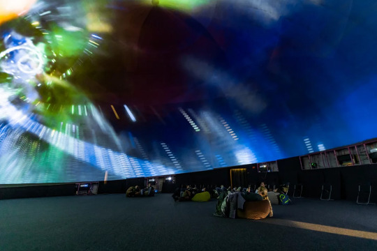
Figure 2 (Planetarium 1 projection, (BenQ, 2022))
Our director, Ian Willcock had iteratively emphasized on the proper export of the render in a 2:1 aspect ratio with either 4K resolution minimum or an 8K resolution if feasible in an equirectangular format. This aligns with one of the principles listed in Lumen & Forge's EVERYTHING YOU NEED TO KNOW ABOUT 360 DOMES; "Advanced software renders the 360 content into ultra high-res equirectangular or cubic projections optimized for dome projection" (Lumen & Forge, 2023). This format can later be changed in Adobe After Effects by applying a VR Converter modifier which changes it into a full dome projection sequence.
Inside Blender, I started tinkering with the camera settings and found out that while panoramic 360 export is not supported in the 'Eevee' render engine, it is however supported in the 'Cycles' render engine. This pretty much dictated that we would be using the 'Cycles' render engine to render out our entire image sequence.
It is imperative to note that you can only render the image sequence in an equirectangular panoramic format if you render using the supported model of the 'Cycles' engine as opposed to its experimental variant.
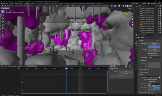
Figure 3 (Camera settings in Blender 1)
While inside the camera settings inside Blender, you can also set the camera type to Panaromic and change the panorama type to Equirectangular format.
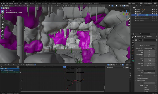
Figure 4 (Camera settings in Blender 2)
REFERENCES
Anon., n.d. Broadwell Air Domes. [Online] Available at: https://broadwellairdomes.com/dome-options/video-projection/#:~:text=In%202019%2C%20Broadwell%20created%20the%20largest%20projection%20dome,three%20days%2C%20the%20dome%20hosted%20over%2060%2C000%20guests. [Accessed 29 January 2025].
BenQ, 2022. BenQ. [Online] Available at: https://www.benq.eu/en-eu/business/resource/case-study/full-dome-projection-system-for-immersive-experience-in-planetarium-1.html [Accessed 29 January 2025].
Lumen & Forge, 2023. Everything You Need to Know About 360 Domes. [Online] Available at: https://lumenandforge.com/everything-you-need-to-know-about-360-domes/ [Accessed 29 January 2025].
0 notes
Text
The 13th edition of the 2024 Richard Murray Newsletter.
The forty-fifth of the Cento series. A cento is a poem made by an author from the lines of another author's work. In the series I place my cento and a link to the other authors poem.
Mandala Sphere- equirectangular image
Dates : Easter fables, astrological dates
IF YOU MADE IT THIS FAR : Questions to writing and things written ; What book do you propose for a questionable literary summary? ; Children of the Quicksands from Efua Traore ; Akira Toriyama Thoughts ; why does Tiktok unite so many legislators , not the people, in the usa? ; Success on Deviantart ; A true story of law enforcement in the usa
URL https://rmnewsletter.over-blog.com/2023/09/03/31/2024-rmnewsletter.html
#rmnewsletter #rmaalbc
#rmaalbc#rmnewsletter#aalbc#cento#poetry#poetryormore#rmtja#shipoffools#deviantart#mandala#sphere#equirectangular#holi#dates#easter#protocol#literary#summary#efua#traore#rayseb#akira#toriyama#dragonballz#tiktok#lawenforcement#usa#black#artist#richard
0 notes
Text

#IFTTT#Flickr#germany#deutschland#sachsenanhalt#saxonyanhalt#magdeburg#stadt#city#place#landschaftspark#elbauenpark#rutschenturm#outdoor#himmel#sky#panoramix#panorama#roundabout#equirectangular#spivpano#360°#stitch#ptgui#circularpatternrectified#fotogruppe#fotogruppemagdeburg#fisheye#canonef15mmf28fisheye#canoneos5dmarkiv
0 notes
Text
Here's what I've been up to lately! Three years after I created the original version, here's a revamp of the first planet I mapped out for @jayrockin's "Runaway to the Stars" project, the homeworld of their Centaur aliens. This post covers Phase One: Geology.


Firstly, the Equirectangular elevation maps with and without the color gradient layer, and tectonic plate map. This color gradient marks sea level, of course, and while there are inland areas that are *also* below that elevation, I have yet to determine which of those basins have lakes and seas therein, and how their shorelines compare; *that* will be seen once I figure out the climate : ) As for the Plate map, most of the smaller, oblong plates without any rift boundaries represent island chains or continent fragments that accreted onto larger landmasses; discretely marking those was helpful for placing and shaping the mountain ranges.


Next, the Poles-Centered Perspective maps, made possible with Photopea's Polar Coordinates tool. The planet's Southern hemisphere, centered on the south pole, is seen at left, and its Northern hemisphere is seen at right. Like the previous set of three, this set includes the color elevation map, greyscale elevation map, and solid color tectonic plates.


Last of all, the basis for the planet's current appearance: it's tectonic history! These gifs, in six frames, cover about 200 million years of continental drift, starting with the breakup of two Supercontinents, and was primarily achieved in Blender. This isn't my first time trying to reconstruct a tectonic history, but it *is* my first time doing so this quickly and efficiently, thanks to the process I developed here using this planet's continents as a test case.
There will be more phases in this project completed and shared in the coming months, thanks for checking out this one! Also, I've already shared these maps on Reddit, where you should be able to see them in even higher resolution. Photopea and Blender, 2025
#mapmaking#imaginary maps#photopea#blender#elevation maps#equirectangular projection#poles-centered perspective#rtts centaurs#fictional planets#runaway to the stars#worldbuilding#world map#imaginary plate tectonics#tectonic history sequence#physical geography#long term project#commissioned mapmaking#Christopher Maida Artwork
624 notes
·
View notes
Photo

Two Rocks Beach at Moonset by lukebusellato
1 note
·
View note
Text
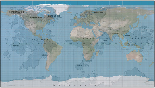
As a part of the research for a fic I wanted to measure some distances across Usea. So I went ahead, found the topographical map, measured some distances using the latitude and longtitude lines on the map and said "wait a second"
There is a grid on this map. It's in mercator projection like hell it is. It's in equirectangular projection. If I find an equirectangular projection map of the Earth I should be able to align these two
So I did exactly that

and that was cool and all but then I thought that the comparison would be even better if I had the whole Strangereal
So I went ahead and grabbed the big map from Acepedia and miraculously it was in the same projection. Actually I was able to align these two because the outline of Usea looked exactly the same, no distortion
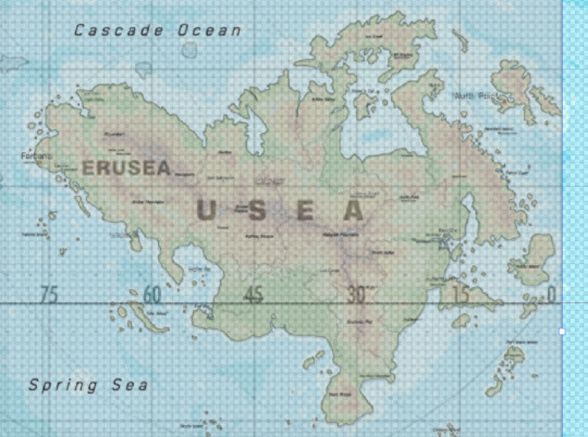
And so low and behold:
Strangereal vs Normalreal for your enjoyment
148 notes
·
View notes
Text
Highlights:
CYLINDRICAL (meridians are equally spaced vertical straight lines, parallels are horizontal straight lines)
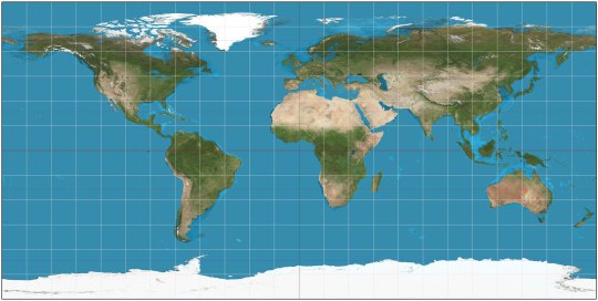
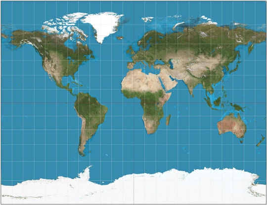
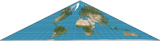
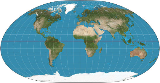
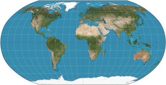
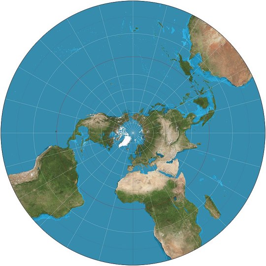
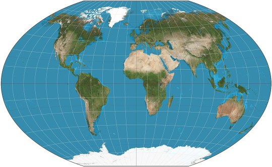
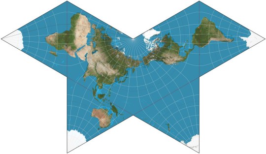
Equirectangular (ca. 120 CE): my favorite! X-Y coordinates on the map correspond exactly to latitude and longitude on Earth's surface, simple and straightforward. Parallels and meridians are all evenly spaced perpendicular lines. Doesn't preserve perfectly shapes or relative sizes, but approximates both.

Cassini (1745): the equirectangular projection, if first Earth is rotated 90° so that the central meridian becomes the Equator
Mercator (1569): gets a bad rep because it inflates areas at high latitudes (so mostly northern continents, since the southern are close to the Equator). In fact, it cannot show the Poles because they'd be infinitely far away. However, it perfectly preserves shapes and it's useful for navigation because sailing with constant bearing always traces a straight line on this map. Some variant of it is used in most web maps.
Gall (1855): variant of Mercator's that can actually show the poles. Landmass shapes are no longer perfect.
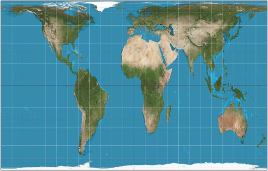
Gall-Peters (1855): kinda the reverse of Mercator: they sacrifice landmass shapes to preserve perfectly their relative areas. Landmasses near the Poles are squashed rather than stretched infinitely. Lambert (1772) has a less extreme version.
PSEUDOCYLINDRICAL (the central meridian is a vertical straight line, but other meridians may be curves, though still equally spaced on any given parallel; parallels are still horizontal straight lines)
Ortelius (1540): preserves neither shapes nor areas, but compromises between both. All meridians except the central one are arcs of circles.
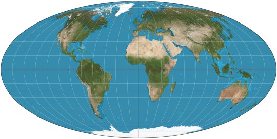
Mollweide (1855): preserves relative areas. Fits exactly in an ellipse, and all meridians except the central one are arcs of ellipses.
Collignon (1865): triangle. Preserves relative areas, somehow.
Goode Homolosine (1923): preserve relative areas and keep landmass shapes reasonably well, at the price of cutting huge gashes through the oceans.
Loximuthal (1935): constant bearing lines are straight lines on the map, like in Mercator. Preserves neither shapes nor areas. Weirdly asimmetrical hemispheres.
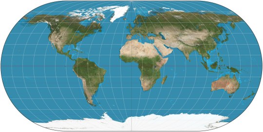
Robinson (1963): preserve neither shapes nor areas, but approximates both quite well. Kavraisky has evenly spaced parallels. The similar Equal Earth (2018) preserves relative areas.
CONIC (meridians are converging straight lines, parallels are arcs of circles)
Equidistant conic (ca. 150 CE): another of the old ones. Preserves only the distances along meridians, like the equirectangular.
PSEUDOCONIC (the central meridian is a straight line, the others may be curves)
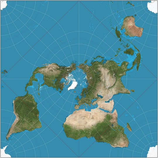
Nicolosi globular (ca. 1000): splits the map in two circles, replicating the feeling of watching the world from space from two sides.
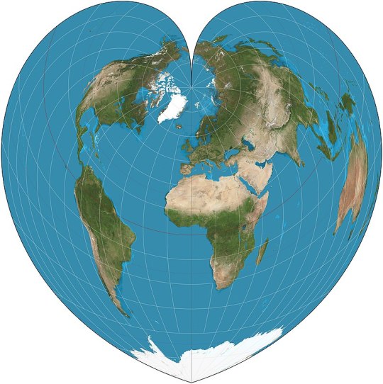
Werner (ca. 1500): heart-shaped, preserving relative areas, with the parallels being concentric circles around the North Pole.
AZIMUTHAL (meridians are straight lines meeting at the center, parallels are concentric full circles)
Gnomonic (ca. 580 BCE): probably the oldest map projection. Unfortunately it can only show at most part of one hemisphere, with the Equator being infinitely far away, much like the Poles in Mercator.
Stereographic (ca. 150 BCE): as before, but only the opposite pole is infinitely far away. The far hemisphere is still distorted, so it's still used in two parts, each centered on one pole.
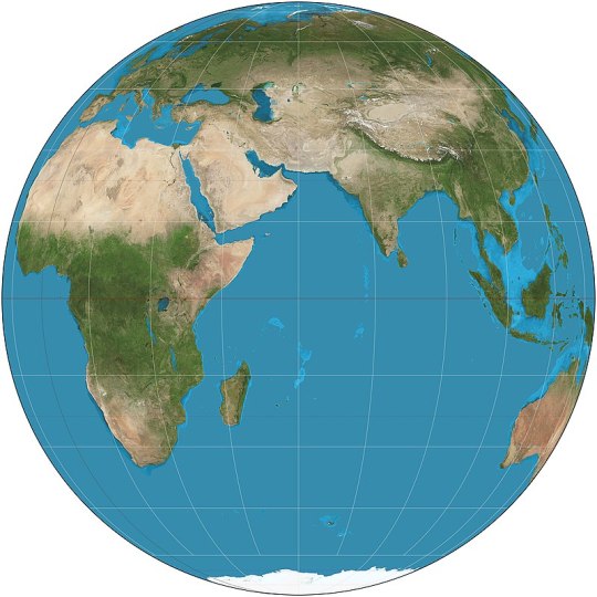
Orthographic (ca. 150 BCE): basically just what the Earth would look like if observed from infinite distance: it shows exactly one hemisphere.
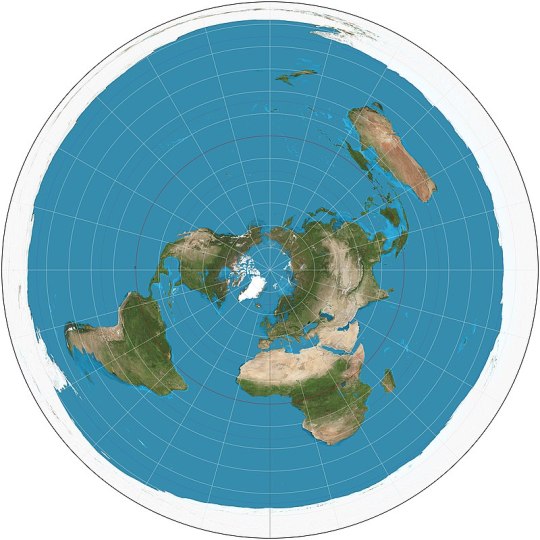
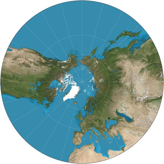
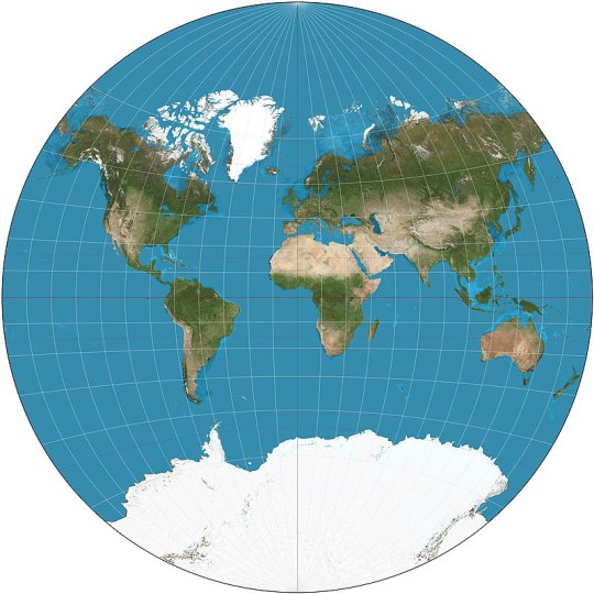
Azimuthal equidistant (ca. 1000): all parallels are full circles centered on the North Pole, and the South Pole is also a circle surrounding all. The map used on the flag of the United Nations. Most Flat Earthers think the Earth has this shape.
Two-point equidistant (1919): preserves distances on the straight line that passes thrrough two arbitrary points. A favorite of history atlases: it's usually used to portray Asia with as little distortion as possible despite its unfortunate proximity to both North Pole and Equator.

Hao projection or plane terrestrial globe (2002): popular in China, replicates as much as possible the curvature of a globe.
PSEUDOAZIMUTHAL (central meridian and equator are straight lines; other meridians curve toward the central meridian, other parallels curve away from the equator)

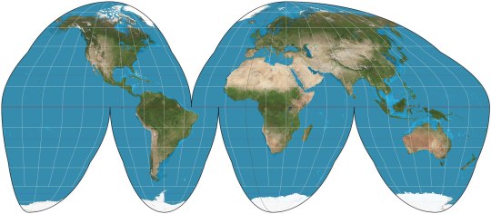
Wiechel (1879): the meridians form a pinwheel! Preserves relative areas, but which great distortion of the opposite hemisphere.

Aitoff (1889): looks like the Mollweide with diverging parallels. Mostly relevant because of:
Winkel Tripel (1921): arithmetic mean between Aitoff and equirectangular; the map used by National Geographic.
OTHER
Peirce quincuncial (1879): a perfect square that can be tiled regularly in all direction. I think Flat Earthers should start claiming that Earth look like this and that there are infinite copies in every direction.
Van der Grinten (1904): built ad hoc to map the Earth onto a circle, preserving exactly neither area nor shapes.
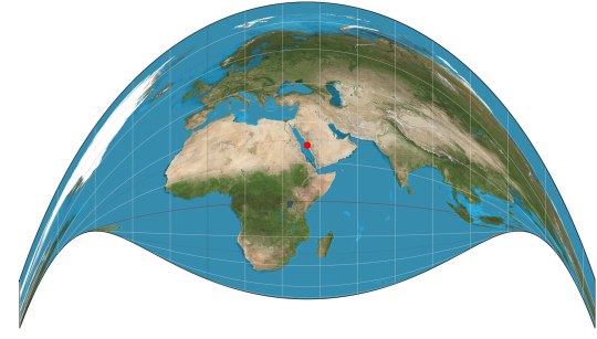
Craig's retroazimuthal or the Mecca Map (1909): looks crazy, but preserves the direction from any place on Earth to one specific point; in fact it was invented to help Muslims find easily the direction to the Mecca.
Cahill's Butterfly (1909): adorable, and can be folded into a perfect octahedron.

Dymaxion (1943): approximates shapes and areas, and preserves close connections between continents, at the price of a really weird shape.
63 notes
·
View notes
Text

#360x180#360°#380ita#architecture#building#cattedraledisantamariaassunta#church#city#citygate#comersee#como#duomodicomo#equirectangular#europa#europe#italia#italien#italy#lagodicomo#lombardei#lombardia#lombardy#lombardía#person#ricohthetaz1#religion#vrpanorama#hapephotographix#provinzcomo
2 notes
·
View notes
Text

COMMISSIONS by Luna (Whirligig-Girl)
Contact: DM me on social media or email me at WhirligigGirl [at] gmail [dot] com
Humans & Humanoids
Prices subject to change based upon complexity and props Backgrounds priced on a case-by-case basis. Very rough ballpark: triple the overall price for a complex background.
Choose a Line Art Style
Sketch: Head or Bust: $14 Full torso: $18 Knees or full body: $20
Clean: Head or Bust: $31 Full torso: $40 Knees or full body: $44
Lineless: Head or Bust: $41 Full torso: $50 Knees or full body: $54
Add on a Coloring Style
Solid Color Head or Bust: +$14 Full torso: +$18 Knees or full body: +$19
Cartoon Shaded Head or Bust: +$19 Full torso: +$23 Knees or full body: +$24
Rendered Head or Bust: +$24 Full torso: +$28 Knees or full body: +$29
Non-Humanoid Aliens & Robots
Prices subject to change based upon complexity and props Backgrounds priced on a case-by-case basis. Very rough ballpark: double the overall price for a complex background. Choose a Line Art Style Sketch: $25 Clean: $55 Lineless: $65
Add on a Coloring Style Solid Color: +$20 Cartoon Shaded: +$25 Rendered: +$30
Vehicles:
Prices heavily subject to change based upon complexity. Backgrounds priced on a case-by-case basis. Very rough ballpark: double the overall price for a complex background. Choose a Line Art Style Sketch: $30 Clean: $65 Lineless: $76
Add on a Coloring Style Solid Color: +$30 Cartoon Shaded: +$35 Rendered: +$40
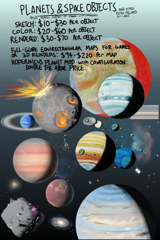
Planets and Space Objects
Prices heavily subject to change based upon complexity. Sketch: $10-30 per object Solid Colored: $20-60 per object Rendered: $30-70 per object Full globe equirectangular map for games or 3D renders: $94-220 per map. (Heightmap and Color map) Kopernicus planet mod with configuration: Double the price above.
Examples of Previous Commissions:


#Long Post#Commission#Commissions#Taking Commissions#Open Commissions#artist#digital artist#sci art#science art#space art#fan art#star trek#trains#spaceships#planets#rockets#spacecraft#hard sf#fantasy art#original characters
159 notes
·
View notes
Text

An equirectangular map of Karya, showing its historical geographical regions (made with MS Paint). Prior to roughly Year 300 of the Third Age and its contemporaneous Era of Rediscovery (Years 293 - 401), this was how Karya's landmasses and great bodies of water were divided and identified.
Landmasses:
1 = Omuros (/'o:ʊmu'ɹoʊz/)
2 = Tehheka (/tɛ'ɦɛkə/)
3 = Gadar (/gə'dɐ:ɹ/)
4 = Quolixitulio (/kwɔ'li:xi'tʉ:lio/)
5 = The Parlenï (/pɐɹ'lena:i/) Isles
6 = Etrias (/'ɛ:t͡ɕɹiəs/)
7 = Iyos (/'a:ijoʊs/)
8 = Bradabas (/brɑdəbəs/)
9 = Amargos (/a'mɐ:ɹgɔz/)
10 = Matachopis (/'mɐtɐ't͡ʃɔʊpiz/)
11 = Hapathiju (/hɐpɐ'θid͡ʒu/)
12 = Andaria (/ɐn'dɐ:ɹiə/)
Bodies of Water:
A = The Pankaryic Ocean
B = The Parlenï Sea
C = The Gadaretrian Sea
D = The Lashroonic (/lɑ'ʃɹʉ/) Ocean
E = Bay of Tears
F = The Greater Inland Sea
G = The Lesser Inland Sea
H = The Amatian (/a'ma:d͡ʑi/) Sea
#artwork#fantasy#oc#projectkarya#sci-fintasy#scifi#art#creativity#fiction#maps#sci fi and fantasy#worldbuilding
4 notes
·
View notes
Text
So when they say autistic folk are "detail oriented", do they mean something like:
Goes to NASA website to download G.Projector in order to convert the world map of Avatar the Last Airbender to equirectangular projection and then apply that resulting image on the Map to Globe website in order to determine how far south Wolf Cove is from the Antarctic Circle (assuming the world of ATLA has the same size and axial tilt as Earth) to determine how plausibly light the sky could get during the winter?
12 notes
·
View notes
Text
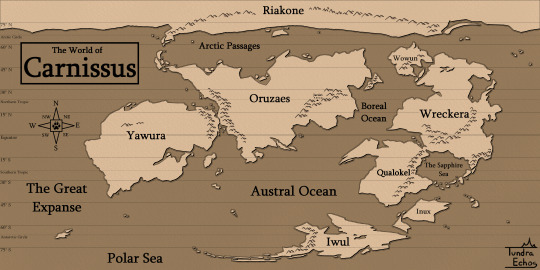

[Image Description: A map of a fantasy world called Carnissus. The landmasses are colored in light brown while the sea is a darker brown. There are 6 continents: Riakone, Oruzaes, Yawura, Wreckera, Qualokel, and Iwul. There are also two large islands: one called Wowun which is off the northwestern coast of Wreckera, and another called Inux which is off the northeastern coast of Iwul. There are also lots of other islands which are too small to have labels. The world is shown in equirectangular projection in the first image, and then the northern and southern hemispheres are shown side-by-side centered on their respective poles. Lines of latitude are included at 15 degree intervals on both maps, and the hemispheres also have the lines of longitude. The polar circles and the tropics are also shown.]
Carnissus is the world of my fantasy setting, MagiCarnivora. It is inhabited by semi-anthropomorphic carnivoran mammals, referred to as "Carnissans" to differentiate them from their non-anthro kin, which also still exist in this world.
While in many ways Carnissus is similar to earth - Same size, only slightly cooler climate, and familiar flora and fauna - There are also many differences. The sun rises in the west and sets in the east, and there is another, much dimmer sun ever-present in the distance. Magic affects almost every part of the world, in ways that aren't always noticeable... and are sometimes very noticeable.
The maps shown above are non-diagetic: nobody on current-day Carnissus would have the means or desire to create a fully accurate map of the entire world. I plan to eventually draw up how certain cultures draw their maps, just for fun.
3 notes
·
View notes
Text
I have a set of points distributed on the surface of a sphere, just like on this page. I have their Delaunay triangulation and Voronoi diagram as well. I want to draw a texture, at reasonably good resolution, showing the Voronoi diagram on an equirectangular projection. For 25 points, it looks something like this:
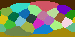
The naive way to draw this would be to take each coordinate on the texture, and check it against every point in the point list, either for whether it is closest or whether it lies inside the bounds of the Voronoi cell for that point. The latter is slightly more efficient, since you can just break off checking once you find a match, but you still might have to check the whole map.
This is obviously slow as balls, especially because I want to be able to generate such a texture for many thousands of points. I need a heuristic or a search structure that reduces how many points I have to check against. A nearest-neighbor search via octree gets a result like this:

because each division in the subtree creates arbitrary boundaries. I think I could combine an octree search with a does-this-coordinate-actually-lie-inside-the-polygon-of-its-point search, but so far my attempts to do this have been... flawed:

Which, to be clear, may be a result of my implementation rather than the approach being fundamentally in error. But this method also seems to be pretty slow for some reason.
(The reason I want to do all this is that when the player clicks on the surface of the sphere, I want a fast way to detect what cell/point is closest to where they clicked. The image is a human-readable proxy for an array of values which are the actual point IDs; by translating the coordiantes of the click to the array, and checking the nearest value on that array, we can easily get the ID of the point without having to do any complicated lookup stuff once all this data has been generated and saved.)
25 notes
·
View notes